Over the years of hiking in the mountainous part of South Carolina, I've come across the ruins of old moonshine stills, mainly rusty old sheet metal barrels, or rusty metal bands by themselves. For my second adventure this week, I thought it would be interesting to actively seek out ruins of old moonshine stills and see how many I could find.
I selected an area of the Mountain Bridge Wilderness Area near Wildcat Wayside between US 276 and Persimmon Ridge Road. One, because it's a short drive and two because the area is relatively undisturbed even by hikers.
My plan was to explore up the unnamed creek with Spider Tunnel Falls from U.S. 276, then over to the base of Heritage Falls, then back down Slickum Creek to Wildcat Wayside, then back to U.S. 276.
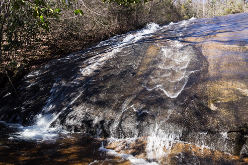
While I wasn't waterfall hunting today, Spider Tunnel Falls is too just good to ignore.
Part of this waterfall can be seen from U.S. 276 during the months when trees are leafless. A faint path leading uphill is on the right side of the creek. The left side of the creek is private property.
I tried to get a photo down in the slot canyon below, but the water flow was heavy today and my camera lens quickly got spotted with water. I stayed around a while enjoying this fine beauty before finally heading upstream.
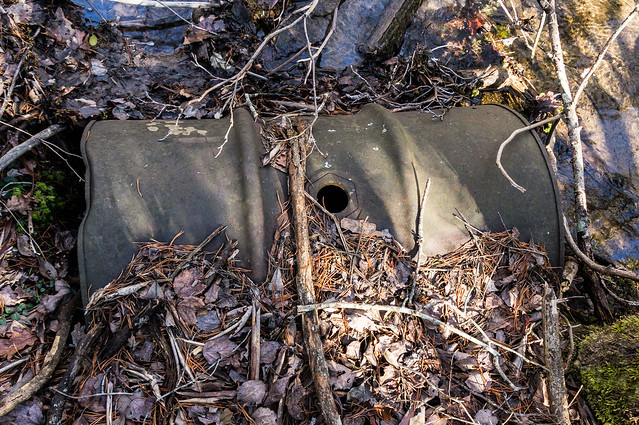
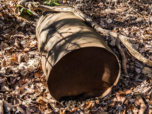
Upstream a bit, another unnamed creek came in from the right. I followed that creek, but found nothing. However, back on the creek I meant to follow, I found my first moonshine still ruins of the day, this sheet metal drum:
What am I looking for and why am I following creeks? A
page on Moonshine Heritage explains the clues I look for nicely, but the short version is moonshiners needed cold water for the alcohol distillation process, and cheaper than copper sheet metal drums were used to keep the cost down.
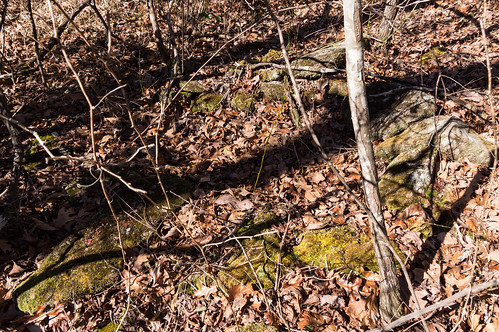
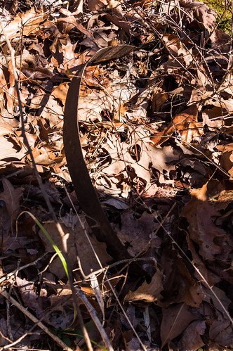
Continuing upstream, I found some sheet metal hoops, a sign I had found my second moonshine still ruins of the day.
I also found a U shaped formation of rocks by the creek giving away where the furnace was located:
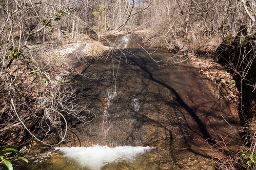
A short distance upstream, I found an undocumented waterfall:
Still continuing upstream, some metal hoops confirmed I had found my third moonshine still ruins of the day:
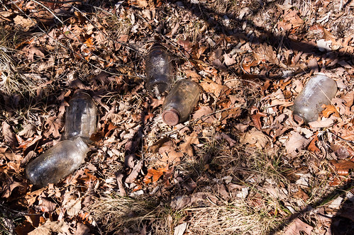
At the fourth site, I found Mason jars a short distance away from the creek:
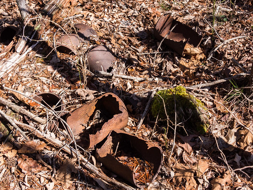
I also found one gallon cans:
I continued on upstream, past where the headwaters for the creek where indicated, until the stream turned west. Finding nothing for some time, I decided to turn east toward Heritage Falls on Slickum Creek. This overgrown and somewhat eroded logging road I met up with assisted me along nicely.
I actually ended up one drop below Heritage Falls, the sixth undocumented and most photogenic waterfall I encountered today:
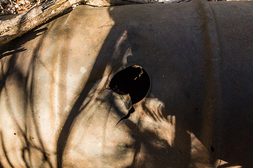
The sun was getting low in the sky, so I figured exploring around the base of Heritage Falls could wait until another day. I wasn't disappointed exploring this area though. The base of this waterfall yielded my fifth moonshine ruins of the day:
This one was more interesting because of the hole in the middle. At first I thought maybe the hole was there because it been pierced, but now I see there must have been a plug there.
As I looked on the east side of the creek, I spotted something I didn't expect to see, a "private property" notice:
I hadn't expected any part around Slickum Creek to be private property, but a later check of Greenville County GIS does show a small part of Slickum Creek is indeed private property.
I avoided this part as best I could, rejoining Slickum Creek further south where the thorns weren't as thick.
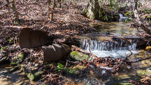
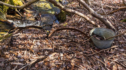
I wasn't expecting to find any more moonshine till ruins today, but in an area where Slickum Creek splits into two for a bit I accidentally found a sixth one.
This barrel is much like the other, but it's center plug is more intact.
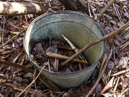
A short distance away I noticed some metal hoops and a bucket:
I made it back to the mostly unvisited western end of Wildcat Wayside. I searched for and found the old pump house and reservoir location built during the CCC days.
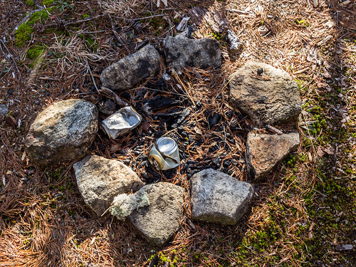
I noticed some people had built a small campfire in the middle of the old reservoir.
In my visits to this more obscure western part of Wildcat Wayside, a mossy tiered rock face, I've come across my share of campfire pits, but this has to be best made one I've ever seen here:
As I was stepping down the rock face, I almost had a surprise close encounter with this poisonous timber rattlesnake.
Fortunately, I noticed in time to change course. It's also fortunate the weather is still too cool for this creature to be active. This is actually the first poisonous snake I've seen out on the trail! All the snakes I've seen in on past hikes were those non-venomous black snakes.
I followed the trail back toward the more visited part of Wildcat Wayside, then down a trail the heads toward U.S. 276. This trail is almost too well blazed for most of the way, then the blazes end. I followed an old logging road the rest of the way down, past a well camouflaged waterfall and a telephone equipment cabinet.
I created a layer in my map of
South Carolina Historical POIs just for the old moonshine still ruins I've encountered over time.
I didn't quite have time to visit Heritage Falls, where I know the ruins of a moonshine still exist near the base. I'll visit that one some other day.
On the day I found 6 ruins of moonshine stills, 6 undocumented (but mostly unremarkable) waterfalls, 1 undocumented somewhat overgrown logging road, and 1 snake in
brumation. Not bad!
If you'd like to go through
my whole album of trip photos on Flickr, you can do so below, or
visit my album directly.


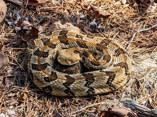


That rattler would be startling, especially this time of year when I'd expect them to be laying low.
ReplyDeleteWhat is the easiest way yo access the one moonshine still ruin just inside Jones Gap State park with the ax marks in the barrel? That sure would be an interesting one to see. Thanks!
ReplyDeleteThis article is great but no wonder why people didn't comment
ReplyDeleteCheck this out 55 gallon drum