I recently got in touch with long time friend Eric Cunningham to see if we might find a day to go exploring. I haven't been on an adventure with him
since 2015 when we went to see Spider Tunnel Falls. He suggested we start at
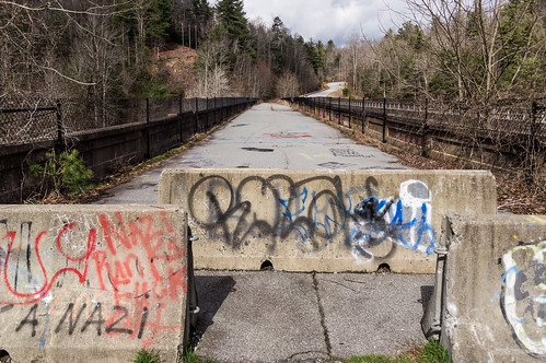
High Bridge, what's now a pedestrian-only bridge over the Green River in Henderson County, North Carolina a few miles east of Saluda.
High Bridge and Lake Summit
High Bridge, also known as the Green River Bridge, carried traffic on U.S. 176 between 1927 until 2001, when a new bridge parallel to it opened. High Bridge then became open only to foot traffic. We walked past the barricades onto the bridge.
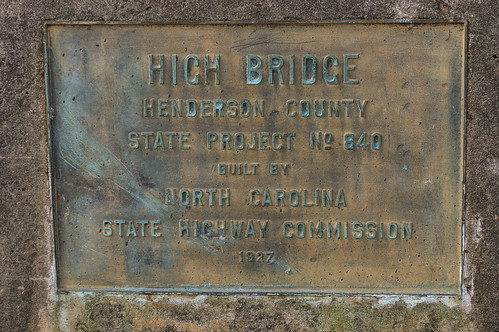
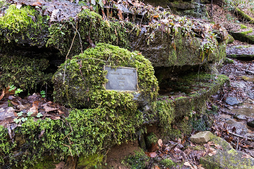
Plaques on both ends commemorate the construction of the bridge.
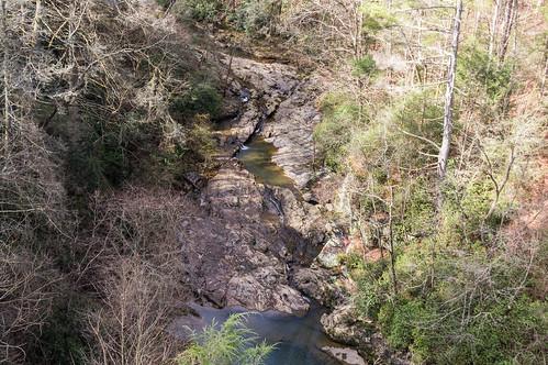
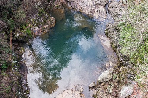
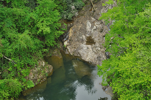
The Green River was far below, but even from the bridge it's easy to see the river is aptly named.
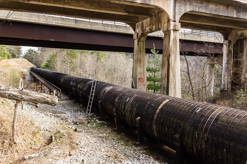
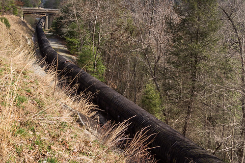
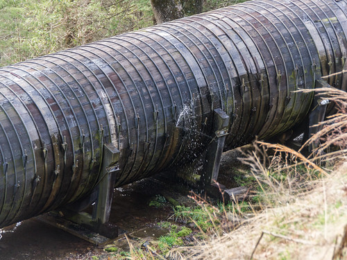
At the far end of the bridge on one side is a steep path leading down to a service road down below, and on the other side is a less steep but longer path down to a service road leading to the Lake Summit Dam. Below the service road is a flume pipe carrying water from the dam to the powerhouse further downstream.
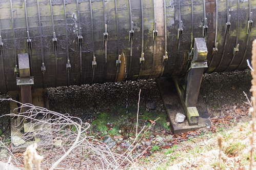
Along the way I spotted a few water leaks.
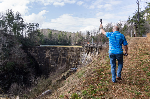
Eric brought along two GoPros, one that takes photos and video, and another that takes 360 degree videos. In this photo he's taking a video of Lake Summit Dam:
which you can view below:
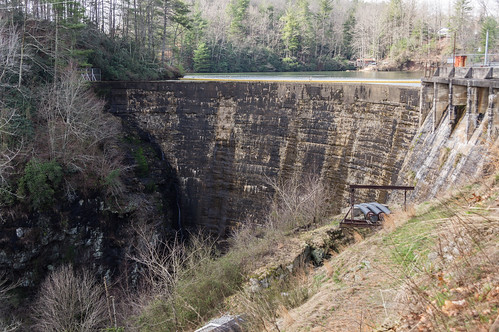
Lake Summit Dam was built in 1920-1921 to generate electricity for the Green River Manufacturing Company. The dam, powerhouse, and lake were sold to the predecessor of Duke Energy in 1927.
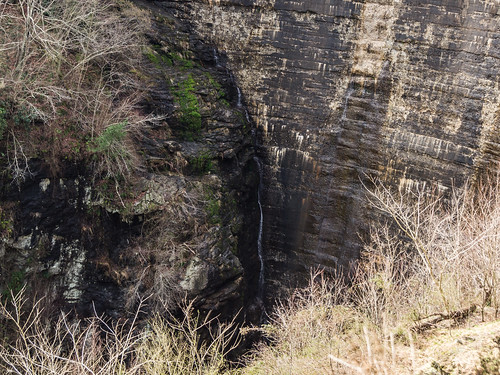
What interested me was the noticeable stream of water from a leak:
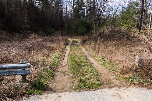
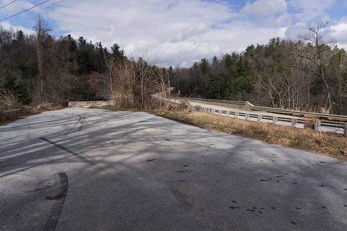
We went back up to High Bridge, then after a quick snack break, we went down this dirt road:
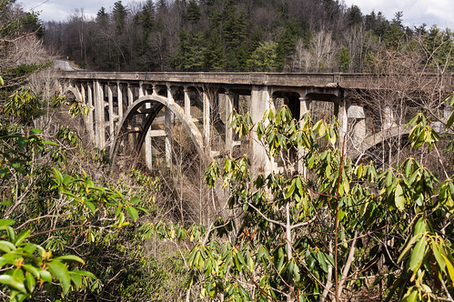
A short distance down this dirt road I took this photo High Bridge from among the rhododendrons.
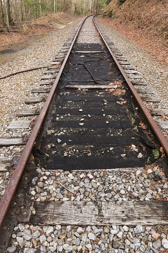
Where the dirt road ends at a pile of trash, we scrambled up the hillside to the railroad grade.
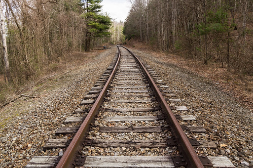
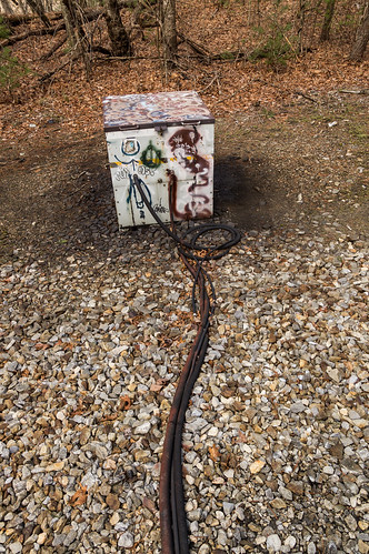
Down this direction we found this curious contraption full of creosote:
hooked up to the track here:
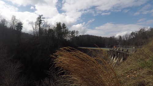
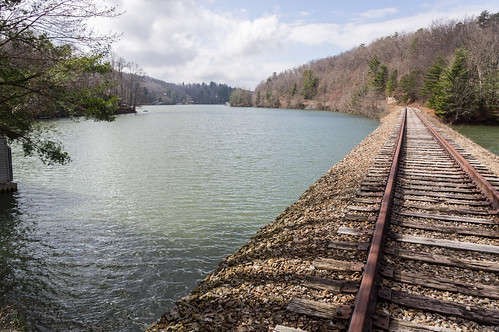
We switched directions and ended up here at this view of Lake Summit.
I paddled to this same trestle back in September 2016:
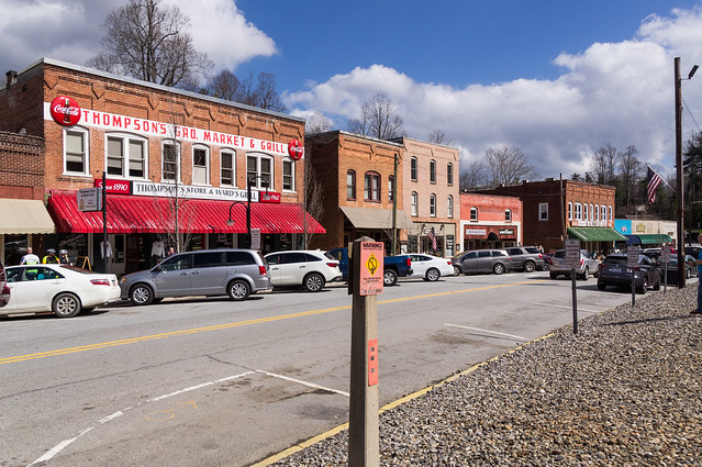
Saluda
A few miles east down U.S. 176 (Spartanburg Highway) from High Bridge is the small
historic mountain town of Saluda. The first train reached Saluda, then called Pace's Gap, on July 4, 1878 to much fanfare and celebration. The population quickly swelled, and the town of Saluda
incorporated three years later in 1881.
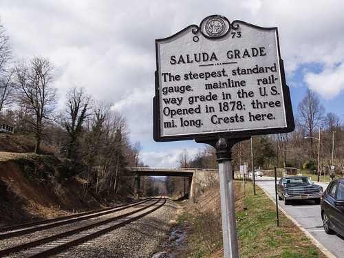
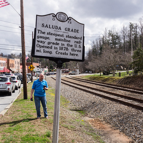
I parked at the old Saluda Depot and we walked across the street to the Saluda Grade historic marker. At 5%, or about 600 feet, the
Saluda Grade was the steepest active mainline railroad grade in the United States from 1878 until 2001 until service was discontinued by Norfolk Southern (although the rails still remain).
I took my photos...
while Eric took his:
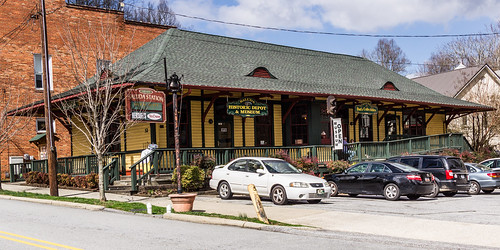
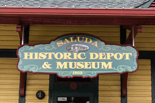
We went back across the street to visit the Saluda Depot. The Saluda Depot, built in 1903 to replace an earlier one, was located
about a quarter mile away from town before being
moved into town in 1983 and operated as a store from 1985 until 2015. In 2015, when the depot put up for sale, a group of motivated citizens
led an effort to buy the depot and turn it into a museum. In 2016,
that effort succeeded and the
Saluda Historic Depot and Museum was born.
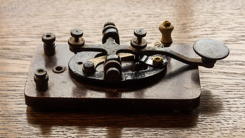
We signed the guestbook, and an older fellow greeted us. His knowledge of the Saluda's railroad history and of the depot itself was impressive. I didn't take any photos of the interior, except for this telegraph key.
I really liked the dioramas of the Saluda Grade, and the dioramas of some of the more infamous crashes that took place.
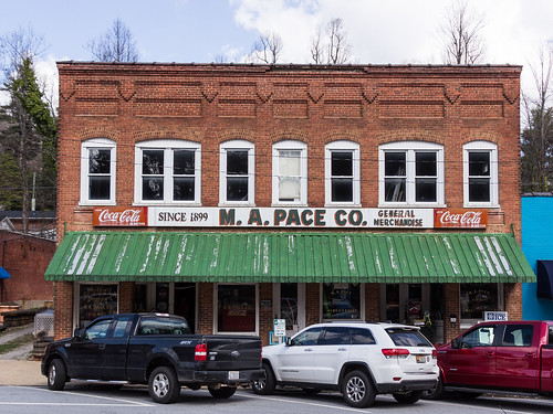
After visiting the depot, we ventured further downtown,
whose building are on the National Register, to see some of the other historic buildings
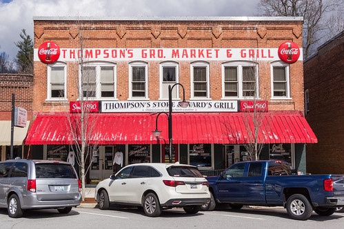
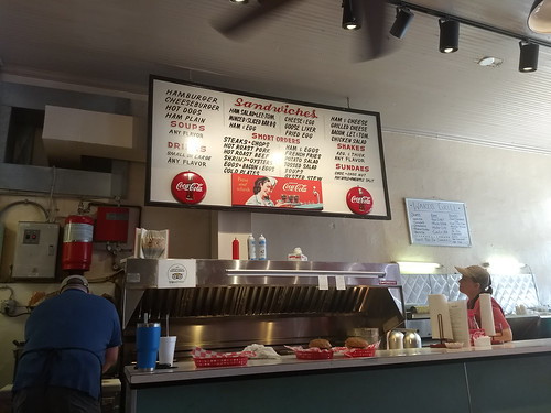
Then we entered Thompson's Store before stopping next door for lunch at Ward's Grill.
We spent a few minutes in Saldua Memorial Park...
before heading on to Pearson's Falls.
Pearson's Falls and Glen
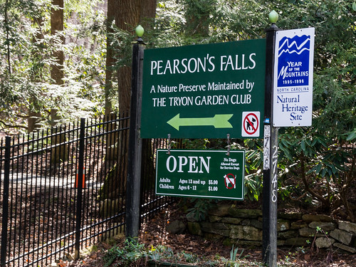
The entrance to
Pearson's Falls and Glen is located
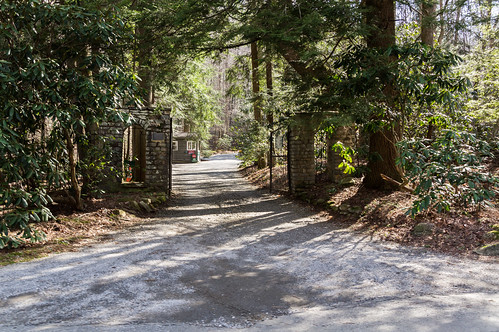
on Pearson Falls Road a mile or so off U.S. 176. A prominent sign and a gate mark the entrance.
A short distance inside is a toll house where we each paid our $5 admission charge.
Pearson's Falls was discovered by and named for Charles William Pearson (1841-1915), the railroad engineer who scouted a path for the
Spartanburg and Asheville Railroad (later Norfolk Southern) through the Saluda Gap. Charles Pearson bought and owned this land until he died.
Pearson's son
almost sold the land to a timber company, but chose instead to sell the land to the
Tryon Garden Club in 1931 after a successful fundraiser by the club.
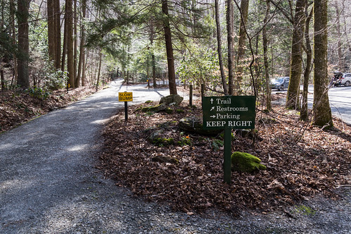
After parking, we heading down the path along Colt Creek toward the waterfall.
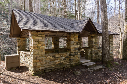
Along the way on the right, we passed by a stone picnic shelter...
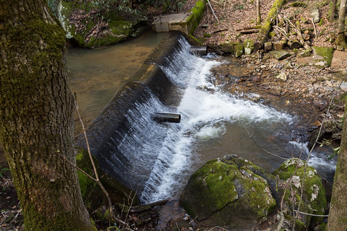
and the rements of a dam.
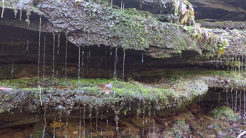
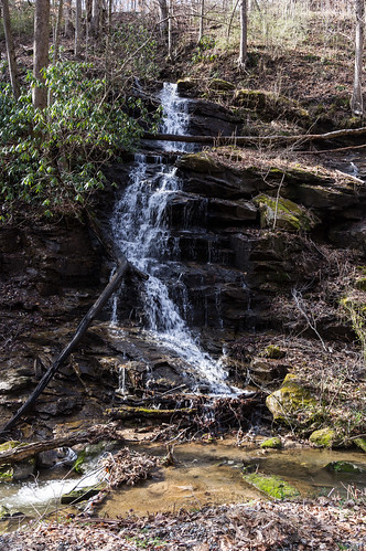
On the left hand side, we came across a dripping rock waterfall.
Eric took a video of the dripping rocks dripping with his GoPro:
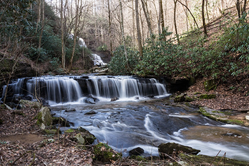
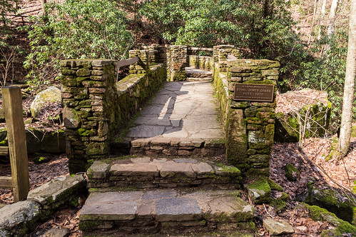
I had to stop to admire a nice cascade visible from a stone bridge.
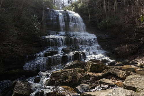
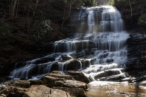
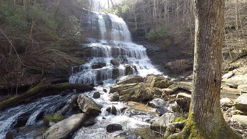
We reached the waterfall in about 15 minutes or so. We struggled to find a place where the sun wasn't shining right into our cameras. One thing the sun did do to our advantage was light up the spray.
Eric took a much better video than my cell phone camera did, so I'll present his instead of mine:
If we had waited another thirty minutes or so, the sun would have been out of our way. However, we chose to move on to our last stop, unofficially called One Lane Bridge.
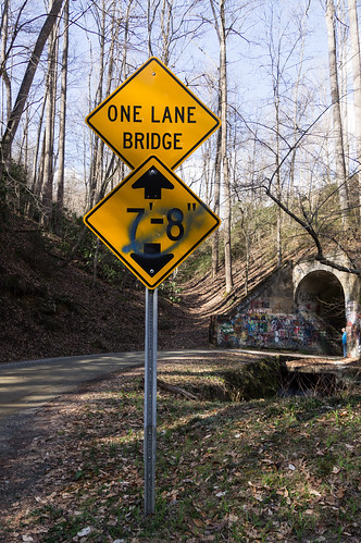
One Lane Bridge
Like Pearson's Falls, One Lane Bridge is located on Pearson Falls Road, but on the dirt road section
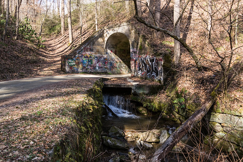
near the intersection with Crisscott Road. This bridge has a rather unique, curious, and interesting feature...
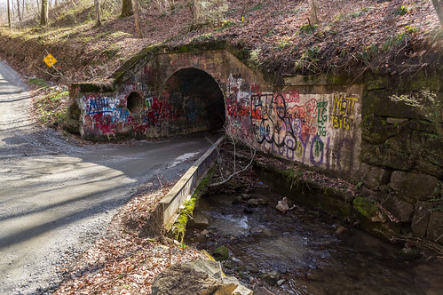
This bridge is also a tunnel! Below you see the creek exiting from One Lane Bridge:
On the other side, you can see the creek entering One Lane Bridge:
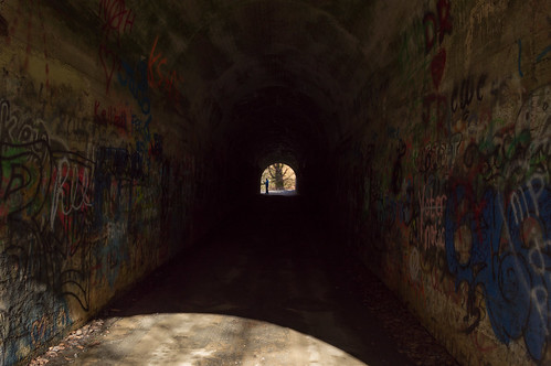
Inside the bridge/tunnel...
I found a grate where you can clearly hear the water running underneath which is what makes this feature a bridge.
We continued down the road, and found this roadside waterfall within a few feet of someone's deck.
I had read
Bucky's Ride post describing his trip on his motorcycle through this area, but somehow I forgot about this waterfall being here.
Eric had his responsibilities to get back to, so I dropped him off at his house and went on home. I had a great time and hope to join him again on another adventure sometime.
If you'd like to check out the rest of the trip photos, you can go through
my album on Flickr, or you can go through them below:
Eric has also uploaded his photos and videos from the trip to
an album on Flickr or you can go through below.
I'll update with more links when Eric posts his 360 degree videos.


Comments
Post a Comment