Posts

Showing posts with the label south carolina

December 2019 Hikes

Image
I've been on a number of waterfall hikes since Thanksgiving, mostly with Meetup groups. Since I don't take many photos when hiking with the Meetup groups, these hikes weren't really worth a post on their own. I did post a few photos to my Instagram account, but if you don't happen to Instagram then these hikes will be news to you. I'll summarize the visits below. Wildcat Wayside On December 11th, I led a small group to Wildcat Wayside , a roadside wayside park located by US 276/SC 11 near Cleveland, South Carolina. First we hiked a trail to visit Lower, Middle, and Upper Wildcat Falls on Wildcat Creek. Then we went down to a trail by Slickum Creek to visit Last Falls on Slickum and Sweet Thing on Slickum. As a bonus, I then led them past a parking area where US 276/SC 11 split to a bushwack up to Spider Tunnel Falls , the top of which is visible from US 276 during the winter. My photos from this trip are in the album Wildcat Wayside and More - Dec 20...
Glassy Mountain Heritage Preserve

Image
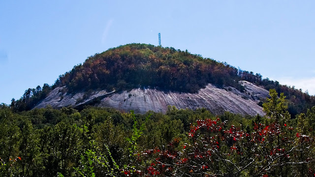
With 2019's endless summer finally gone for the year and cooler less humid weather firmly established, I finally felt able to venture outdoors. I have some long hikes planned for this weekend, so I wanted something that wouldn't tax me too much. Glassy Mountain Heritage Preserve fit my needs perfectly. Glassy Mountain Heritage Preserve is a 65 acre nature preserve located on Glassy Mountain in Pickens County, SC , not to be confused with a mountain of the same name one county west in Greenville County. The South Carolina Department of Natural Resources acquired the property in 1990. One official trail winds around the mountain up to the summit, but I also found a few unofficial trails leading to several overlooks. Glassy Mountain is an example of a monadnock , an isolated mountain rising above the foothills of the Upstate of South Carolina. Paris Mountain in Greenville County is another example of a monadnock. Paris Mountain also has hiking trails (courtesy of the state...

Ramble around Rocky Bottom

Image
A few weeks ago, I went out to Rocky Bottom to visit the Eastatoe Creek Heritage Preserve . I had wanted to find a path down to the creek so I could explore and see if I could some waterfalls. I didn't find a path, even after I had been studying old aerial maps to find logging roads, and I wanted to try one more time. Once again I parked in the Foothills Trail parking access area. I expected the parking access to empty like last time, but to my surprise it wasn't. I hiked down the road to where a satellite view showed what may have been some old logging roads, but I found nothing but forest. So I went back to my car and parked near the gate to the trailhead for the Eastatoe Creek Heritage Preserve. These photos are from my most recent visit: I found a spot where I thought an old logging road may have once branched off from the trail. If there was a logging road, it didn't go far. I did find an old rusting mattress box spring and some old cans of J ohnson's...