Hike to Upper Whitewater Falls Lower Viewing Platform
Last Satuday, the meetup group Tri-County Adventure group (Hike, Paddle & More!) hosted a meetup to hike from the Duke Energy Bad Creek Foothills Trail access area to the lower viewing platform for Upper Whitewater Falls, a distance of about 3 and a half miles. I didn't take that many photos on this trip, so I will mix in some photos from my last visit in June 2018. Just mentally erase some of the greenery and pretend they were taken in December.
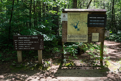
The day was cloudy cold with freezing rain in the forecast that evening. As we gathered in the parking area, a snow and sleet shower passed by. I've already met some of these people, others were new to me.
This is what the parking area looked like back in June:

 Last time I was here I hiked to the Lower Whitewater Falls viewing platform. Part of the way was the same as in last June, just with no leaves:


 This time instead of turning down the spur trail to the viewing platform like I did in June, we continued on Foothills Trail:
 Parts of the trail were soggy, and I was wearing shoes instead of my usual sandals this time (which got comments!) due to the cold, so I had to hop around like everyone else this time.
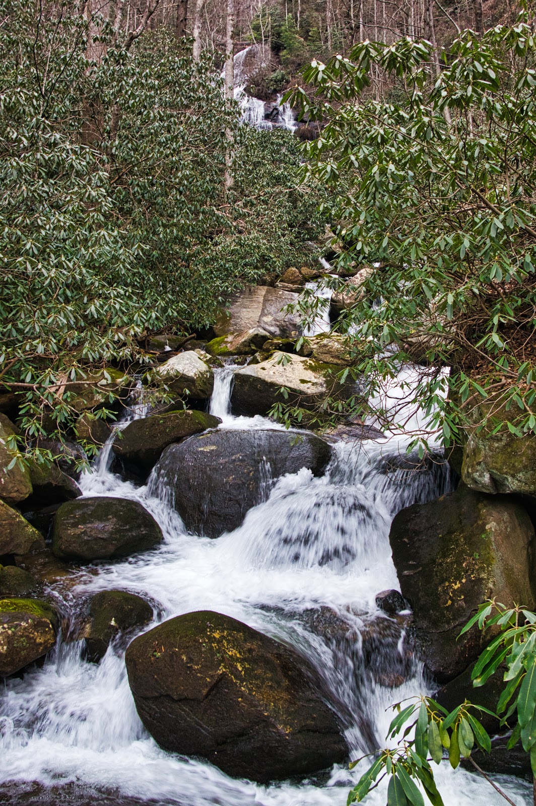
A wooden sign informed us we were leaving Duke Energy property, but it also happens to be the South Carolina-North Carolina border. As we crossed Corbin Creek, we could see the waterfall further up the ridge:
Parts of the trail were soggy, and I was wearing shoes instead of my usual sandals this time (which got comments!) due to the cold, so I had to hop around like everyone else this time.
A wooden sign informed us we were leaving Duke Energy property, but it also happens to be the South Carolina-North Carolina border. As we crossed Corbin Creek, we could see the waterfall further up the ridge:
 We could also now see Upper Whitewater Falls from the trail:
 We crossed over the Whitewater River on the same bridge I stopped at back in June.

 Back then, I started hearing thunder and had to hurry back so I didn't get soaked, making it just in time.This time there was no such need to rush, but a long series of steep wooden steps forced me to stop once to rest a bit.
 We arrived at the lower viewing platform. The view was just as good as last time, if not better without the greenery to get in the way this time.
 We ate our snacks until we started getting pelted with sleet from a passing shower. That's when everyone suddently decided it was time to go.
We made our way back the 3.5 miles to the Bad Creek parking area, faster this time since we were heading mostly downhill. We said our goodbyes and I pulled out of the parking area.
Instead of turning right head back out to the highway, I turned left down to an overlook I wanted to visit. I had mentioned my plan to one person during the hike, and so several of us ended up down at the overlook. I took a photo of this monument first:
 My meetup friends even accidentally ended up in one shot, though I was able to erase and crop them out.
 I put them back for this shot so you can see what I did:
 A walkway leads down to a gazebo:
 A good view of Lower Whitewater Falls emptying into Lake Jocassee can be seen from the wooden fence:
 My remaining meetup friends had other places to be, so we all parted ways and made my way home.
I made a map of my GPS track overlayed on top of OpenStreetmap:
My photos from this trip are in the album Hike To Upper Whitewater Falls - Jan 2019 on Google Photos. Photos from my June 2018 trip are in the album Upper and Lower Whitewater Falls - June 2018 also on Google Photos.
The day was cloudy cold with freezing rain in the forecast that evening. As we gathered in the parking area, a snow and sleet shower passed by. I've already met some of these people, others were new to me.
This is what the parking area looked like back in June:


We made our way back the 3.5 miles to the Bad Creek parking area, faster this time since we were heading mostly downhill. We said our goodbyes and I pulled out of the parking area.
Instead of turning right head back out to the highway, I turned left down to an overlook I wanted to visit. I had mentioned my plan to one person during the hike, and so several of us ended up down at the overlook. I took a photo of this monument first:


I made a map of my GPS track overlayed on top of OpenStreetmap:
My photos from this trip are in the album Hike To Upper Whitewater Falls - Jan 2019 on Google Photos. Photos from my June 2018 trip are in the album Upper and Lower Whitewater Falls - June 2018 also on Google Photos.


Comments
Post a Comment