Photographic explorations centered around Upstate South Carolina.
The Adventure of Upper and Lower Whitewater Falls
Get link
Facebook
X
Pinterest
Email
Other Apps
Yesterday I headed north to visit the Upper and Lower Whitewater Falls, two impressive waterfalls located on the Whitewater River both located near the North Carolina-South Carolina border. Whitewater River empties into Lake Jocassee a few miles downstream from Lower Whitewater Falls. Ordinarily I avoid hiking in humid weather, but with three days off in a row I found I could not resist the idea of an outdoor adventure. These two waterfalls were definitely worth seeing even in the high humidity.
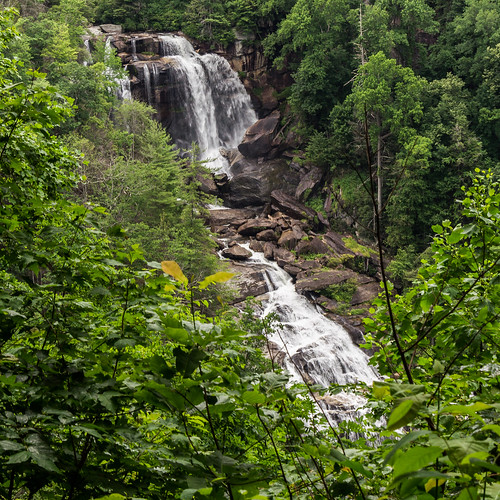
Lower Whitewater Falls
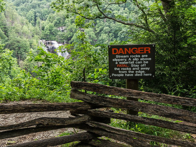
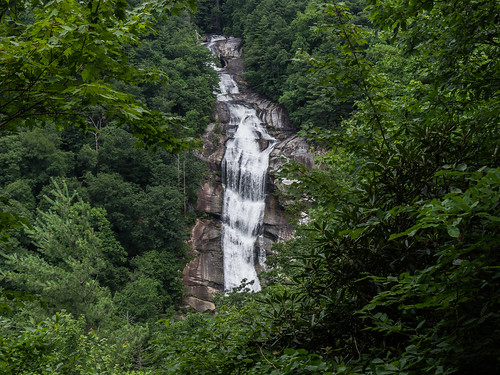
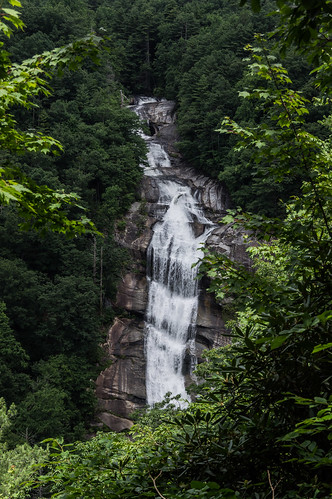
Lower Whitewater Falls is a 200 foot drop (over 400 feet if the surrounding cascades are included!) on the Whitewater River in northern Oconee County on land owned by Duke Energy for their Bad Creek Hydroelectric Station.
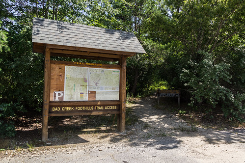
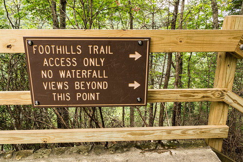
Lower Whitewater Falls is most easily accessed from the Foothills Trail and Whitewater River Access Area Parking off Bad Creek Road:
Bad Creek Road is off SC 130 near the NC border. The gate was open when I arrived, and stays open until dark. The gate will automatically open when you leave after dark, but not open when you attempt to enter from the highway.
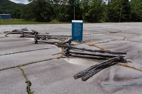
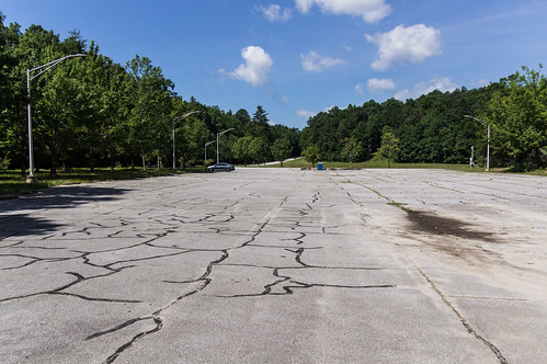
Today, being a weekday, the parking lot was mostly empty:
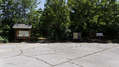
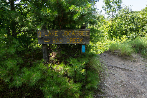
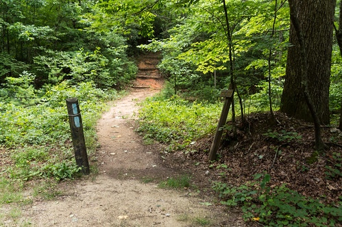
The trailhead for the trail to the waterfall is located on the far end of the parking lot:
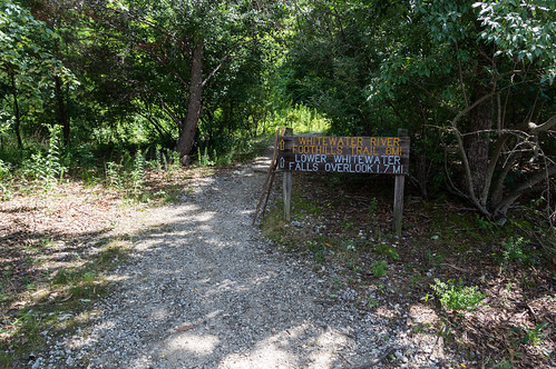
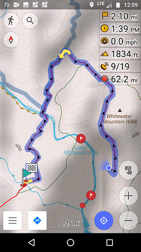
This sign gave the distance as 1.7 miles, ...
... but according to my navigation app the distance was actually about 2.1 miles.
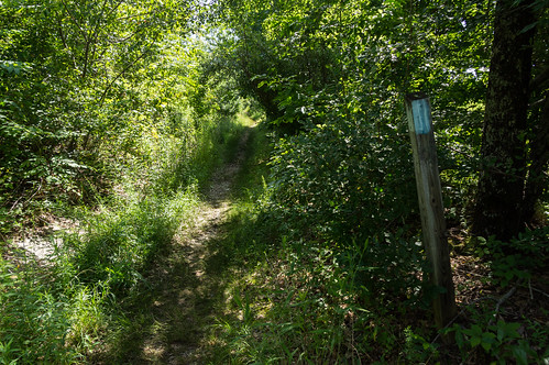
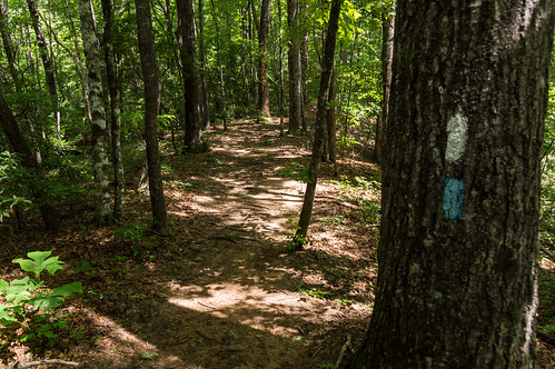
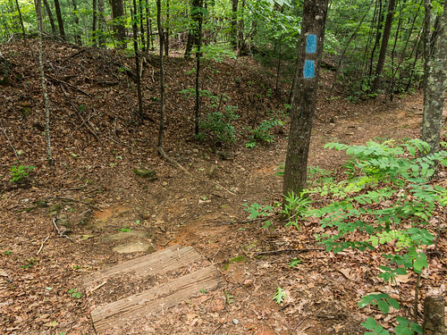
The trail to Lower Whitewater Falls is blazed blue, and unlike the last trip, I had no problem following the trail.
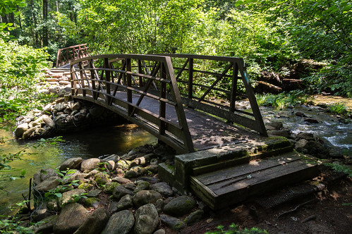
The trail heads north over the Whitewater River, aided by two bridges:
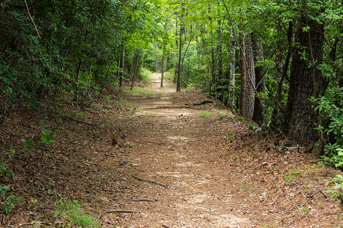
On the other side, the trail soon joins with the Foothills Trail, white blazed:
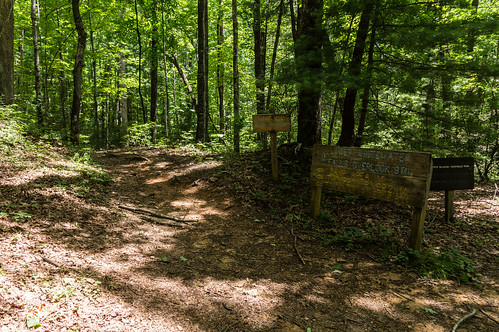
The trail to the waterfall splits off from Foothills Trail...
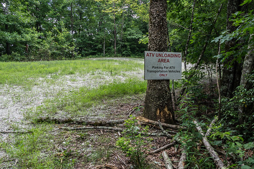
before joining up with Musterground Road at an ATV unloading parking area:
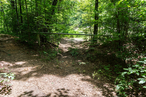
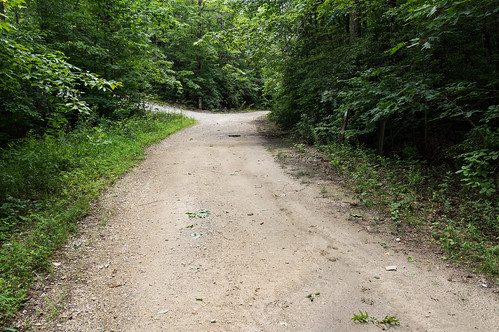
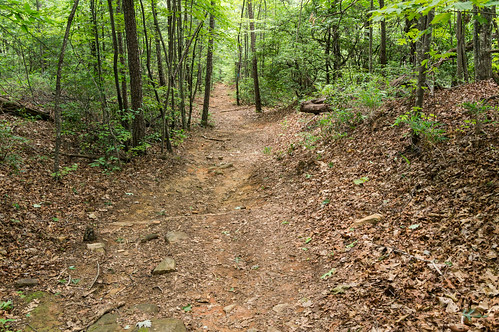
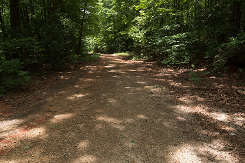
The trail follows Musterground Road for a short distance before splitting off on its own again:
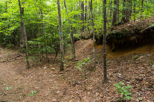
I noticed in this section portions of the trail reused old forest roads. Here's one section where an overgrown forest roads splits off:
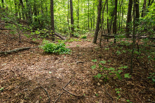
This section probably also runs along what appears to be an old forest road. It's too wide to be anything else.
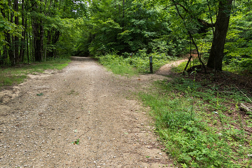
The trail and the old road seperate, but then come back together again later on (or perhaps it's a different old road?):
The old forest road split off (again)...
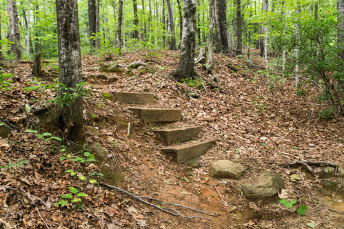
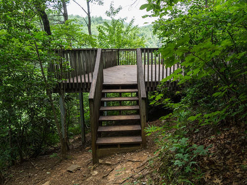
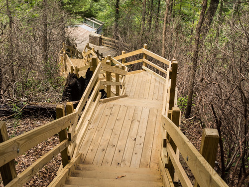
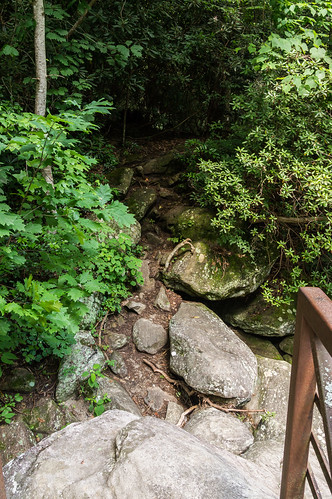
...and the trail makes a right turn and narrows before heading downward toward the viewing platform:
The platform provides an excellent but distant view of the 200 foot waterfall:
I took a short (poor) video of the waterfall in action:
On the return, I decided to come back by Musterground Road instead of returning the way I came.
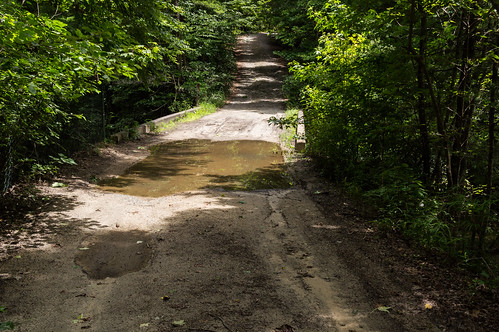
Musterground Road passes over the Whitewater River just above the waterfall.
On the way back, I spotted two obvious unofficial paths that I thought would lead to the river. I took one and ended up about midway down the waterfall.
I stayed by the tree line for my own safety. Slipping in that water would likely have ensured my untimely demise. I had in my mind the unfortunate fate of an 18 year old student at Clemson University, Anna Mimms. Back in May 2018 when heavy rains caused flooding, Anna Mimms was hiking with friends along the river above this waterfall. She lost her footing, slipped and fell into the water, and then water flow from the recent heavy rains swept her over the waterfall.
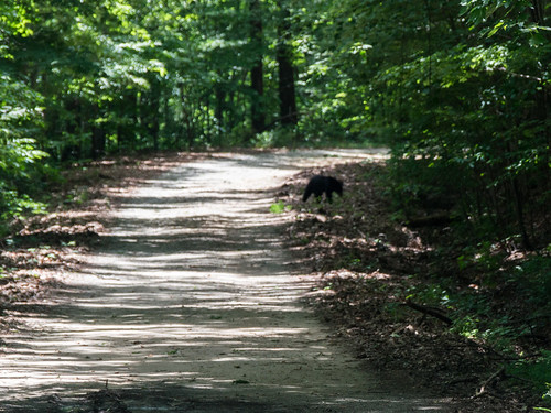
I made my way back up the steep slope and back to the road. I saw a young bear crossing the road, but the bear crossed the road so quick I didn't really have a chance to take a good photo.
By the time I walked down to the curve, the bear had been long gone. I made it back to my car, and moved on back up Bad Creek Road to SC 130 then north to the state border. Upon entering North Carolina, SC 130 becomes NC 281. A short distance north of the border is the Upper Whitewater Falls Access Area.
Upper Whitewater Falls
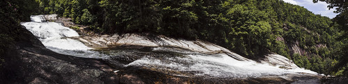
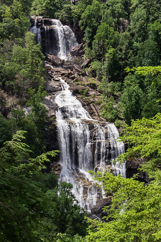
Upper Whitewater Falls is a 400 foot impressive waterfall a few miles of Lower Whitewater Falls, also on the Whitewater River. The most convenient access to the waterfall is at the Upper Whitewater Falls Access Area. Parking costs $2 per vehicle, and since I was alone my cost was .... $2. I deposited the money and parked.
After a few minutes walking along a paved half mile trail, I arrived at the upper overlook to Upper Whitewater Falls. Some people were hanging around taking photos, so took my photos on the return and luckily I had this overlook to myself this time:
I definitely like the view from the bottom better:
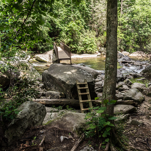
I decided to take the Foothills Trail down to the river.
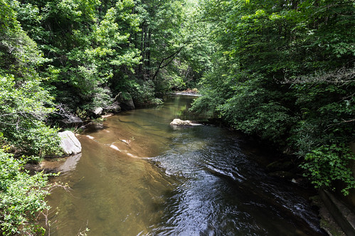
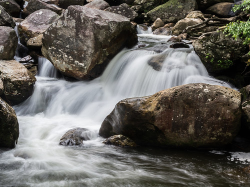
The trail in this section is a series of switchbacks down to the river, which also happens to be the border between Jackson and Transylvania Counties. Even without a waterfall, the river is still rather photogenic.
Crossing the river involves climbing up a ladder to a large boulder, then hopping from that boulder over to the bridge over the river.
The bridge was my turnaround point. I did stop to take some more photos of the river.
Although I did peek over the other side to see where it went.
As I headed back up toward the viewing decks, I noticed the sky had become cloudy. As I was heading back up the stairs, sporadic sprinkles turned into a downpour. Fortunately, by the time I reached the upper viewing deck the downpour had stopped, at least temporarily. With nobody around competing for space I could now take my photos of Upper Whitewater Falls from the upper viewing deck. I already showed those, so won't repeat them. I also took a short video here too:
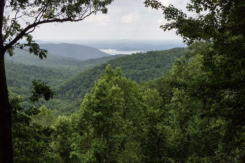
As I walked back to the car, I noticed this nice view of Lake Jocassee:
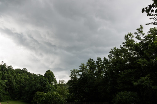
I sat in the car a few minutes while the clouds got darker and darker. The clouds looked ominous...
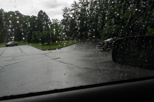
then downpour began, and the lightning and thunder became intense.
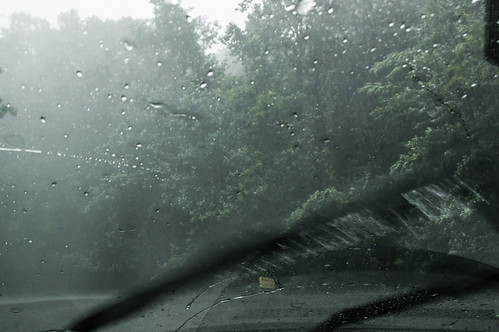
I had plans to visit two more waterfalls, D.E.W. Falls and John's Jump, located a short distance north on NC 281, but that idea was now out of the question. I turned south instead of north toward home.
Wrapup
The storm certainly added a dramatic ending to a good day on the trail. The downpour continued the whole way home, with only a few brief breaks before the downpour would start right up again.
I've uploaded my trip photos from this trip to an album on Flickr, or you can go through them below:
I've been to Dupont State Forest several times over the years to visit its lovely waterfalls. All but one that is, Wintergreen Falls. And then recently I heard about an undocumented waterfall in Dupont State Forest, and that increased my interest in return visit even more. But first I had to locate this undocumented waterfall! I first heard about this waterfall on the Facebook group North Carolina Waterfalls . Those posting their photos of this waterfall were coy about its exact location, and asking them for more information would have been a waste of time. To get its exact location, I would have to find out on my own. My first step was to view a few photos of the waterfall to get familiar with what it looked like. A panoramic photo of the waterfall by Christopher Cockfield and a photo by Dan Goodwin both showed a sandy beach area on the left side in front of the waterfall. (Note: I tried to embed these two photos, without success. Sorry!) I was prepared to pore over a ...
I dedicated one of my vacation days this week to visit Pinnacle Mountain Falls, a waterfall located off the Palmetto Trail on Pinnacle Mountain near Table Rock State Park in Pickens County. The trailhead is located in Table Rock State Park ($2 admission fee until the busy season, then it's $5) by what is now called Pinnacle Pavilion, formerly known as The Barn. I had the area to myself, so I felt free to give the pavilion a quick looky look. I took a peek in the window, and thought about what kind of events could be held here. Then it was on to the trailhead. I took notice of this sign. I did see plenty of small, nuisance type bees going to and from the waterfall, and a few bumble bees too, but none of them showed any interest in me. The trail is blazed yellow, and easy enough to follow. The trail crosses a dirt road... before descending toward the Table Rock Wesleyan Camp . The camp was greatly obscured by greening trees, so I couldn't capture m...
With September comes meteorological fall and cooler weather, and the area experienced just that for a few days around last Sunday. My original plan last Sunday was to spend time with my ailing 14 yr old cat, Princess, but she didn't even make it past Monday. I changed my Sunday plan to a day trip and, after consulting my ever growing to-visit list, I settled on a paddling tour of Lake Summit in Tuxedo, North Carolina. I arrived there early, at least by my standards. The place wasn't very busy when I arrived. Permits are required to access Lake Summit for powered boats and personal watercraft like jet skis, but no permit is required for kayaks. Works out fine for me! However, to get a permit you must live in the Green River Fire District. The website of the homeowner's association has those details. The gate for the boat ramp was closed at the time, forcing me to walk through the pedestrian access with my inflatable kayak. I launched and headed for my first plann...


I've been to the Lower falls many times but had no idea that the Upper falls were a much shorter hike! I'll have to go this fall when it's cooler.
ReplyDelete