I have some time off this week, and I've planned a few adventures to fill the time. The first day I
went on a bit of a ramble in Spartanburg and Greenville Counties, the second day I
visited Sids Falls in Oconee County. The third, and last, adventure this week is to Lake Hartwell to search for ruins of post-Andersonville buildings on Shaw Island and continue that search on Andersonville Island.
The last I went there (
with Tom Taylor and Bernie Waddell), we launched from Jarrett Landing. We didn't have much to show after our expedition. As usual, I hope for the best, but expect nothing.
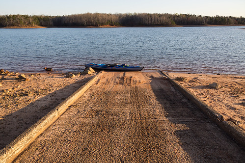
I launched my kayak from Double Springs Boat Ramp (
at the end of Double Springs Road) this time because its closer to Shaw Island and the northern part of Andersonville Island.
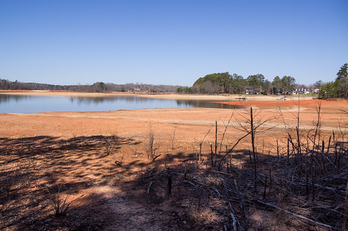
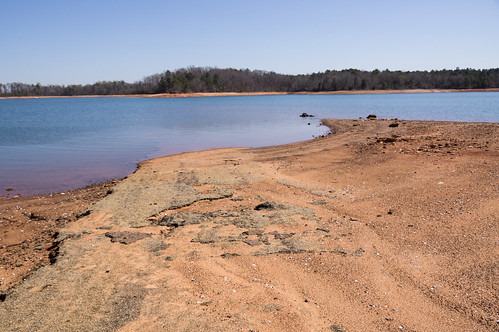
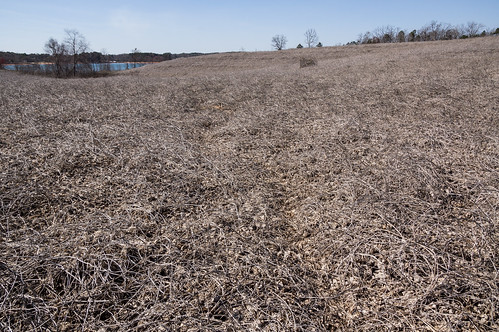
The lake level remains about 10ft below full pool:
I landed first on the western part of Shaw Island where an abandoned road enters the lake.
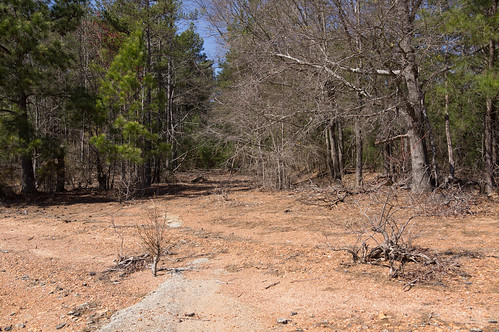
I then followed the abandoned road into the interior.
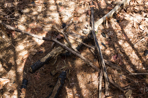
I searched around both sides of the road, not finding much except plenty of dead trees and
some evidence of a fire in 2007.
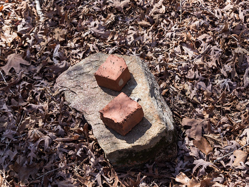
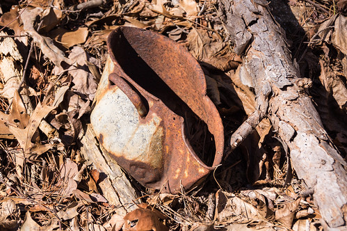
My search only turned up a few bricks and some rusting metal. No signs of building ruins.
My goal was to reach the center of the island where three roads converged. That is where the best chance of finding building ruins would be.
The way became thick with dead trees and young pine trees. Progress was way too slow, so I had to head back. I'd have try this island again some other day. On to Andersonville Island.
Andersonville Island was a short distance away. The Shaw Island portion of the trip was a dud, and I hoped this part will turn out better. At least in this part of Andersonville Island I had no trees to worry about.
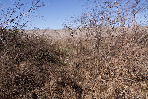
The whole area is covered with loud, crunchy dead kudzu with a few clusters of blackberry bushes scattered around. I could see where faint paths have been "carved" by other explorers.
My first target was the GNIS location of Morris Shoals School (there's also a second school with that the same name further north). GNIS locations of old historical buildings like this school are rarely exact, but they do get you to within a few feet.
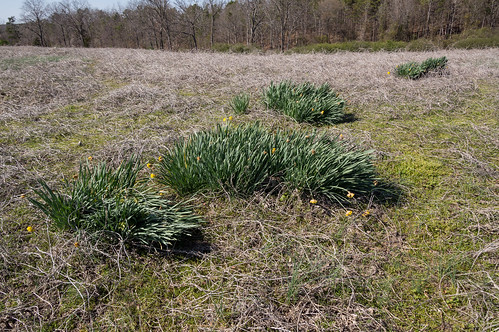
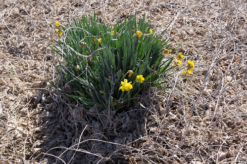
Very near the marked location of the old school, I found daffodils (
showing people were here) and a mound:
This is something! I found another group of daffodils a bit further away, and a mound.
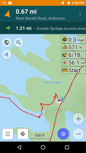
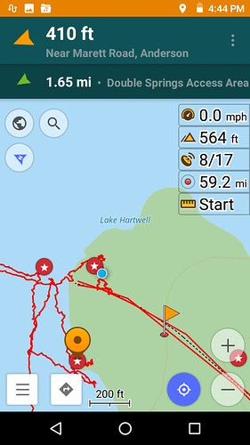
I already knew there were some good possibilities at the very northern end of the island based on my research studying aerial maps for the last trip here. Those possibles are represented by red stars:
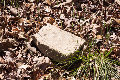
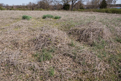
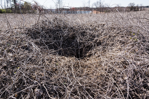
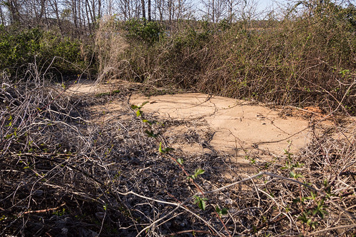
Near where the abandoned road enters the lake, the red star in the screenshot above and to the left of the blue circle (representing my current position) was my last stop, and my best stop.
An old historic aerial from the late 1940s showed a structure here, and this concrete pad confirms it.
I wanted to visit the location of the second, more northern Morris Shoals School, but the sun was getting low in the sky and I wanted to get back to the boat ramp before it got dark. I paddled my way the 2.3 miles (according to my GPS trace) back to the boat ramp. I had the place to myself except for someone fishing.
Shaw Island was a bust this trip, but northern Andersonville Island came through. The concrete pad was the best find, but finding daffodils was still a win. I still want to explore the center of Shaw Island, where the converging roads make it a more likely place to find building ruins. I also still want to explore more of northern Andersonville Island, especially where GNIS records the location for the northern school.
Update: I've added a map of the GPS trace of this adventure:
You can view my photos from this trip in
an album on Flickr and in
an album on Google Photos.


Interesting finds. As I said on our last outing, I think any ruins would be post-Andersonville. Daffodils are always a good indicator that there was a homestead nearby.
ReplyDeleteYea, I didn't make clear I was searching for later ruins, not ruins of the town of Andersonville itself.
DeleteGreat finds. I first found out about this place from your previous post. I went today (by powered boat) to poke around a bit, but didn't have enough time to explore. I'll be heading back in a week or two, walking the length of the island, and hoping to find something. interesting.
ReplyDeleteI know where there are several old homesites on this island and would be glad to show you.
ReplyDeleteMany years ago, my dad transplanted some jonquils from what was once his moms garden on Shaw Island. My sibs also walked the island with dad and Uncle Henry, who told the story about the last bag of cotton he picked before taking off to fight in WW2.
ReplyDelete