The first outing this week was
a walk on the Swamp Rabbit Trail. In the second of three outings this week, I visited Dupont State Forest in Western North Carolina for the third time this year. The first two visits to Dupont State Forest were to visit Upper Grassy Falls, sometimes called Secret Falls. This visit was prompted by
a 2007 article I came across (no telling how long ago) on BlueRidgeNow.com about some foundation ruins off Longside Trail near the Corn Mill Shoals Access Area
off Cascade Lake Road.
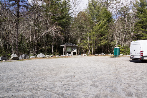
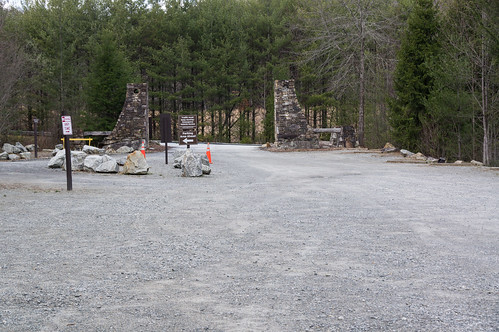
I found the Corn Mill Shoals Access Area mostly empty.
The directions in the article were a bit vague, but good enough as a starting point.
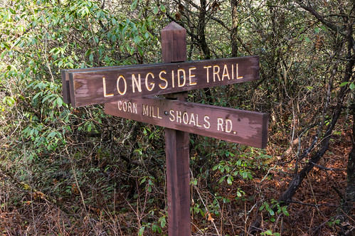
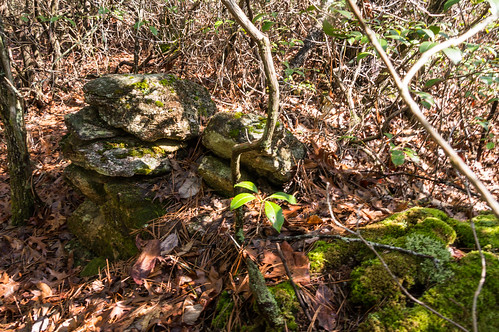
Bear right onto Longside Trail and within minutes, what remains of a stone foundation becomes visible just off the trail.
From the Corn Mill Shoals Parking Area, you bear left onto Longside Trail, not right. The author must have come in the other end from Pine Tree Trail then, placing the ruins much closer to the other end of the trail.
I walk around a gate on Corn Mill Shoals Road, then left onto Longside Trail.
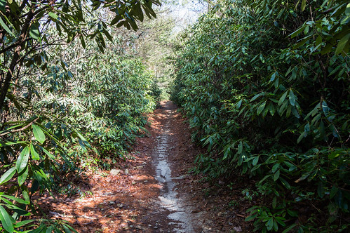
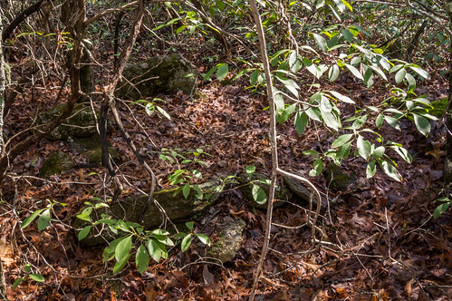
This part of the trail was surrounded by rhododendrons. No ruins were likely to be around here.
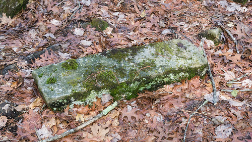
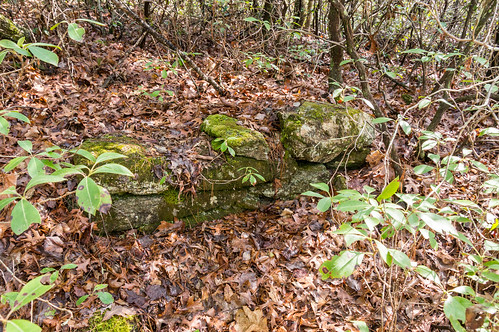
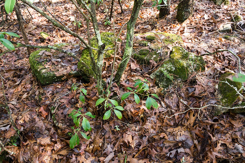
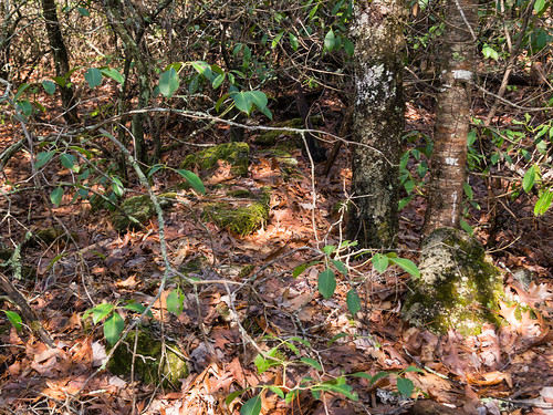
After a sharp turn to the left, then one to the right, I get to an area that looks much more promising. Soon I spotted some rocks just off the trail.
I went over to investigate. A quick look was enough to convince myself I had found the foundation ruins from the BlueRidgeNow article.
The tricky part was getting photos of the stones that weren't too obscured by vegetation. Several photos were good enough to keep though.
The location is approximately 35.18025 N, -82.63797 W, or
just beyond the S curve on Longside Trail a few feet off the trail:
I made the quick trip over to the Buck Forest Access Area i
n Henderson County off Staton Road, a convenient area to access Dupont's major waterfall attractions. I was curious to see what's changed
since my last visit in 2013 to this area of Dupont State Forest.
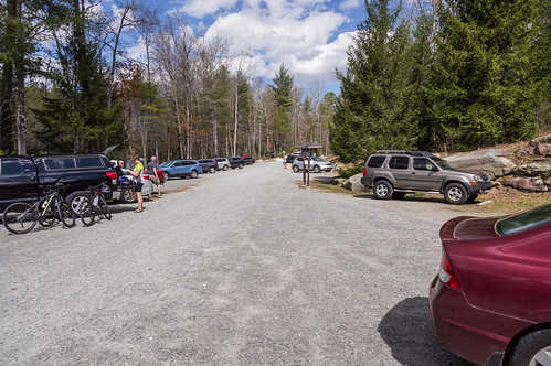
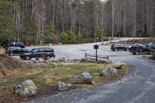
One change I noticed immediately was when entering the parking area, you must now turn left, then follow a new road as it goes around then loops back around to the existing parking area.
Also interesting was how full the parking area was, even on a weekday. This area is much busier than
my last visit.
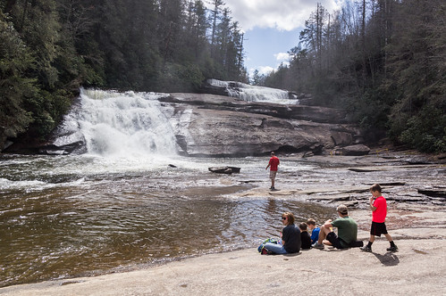
I wanted to see the
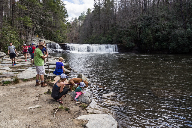
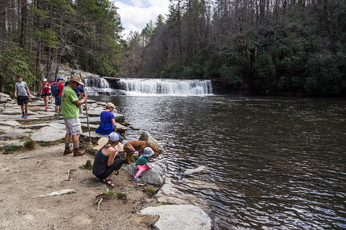
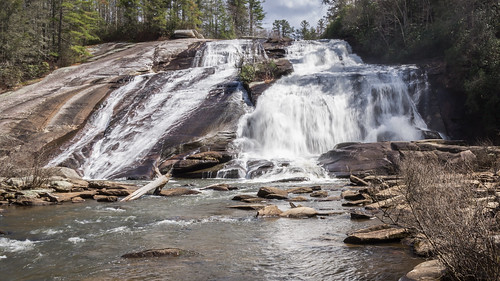
Hooker-Moore Cemetery while I was here. To get there, I'd have to head down Triple Falls Trail. As you might suspect from the descriptive name of the trail, Triple Falls was on the way there. People of various ages were at the waterfall taking photos, or just plain relaxing.
The waterfall was brightly light. Unfortunately, I don't have a neutral density filter I could put over my lens to drop the exposure. Fortunately, rapidly moving clouds passing over the area were enough to act as a natural density filter.
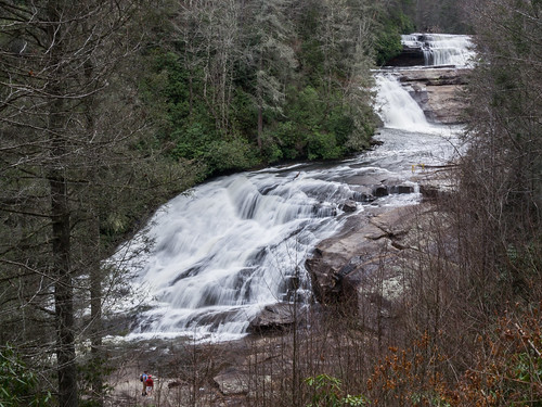
Back on the trail, I took a photo from an overlook along the trail.
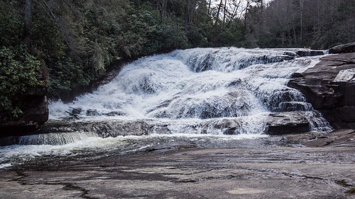
Then I continued down Triple Falls Trail where it descends to the river level. A path branches off back toward the base Triple Falls, closely hugging the river bank.
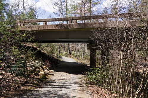
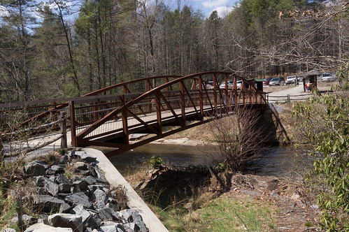
I backtracked to Triple Falls Trail and headed toward Staton Road. When I last visited a few years ago, hikers had to risk crossing the road to get to Hooker Falls. Since then, the powers-that-be have rerouted the trail underneath the Staton Road bridge over Little River.
A short distance down the trail, a pedestrian bridge now crosses over Little River to bring hikers to and from the Hooker Falls Access Area.
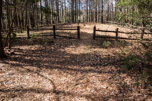
When I last visited, the road to the Hooker-Moore Cemetery was at the end of the parking area. Now that the parking area has expanded, the cemetery road stayed put, but is now between the original parking area and the newer parking area beyond the original one.
I found myself all by myself for a welcome change.
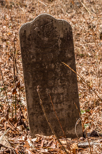
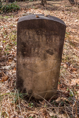
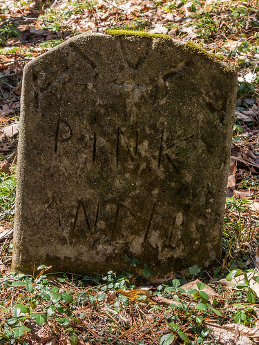
I found a lot of unmarked field stones. Some of the graves were too worn to be intelligible. I labeled my photos from the
Find A Grave listing for this cemetery thanks to those with more ability than me.
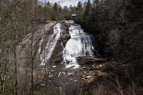
As expected from the many cars in the parking area, Hooker Falls was busy.
Fortunately, with some patience and some cropping in editing I got the few shots I wanted.
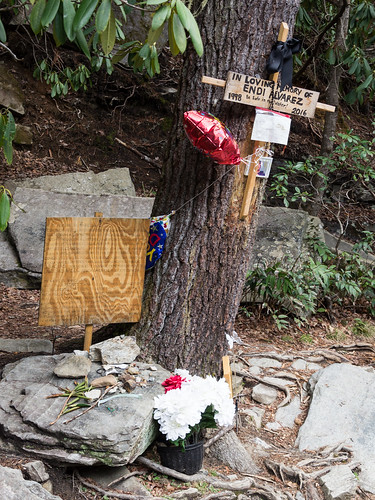
Nearby is a sobering reminder that waterfalls, even low topped ones like Hooker Falls are dangerous.
I've heard of several incidents in the past year, including this one, were people were severely hurt or killed at waterfalls in both Carolinas. Too many to list here sorry to say. Actually, one is too many, but anyway... Endi Alvarez, 18, was swimming on July 10, 2016 with friends below Hooker Falls when he went under and didn't come back up. Friends brought him out of the water, but he died on the way to the hospital.
WNCN.com,
WLOS.com,
Citizen-Times.com,
among others, reported on the accident.
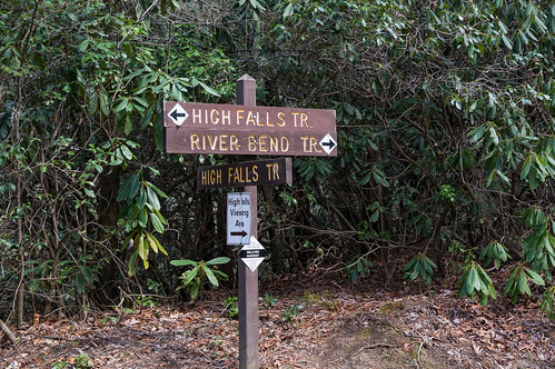
I decided I had time to visit one more waterfall today, High Falls. The route took me down High Falls Trail to the junction of River Bend Trail.
In my earliest visits, getting to the base required going down a slippery, steep path. I almost once lost a lens cap down this path because once it started rolling downhill it just kept on going. Not only is this path forbidden now, they've blocked it with branches to keep you from even thinking about it.
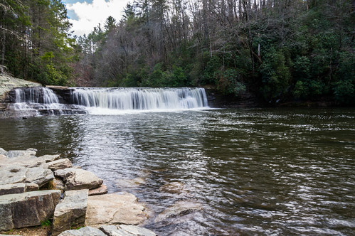
River Bend Trail is the officially sanctioned way of getting to the base of High Falls. I only found a few people here, certainly nothing resembling the crowds at Triple Falls and Hooker Falls.
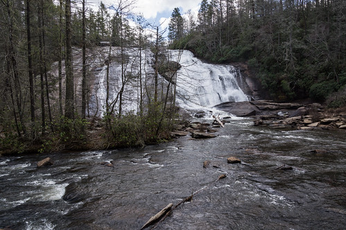
As before in my previous visits, trees block more than half of the falls from this straight on view.
Continuing down the river side trail provides a much better, unobstructed view.
I headed back to High Falls Trail and continued up the trail to the overlook. Trees obstruct the view here too.
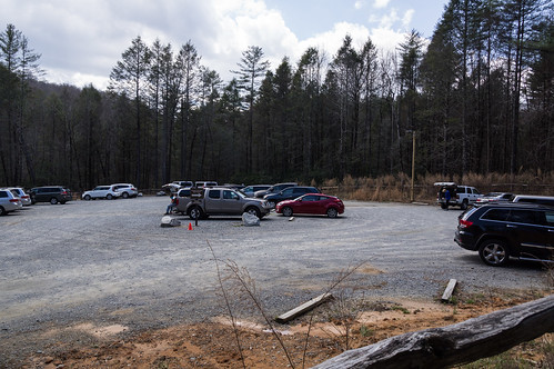
Continuing up the trail then down a foot path brought me back to the parking area. The parking area was still busy with people coming and others going. If it's like this on a weekday, I have to wonder how crazy busy it must be during the weekends.
I had a good time today finding the stone foundation ruins and revisiting some old favorites. It was interesting seeing some of the improvements I've heard about but haven't yet seen since my last visit to this area of Dupont State Forest a few years ago.
I've shared my photos to
an album on Flickr.


Comments
Post a Comment