Photographic explorations centered around Upstate South Carolina.
Stumphouse Tunnel and Isaqueena Falls
Get link
Facebook
X
Pinterest
Email
Other Apps
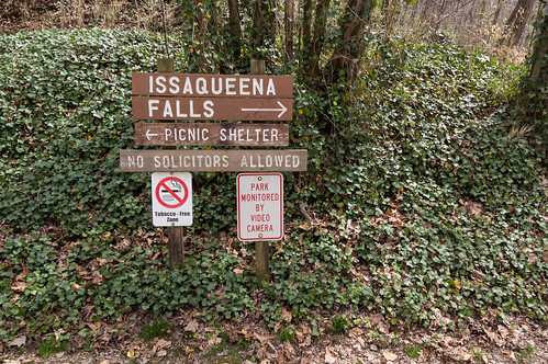
For whatever reason, I've never been to Stumphouse Tunnel and Issaqueena Falls before now. Considering the site features tunnels from a never completed railroad, and a nearby waterfall with a lovers leap type legend, it's a mystery why it took so long for this site to bubble up to the top of my to-visit list. Both sites are located off Stumphouse Tunnel Road, itself off S.C. 28, a few miles north of Walhalla.
Introduction
Stumphouse Tunnel was one of three planned tunnels in South Carolina for the Blue Ridge Railroad, a 195 mile railroad to be built from Anderson, South Carolina, to West Union, South Carolina, to near Clayton, Georgia then north up to Knoxville, Tennessee. The motivation for the project was to provide a more direct route for goods to travel between South Carolina and Tennessee, cutting out the much longer, costlier ways required at the time to avoid the mountains.
The Blue Ridge Railroad obtained a charter from South Carolina in 1852, but work on the railroad didn't actually begin until 1854. In South Carolina, the path required three tunnels, named Stumphouse Tunnel (through Stumphouse Mountain), Middle Tunnel, and Saddle Tunnel (through Turnip Top Mountain). In Georgia, two tunnels were required. The first was to be cut was Dick's Creek Tunnel (now Black Diamond Tunnel) through Wall Mountain, the second tunnel was to be cut in Warwoman Valley where Warwoman Dell is today.
By 1859, only the part between Anderson, SC to Pendelton, SC to West Union, SC was in service, along with a short line from Anderson to Belton, SC. The South Carolina Legislature decided against subscribing more money in 1859 to the railroad project and work on the railroad wound down, with one exception:
In 2000, the railroad segment between Walhalla and West Union was abandoned due to lack of customers and traffic.
A few proposals were made after the Civil War over the years to finish the project, the last one floated in 1940, but they all came to nothing.
Of the five tunnels started in South Carolina and Georgia, only the Middle Tunnel was excavated all the way though.
This snippet from Colton's 1860 map of Georgia shows where the railroad would have gone through South Carolina and Georgia if completed past West Union and put into service:
In 1940, Clemson College (now Clemson University) leased Stumphouse Tunnel to experiment with making cheese:
In 1946, Clemson College bought a half interest in the site. Five years later in 1951, Clemson College bought the other half interest to complete ownership of the site.
Operations resumed in 1953, but ended five years later in 1958 when the cheese manufacturing operation moved over to the campus. The site was leased to the Pendleton Historical District Commission in 1970 and the site became a tourist attraction. The City of Walhalla now owns and manages Stumphouse Tunnel and Issaqueena Falls, and also owns part of the old roadbed (now a trail). The South Carolina Department of Natural Resources owns another part of old railroad roadbed from about Middle Tunnel up to Saddle Tunnel where the old right of way enters private property.
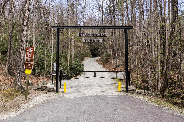
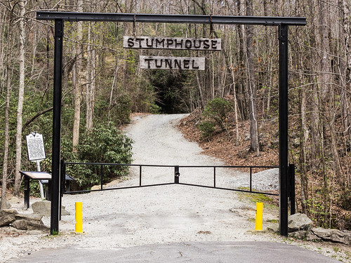
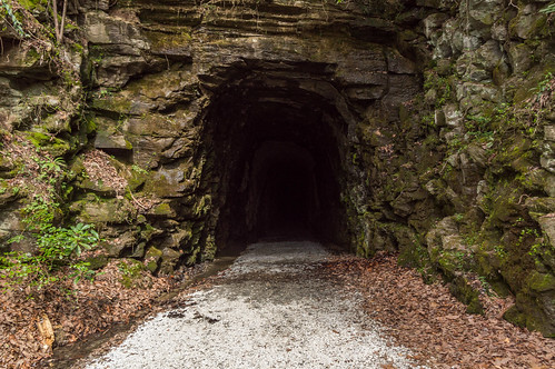
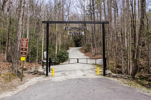
Stumphouse Tunnel
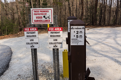
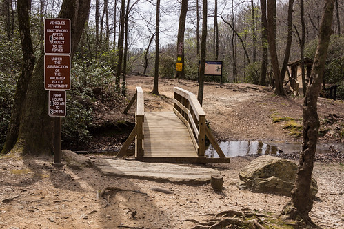
I stopped at the pay station to leave my meager payment, but the directions were either confusing or out of date. The instructions said to detach the hangtag from the pay envelope, but hang on rear view mirror. Except there was no hangtag to detach, and none of the other envelopes I checked had any either. Oh well.
I chose a parking spot about halfway between the tunnel and the waterfall, since I'd be visiting both anyway. The walk to the gate was a short one.
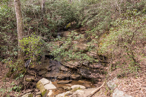
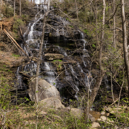
What I noticed first was this low flow waterfall.
This one would look beautiful just after a period of rain.
Stumphouse Tunnel was the longest planned (at 5863 feet, over a mile!) of the three tunnels in South Carolina. I found an 1857 article in the Edgefield Advertiser about the process of how the blasting related to the air shafts an interesting read:
What I noticed when nearing the tunnel was the cool breeze blowing out:
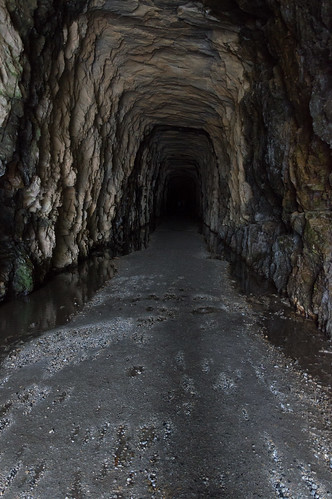
Inside the tunnel is cool, drippy, and humid.
I eventually reached a locked gate. My camera was out of its element in the dark:
But my cellphone did better with its flash and its better low light lens:
In earlier years, you could go much further on, but now it's sealed off to prevent injury from any falling rocks.
I turned around and started walking back toward the light.
I made a terrible video, but I thought it worth posting for the audio of dripping water and the echo-y voices.
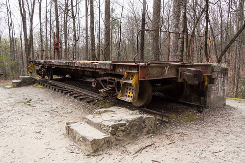
Outside the tunnel is a Southern Railway caboose, or at least it was once. The actual caboose is missing. What happened to the rest of it?
While Stumphouse Tunnel was under construction, the workers, mostly Irish, lived on top of the tunnel on Stumphouse Mountain. At Tunnel Hill's peak, 1500 people once lived there. When work was suspended in 1859, the population rapidly dwindled.
...was once a busy town of fifteen hundred people, including five hundred laborers, who worked in and around the tunnel. The town had a hotel, boarding houses, a school, a church (Catholic) and the usual complement of barrooms. There were several stores.
I've snipped the most relevant part of the article below:
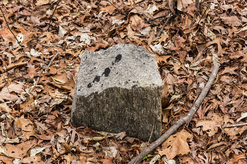
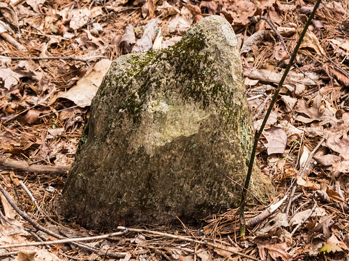
The cemetery is all that's left of Tunnel Town, and is nothing but field stones now. The rest, including the cemtery, was looted the Civil War.
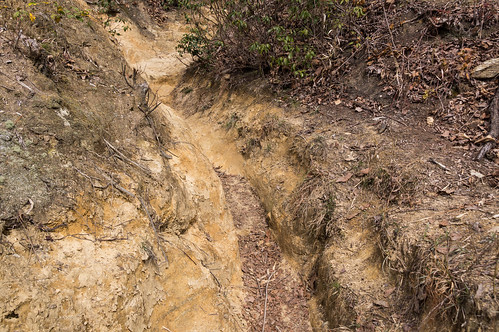
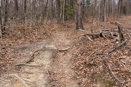
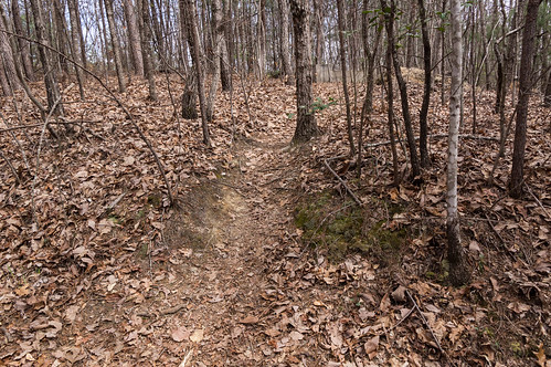
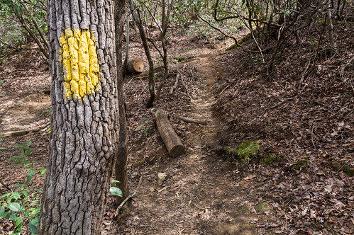
Several steep paths to the right of Stumphouse Tunnel lead up the hill before joining to become one path:
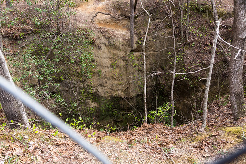
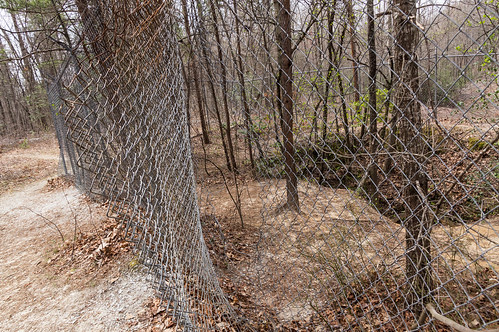
I followed the path past the first or four airshafts. A fence surrounded the airshaft.
Someone cut a hole in the fence, but I wasn't feeling suicidal today so I kept going.
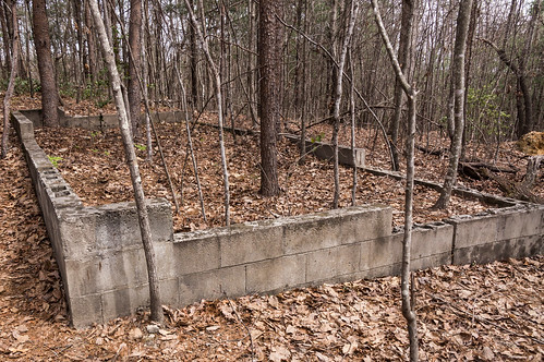
A foot path leads past a concrete block foundation...
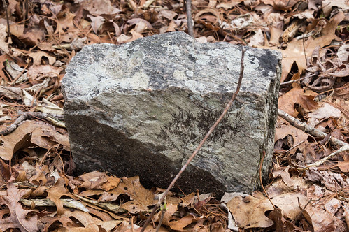
I saw several field stones that must mark graves, but no engraved gravestones.
I explored a bit more, but I also didn't bother looking for the three other air shafts. No thanks! I headed back down the steep grade...
to visit Issaqueena Falls
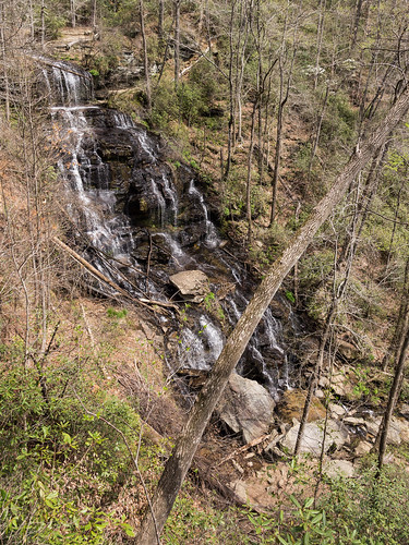
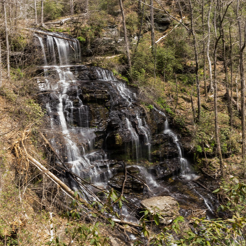
Issaqueena Falls
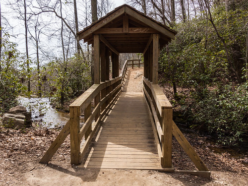
A walk over two bridges...
then down a dirt path to an overlook. The overlook provides a good view of the waterfall, but a steep path leads down to the base where several parents and their children were enjoying themselves.
Issaqueena Falls is named after Issaqueena, a Native American maiden (the tribe varies) captured by the Cherokee. As the legend goes, Issaqueena fell in love with a white man (whose name and occupation varies) and left the tribe to be with him. When the Cherokee tribe eventually catches up with her, she either jumps off the waterfall to her death or she just fakes it. This legend is almost a Choose Your Own Adventure type story.
The beauty of this waterfall is certainly not in question. I took a few different angles from the viewing deck down toward the base. It's too bad the flow was rather low.
I took a short video to show off the water flow that also happens to show people frolicking at the base:
Blue Ridge Historical Trail
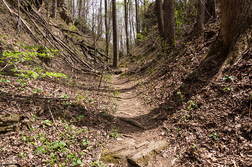
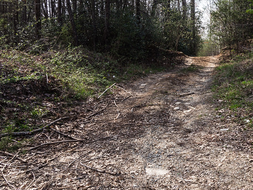
Near the top of the waterfall is the trail head to the Blue Ridge Historical Trail, a trail made by the Boy Scouts that closely follows the roadbed of the Blue Ridge Railroad. The initial part of the trail ascends up to the railroad grade on the mountain.
After that, the trail stays on the old railroad grade, except to detour around the two tunnels along the trail. It seemed like the old roadbed was mostly cuts...
with only the occasional fill.
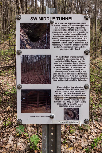
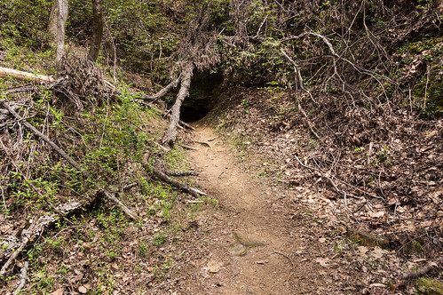
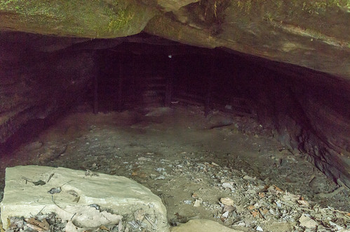
An informative sign gives context to the southwest entrance to the Middle Tunnel.
This tunnel, because it was earthen instead of stone like the other two, was the only one completed to some degree.
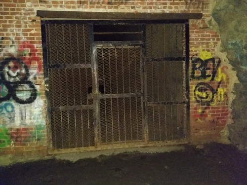
A bat friendly gate keeps people out while allowing bats to pass through.
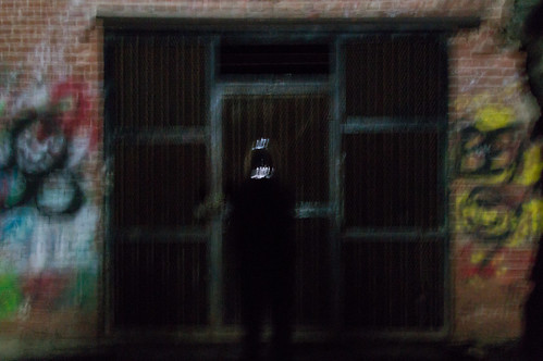
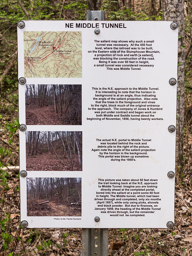
I passed by two closed red gates along the Middle Tunnel detour to what was once the northeast entrance to Middle Tunnel.
According to the sign, this entrance was closed in the 1950s.
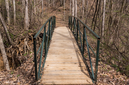
Back along the trail, I cross over a pedestrian bridge, ...
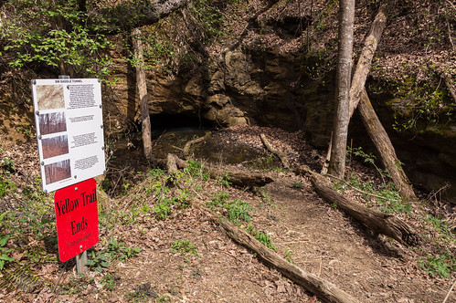
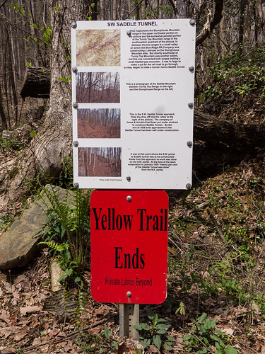
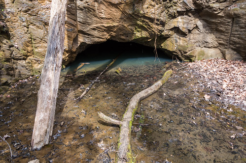
to approach in a few minutes the third tunnel, Saddle Tunnel.
As the sign explains, little work was done on this tunnel.
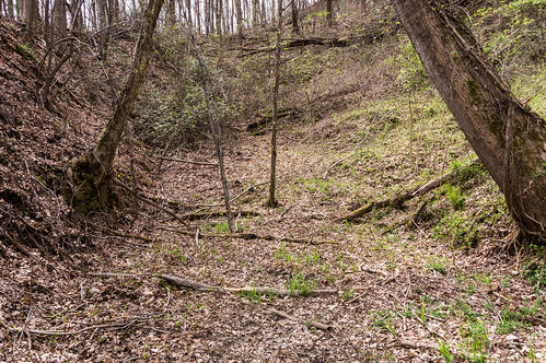
And what remains today is submerged in water.
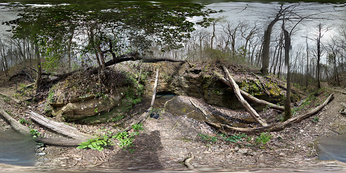
I even took a 360 panorama of the trail's end for no particular reason except that I could. You may have to click though for the best experience:
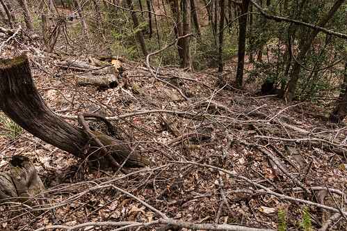
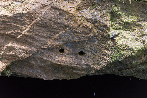
All that's visible now of these worker's efforts are some drill marks.
When I was finishing up, some what I supposed where maintenance workers showed up in a John Deere car. They stopped for a minute, then left again. I caught up to them a few more times along the way. This would also explain the open gates when I passed by this time through.
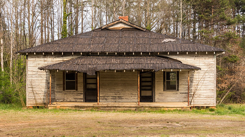
Neville School
On the way in, I spotted an old school off S.C. 28. My POI map identified this place as Neville School. I just had to stop by for a quick visit on the way back, so I did.
This is at least the second Neville School..
The school that preceded this one was located where Neville Cemetery is now. According to newspaper archives of the Keowee Courier, this earlier school was also used as a church, and the grounds as cemetery. I cross referenced one person, Joseph Merrill, with Find A Grave. Find A Grave listed his burial location as Neville Cemetery, off Cemetery Road a short distance away from the later school building.
A 1947 aerial shows a building that may have been the earlier school at the southern end of Neville Cemetery, but was gone by the 1950s aerial, replaced with graves.
The earlier school building was succeeded by the existing one in either 1922 or 1923.
The property was purchased in July 1922 according to this deed.
Given the time needed to build a new school, the new school building probably wouldn't have been ready before the 1923 term. I found a listing for this school in the 1954-1955 School Directory of South Carolina, but not in the 1955-1956 edition. This places the school's likeliest active years from 1923 until 1955. The Neville Community Club has owned the school building since 1970.
White Cut Road
In doing my research for this adventure, I studied this USGS map from 1960 of the area depicting the old Blue Ridge Railroad grade:
One area in particular on the USGS map interested me.
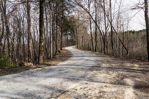
The old railroad grade joins up with a road for a short distance! I thought it would be neat to drive over the old roadbed. The road on the map is named White Cut Road, paved part of the way, and dirt and gravel for the rest. The old railroad grade is located on the dirt and gravel part.
The old railroad grade, seen here on a private dirt road, joins White Cut Road:
White Cut Road curves and follows what was a fill on the old railroad grade.
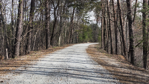
White Cut Road soon curves away from the old railroad grade. The old railroad grade is only visible for a very short distance before being disappearing.
Wrapup
I've uploaded to my Google Maps account tracing what I've found of the old Blue Ridge Railroad grade.
I hope to visit Warwoman Dell someday where more remnants of the Blue Ridge Railroad can be found. According to RailGA.com's section about the Blue Ridge Railroad tunnels, landslides have closed off one end of Warwoman Tunnel at Warwoman Dell and road construction has closed off the other end. Dick's Creek Tunnel (now called Black Diamond Tunnel) was about half finished. The west end of Dick's Creek Tunnel is about 1400 feet long, but is also flooded and on private property. The west end is on public land, but only extends 59 feet and is not easy to reach (if your familiar with bushwacking that is).
I've uploaded my photos to an album on Flickr, or you can go through them below:
I'm pretty sure the caboose was vandalized, in the 80s?
At Sandy Ford, on the SC side of the river, if you hide downstream you can find the remains of a quarry that was going to be used in the bridge that would cross the river at Dick's Creek.
I've been to Dupont State Forest several times over the years to visit its lovely waterfalls. All but one that is, Wintergreen Falls. And then recently I heard about an undocumented waterfall in Dupont State Forest, and that increased my interest in return visit even more. But first I had to locate this undocumented waterfall! I first heard about this waterfall on the Facebook group North Carolina Waterfalls . Those posting their photos of this waterfall were coy about its exact location, and asking them for more information would have been a waste of time. To get its exact location, I would have to find out on my own. My first step was to view a few photos of the waterfall to get familiar with what it looked like. A panoramic photo of the waterfall by Christopher Cockfield and a photo by Dan Goodwin both showed a sandy beach area on the left side in front of the waterfall. (Note: I tried to embed these two photos, without success. Sorry!) I was prepared to pore over a ...
I dedicated one of my vacation days this week to visit Pinnacle Mountain Falls, a waterfall located off the Palmetto Trail on Pinnacle Mountain near Table Rock State Park in Pickens County. The trailhead is located in Table Rock State Park ($2 admission fee until the busy season, then it's $5) by what is now called Pinnacle Pavilion, formerly known as The Barn. I had the area to myself, so I felt free to give the pavilion a quick looky look. I took a peek in the window, and thought about what kind of events could be held here. Then it was on to the trailhead. I took notice of this sign. I did see plenty of small, nuisance type bees going to and from the waterfall, and a few bumble bees too, but none of them showed any interest in me. The trail is blazed yellow, and easy enough to follow. The trail crosses a dirt road... before descending toward the Table Rock Wesleyan Camp . The camp was greatly obscured by greening trees, so I couldn't capture m...
Yesterday I headed north to visit the Upper and Lower Whitewater Falls, two impressive waterfalls located on the Whitewater River both located near the North Carolina-South Carolina border. Whitewater River empties into Lake Jocassee a few miles downstream from Lower Whitewater Falls. Ordinarily I avoid hiking in humid weather, but with three days off in a row I found I could not resist the idea of an outdoor adventure. These two waterfalls were definitely worth seeing even in the high humidity. Lower Whitewater Falls Lower Whitewater Falls is a 200 foot drop (over 400 feet if the surrounding cascades are included!) on the Whitewater River in northern Oconee County on land owned by Duke Energy for their Bad Creek Hydroelectric Station . Lower Whitewater Falls is most easily accessed from the Foothills Trail and Whitewater River Access Area Parking off Bad Creek Road: Bad Creek Road is off SC 130 near the NC border. The gate was open when I arrived, and stays open until dark...


I'm pretty sure the caboose was vandalized, in the 80s?
ReplyDeleteAt Sandy Ford, on the SC side of the river, if you hide downstream you can find the remains of a quarry that was going to be used in the bridge that would cross the river at Dick's Creek.
Look forward to all your posts, they are great.