Exploring Yellow Branch and Rocky Bottom Creek
I spent two days this week exploring two different creeks in two different counties in the Upstate of South Carolina. This is a rundown of what I found.
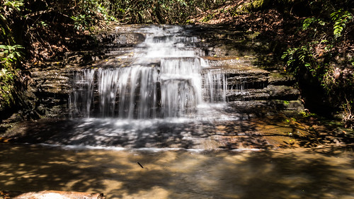
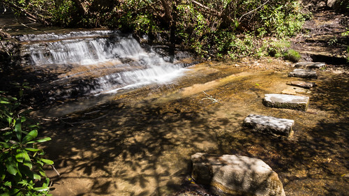
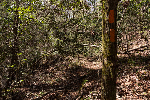
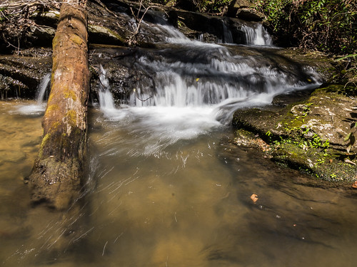
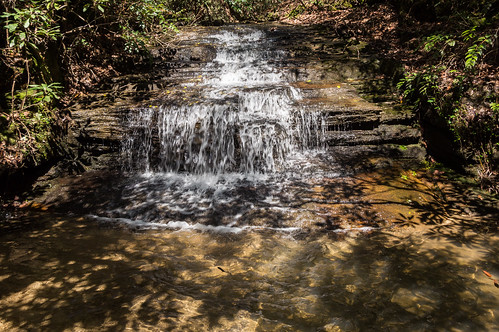
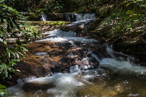
Yellow Branch has several minor drops before reaching Yellow Branch Falls, and the first one is actually located upstream from the parking area. A trail from the parking area goes right by this waterfall which is officially unnamed but I call it Upper Yellow Branch Falls.
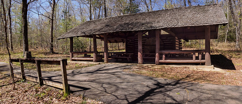
 I explored the trail a bit, before heading back through the parking area. I couldn't fit the picnic shelter into one frame, so I decided this would be the perfect opportunity to try out some photo stitching software:
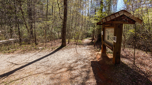
 I took another set at the trailhead and thought the stitched together result was good enough to keep:
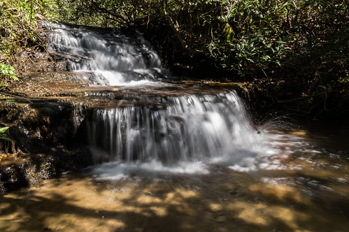
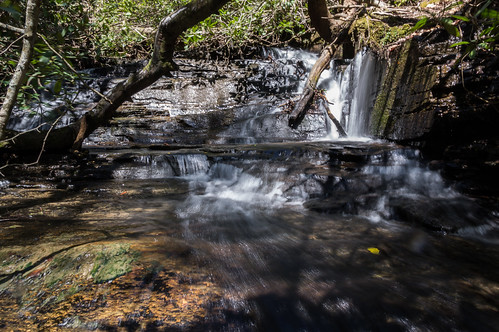
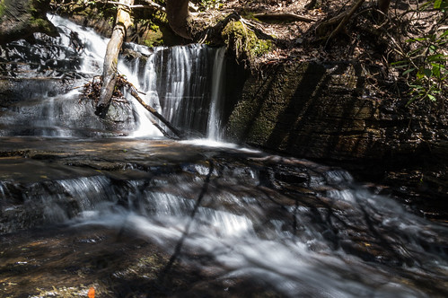
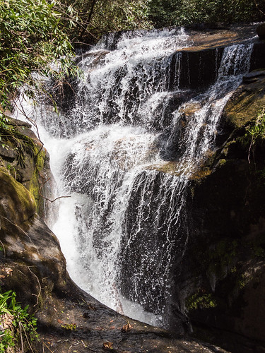
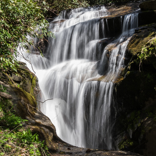
 Waterfalls two through four are easily visible from the trail. Some of my efforts at photographing them were more successful than others.
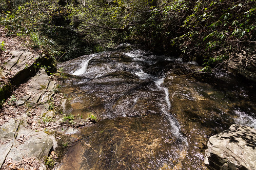
Waterfall #2:
 Waterfall #3:
 Waterfall #4:
 Instead of following the official trail across the creek...
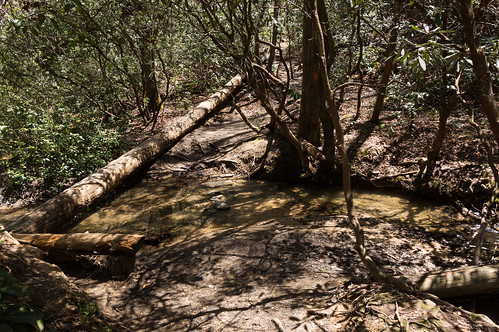 I took the old, abandoned trail to Yellow Branch Falls. Several years ago, the trail to Yellow Branch Falls was rerouted over this creek crossing and took a different path well away from the creek. The old way is no longer maintained...
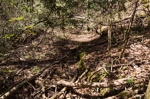 but it follows Yellow Branch. The trail is still mostly followable, except for a few spots where large trees have fallen and I had to either climb through them or around them.
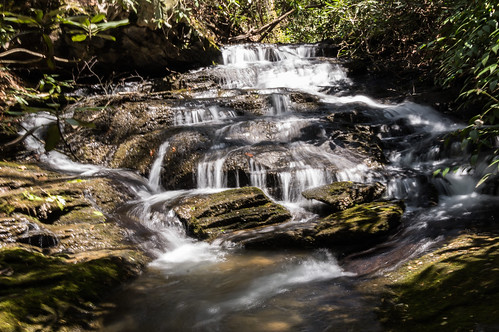
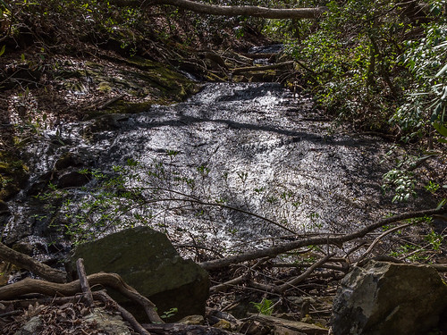
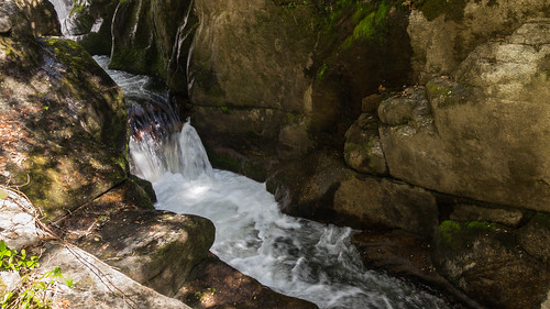
I found two more waterfalls along Yellow Branch before reaching the top of Yellow Branch Falls.
I thought the first one was easily the nicer of the two.
Waterfall #5:
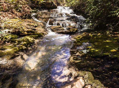 Waterfall #6:
 I followed the trail, now faint, to the top of the Yellow Branch Falls:
 I could see several people down at the bottom admiring the waterfall. However, I didn't want to head down to the base just yet. I wanted the sun out of the way, and I also wanted to see Lohr's Falls, located on a creek that feeds into Yellow Branch. There is no trail to Lohr's Falls, so I had to bushwack.
The bushwack was relatively easy, but the way I thought would work wasn't. I walked along a goat path back to the creek where I came across a waterfall a few hundred feet down from Lohr's Falls. The sun was perfectly positioned to make taking a good photograph of this waterfall impossible.
I could see several people down at the bottom admiring the waterfall. However, I didn't want to head down to the base just yet. I wanted the sun out of the way, and I also wanted to see Lohr's Falls, located on a creek that feeds into Yellow Branch. There is no trail to Lohr's Falls, so I had to bushwack.
The bushwack was relatively easy, but the way I thought would work wasn't. I walked along a goat path back to the creek where I came across a waterfall a few hundred feet down from Lohr's Falls. The sun was perfectly positioned to make taking a good photograph of this waterfall impossible.
 Fortunately, Lohr's Falls was a better subject, but the flow was a bit low for good results.
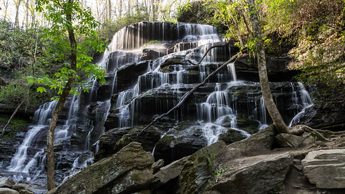
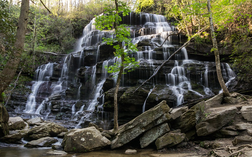
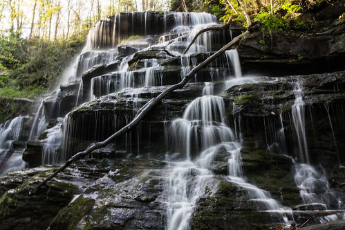
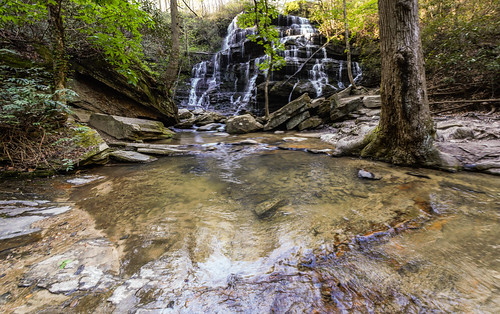
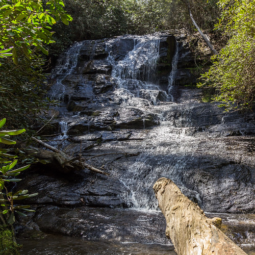 I went back to the top of the waterfall, and the sun still wasn't quite out of the way, so I elected to walk back down the old trail to the current trail. I met a few hikers returning from the waterfall. By the time I got to Yellow Branch Falls, I was by myself and the sun was mostly out the way now. These photos of Yellow Branch Falls were easily my best shots of the day. Then again, when the subject is this good looking as this one is, it's hard to go wrong:
 I took a short video to show the waterfall in action:
I made a map of my wanderings with points for the waterfalls I visited.
These photos are in an album on Flickr, or you can go through them below:
I tried to reach Rocky Bottom Creek a few weeks ago from Spencers Alley/Hunter Camp Road but I couldn't find a way that time. From my earlier look at a topo map of the area, I knew the area closest to U.S. 178 was the best place to approach, if approaching from the south. One problem was there was a ravine (with a creek at its bottom) passing through by U.S. 178 along the small parking area, making a return up such a steep hill I is something I had knew I no appetite for these days.
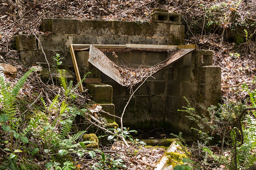
 In trying to avoid passing by a house on a small plot of private property surrounded by public property, I ended up wasting a lot of time bushwacking through pine trees and rhododendrons before coming across an overgrown logging road. I did come across an interesting find along the way though, an old spring:
 The old logging road seemed to end very near the creek. I followed near a trickle of a low flow stream down to near the creek. I crawled down to small ledge through some much to where I could access the creek.
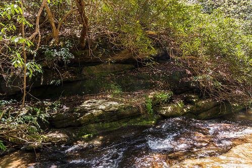 On the other side of the creek, I noticed a faint creekside trail, and above that I noticed another old logging road. But first, I took some photos of an interesting S shaped cascade:
 I turned my attention to following he old logging road above. I could hear two waterfalls, one was what I'll call Rocky Bottom Gorge Falls, the other one is Rock Bottom Falls. I could see Rock Bottom Falls, but I didn't try to head down from above since I thought the trail below would get me there. I went back and then down to the creek side trail. Soon I arrived at this fantastic waterfall pouring into a gorge:
 The water flows into this gorge:
 My photos don't really do this waterfall and gorge justice, so I took a phone video to show how neat this feature really is:
I thought I'd proceed on to Rock Bottom Falls, but the trail seemed blocked by a lot of fallen trees, similar to the damage I've seen around Triple Falls a few weeks ago. I thought maybe a path went sharply up, but after a quick look at my watch I decided I had no more time left and began to head back.
I expected the trip back to take a long time, but I actually ended up back at the car much quicker than I expected. I began following the same overgrown logging back, but I accidentally skipped the twists and turns of the old logging road for a more direct return this time. At the time I was just taking the path of least resistance. I ended passing near the private house, my track showed I only skirted the edge of the private property line.
I've made a map of my wanderings and the marked waterfall I visited, shown below:
My Rocky Bottom Creek photos are in their own album on Flickr, or you can go through them below:
Yellow Branch
A few miles north of Walhalla, almost across the road from Stumphouse Tunnel and Issaqueena Falls, is the Yellow Branch Recreation Area, a picnic area and a trailhead for Yellow Branch Falls. Yellow Branch Falls is a beautiful 50 foot waterfall about a mile and a half down a moderate trail and several stream crossings.Yellow Branch has several minor drops before reaching Yellow Branch Falls, and the first one is actually located upstream from the parking area. A trail from the parking area goes right by this waterfall which is officially unnamed but I call it Upper Yellow Branch Falls.
Waterfall #2:
I found two more waterfalls along Yellow Branch before reaching the top of Yellow Branch Falls.
I thought the first one was easily the nicer of the two.
Waterfall #5:
These photos are in an album on Flickr, or you can go through them below:
Rocky Bottom Creek
Rocky Bottom Creek is located in Pickens County near the mountain community of Rocky Bottom. The headwaters are located on the slopes of Sassafrass Mountain, then flow through Rocky Bottom before emptying into Eastatoe Creek in the Eastatoe Creek Heritage Preserve.I tried to reach Rocky Bottom Creek a few weeks ago from Spencers Alley/Hunter Camp Road but I couldn't find a way that time. From my earlier look at a topo map of the area, I knew the area closest to U.S. 178 was the best place to approach, if approaching from the south. One problem was there was a ravine (with a creek at its bottom) passing through by U.S. 178 along the small parking area, making a return up such a steep hill I is something I had knew I no appetite for these days.
I expected the trip back to take a long time, but I actually ended up back at the car much quicker than I expected. I began following the same overgrown logging back, but I accidentally skipped the twists and turns of the old logging road for a more direct return this time. At the time I was just taking the path of least resistance. I ended passing near the private house, my track showed I only skirted the edge of the private property line.
I've made a map of my wanderings and the marked waterfall I visited, shown below:
My Rocky Bottom Creek photos are in their own album on Flickr, or you can go through them below:


Comments
Post a Comment