Spencers Alley and What I Found There
Rocky Bottom is a small mountain community nestled in northern Pickens County. I've passed through here many times over the years, and I've wanted to stop to take a few photos, but I've never done so until now. I wanted to try and reach a waterfall on Rocky Bottom Creek, and this was the perfect opportunity to explore a few features in Rocky Bottom I've had on my list for some time now.
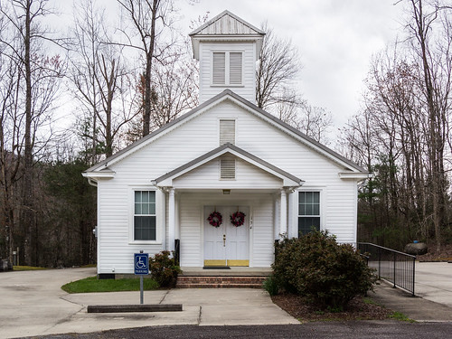
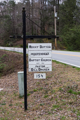
I parked at Rocky Bottom Independent Baptist Church.
As the sign shows, the church was established in 1941.
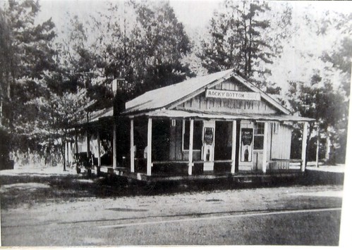
Then I walked by the side of U.S. 178 down to an old country store, the old Rocky Bottom Store.
The Pickens County Library's Flickr account has this old photo of the store when it was in business:
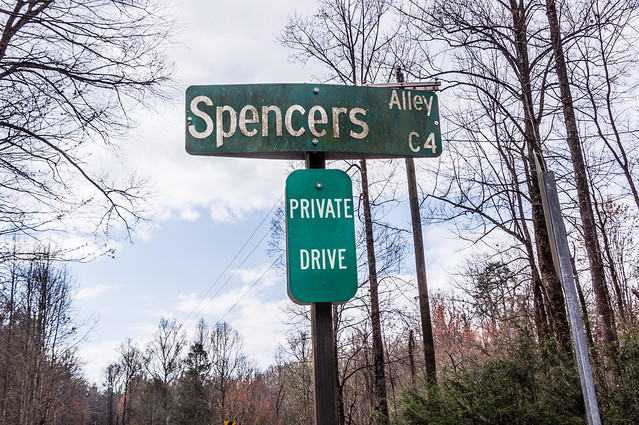
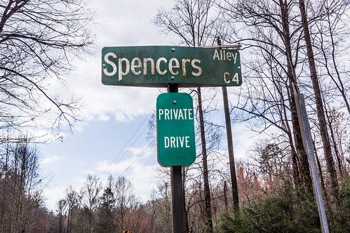
Then I moved my car down to a small parking area off U.S. 178, as far off the road as I safely could, then walked down to Spencers Alley.
A few private homes are off this road...
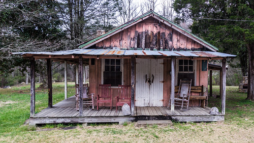
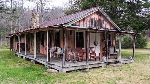
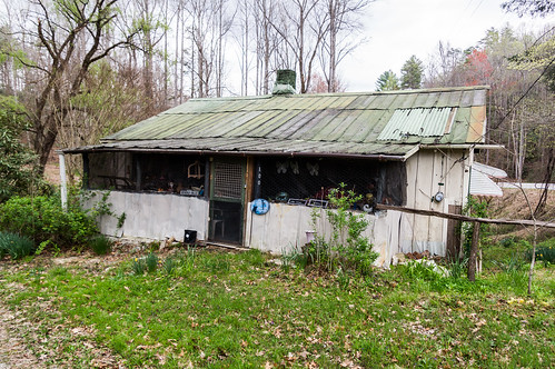
I walked down a gravel road to check out one house in particular located where Rocky Bottom School once stood (all the land surrounding the house is public land). One look and it's clear this house was never a school.
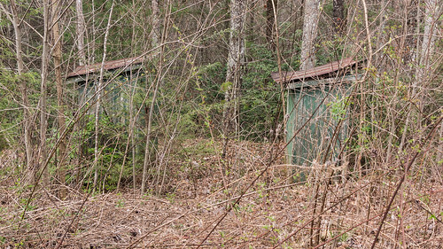
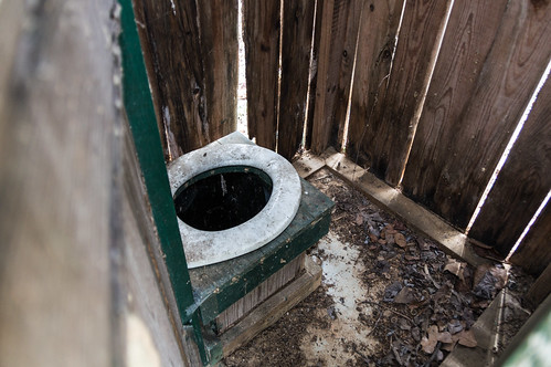
I walked back to Spencers Alley. I didn't expect to find anything else around here, yet I did. Off the side of the road, I noticed what I found to be two outhouses. I nicknamed them "Spencers Privies" to go with the road name.
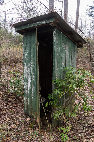
One door was partially open...
So I peeked in. Fortunately, I didn't startle anybody. And no, I didn't have a seat..
Spencers Alley, beyond the homes, is rutted in stretches. My car would not have made it through here, but a jeep or a truck most certainly would.
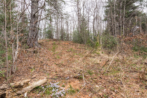
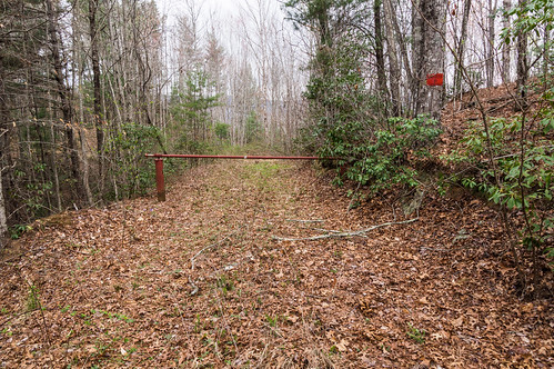
Spencers Alley ends at a red gate, but before going beyond I wondered if an overgrown forest road might be beyond the hill to the right.
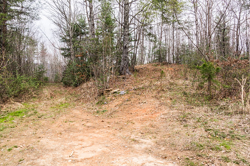
I was seeking an way to Rock Bottom Falls on Rocky Bottom Creek from here. Rock Bottom Falls is located in a gorge, so I knew the descent may end up being to steep from this direction. But I also knew this area was well logged in the past, so there must be plenty of logging roads to follow, and perhaps one will get me close enough.
I was right about finding overgrown logging roads to follow. I followed this one as far as it would take me:
This old logging road got me to within a few hundred feet, but I knew the road ended when the rhododendrons got so thick. I started to bushwack through the rhododendrons until the descent became too steep for me. I knew from previous experience it would take much more time to climb back out than I wanted and it would take way too much effort also. I turned out and headed back up.
Back at the red gate, ...
I found this warning sign:
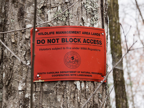
My car way back off U.S. 178, so I wasn't too worried about a fine.
As you'll see when I show my GPS track below, I found more old logging roads, but none got me closer or offered an easier bushwack down to the creek. but none really got me closer than 500 ft to Rock Bottom Falls. I moved on to my backup target, Triple Falls, on Reedy Cove Creek.
At the red gate, Spencers Alley becomes Hunting Camp Road. The hike was easy, except for having to carefully avoid the wild, thorny, blackberry vines that have taken over sections of Hunting Club Roads, and to avoid some fallen trees.
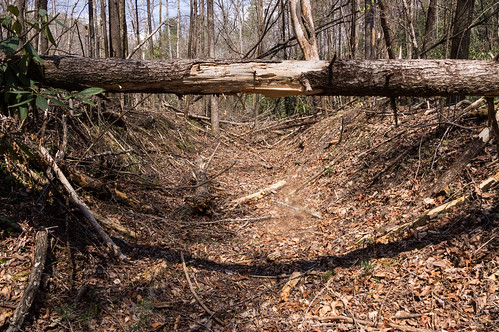
The height contours on my map showed the slope near Reedy Cove Creek wasn't anything as extreme as the approaches to Rocky Bottom Creek I had tried. I even found a overgrown logging road that took me close to the Reedy Cove Creek. There I met up with a foot path. I also found this curious long cut:
I wonder if the Appalachian Lumber Company, who once had a railroad in the area in the late 1920s, made this cut? Whoever made this cut, it took me close enough to the top of the waterfall to bushwack the rest of the way.
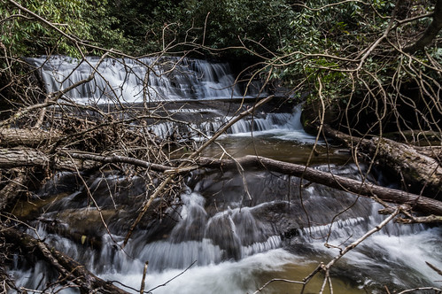
I carefully made my way near to the bottom of the waterfall, however the downed trees made things more difficult and time consuming than I would have liked.
Fortunately, some clouds moved over just in time to allow me to take a photo with a slow shutter speed:
It's unfortunate fallen trees have obscured this beautiful small waterfall . They must have fallen with the past year because these 2017 photos by Christopher Cockfield did not have those trees in his shots.
I took a short video of the water flow:
I was tempting to follow the path up creek to visit more waterfalls I knew were waiting for me, but I had already wasted a lot of time trying to find a way to Rock Bottom Falls from Spencers Alley, so I had to head back.
The hike from U.S. 178 to the waterfall, according to my calculations, was about two miles. The hike back, without the time consuming side trips this time, went by rather quickly. However, I did end up with some scratches from having to hike through.all those wild blackberry bushes. I'll have to look into buying a machete.
It's too bad this area doesn't appear to get much use or maintenance. From my waterfall loving point of view, Hunting Club Road offers good access to the part of Reedy Cove Creek above Twin Falls that doesn't involve much bushwacking.
Now that I know the Spencers Alley approach to Rock Bottom Falls is doomed to failure, next time I'll either try coming more directly in from the same U.S. 178 parking area (might work), or from the south from Twin Falls (will work). I prefer to head back downhill if I can so I'm strongly leaning toward the Twin Falls approach for next time.
As promised, here's my GPS record of the hike:
My trip photos are in its own album on Flickr, or you can go through them below:
I parked at Rocky Bottom Independent Baptist Church.
As the sign shows, the church was established in 1941.
Then I walked by the side of U.S. 178 down to an old country store, the old Rocky Bottom Store.
The Pickens County Library's Flickr account has this old photo of the store when it was in business:
Then I moved my car down to a small parking area off U.S. 178, as far off the road as I safely could, then walked down to Spencers Alley.
A few private homes are off this road...
I walked down a gravel road to check out one house in particular located where Rocky Bottom School once stood (all the land surrounding the house is public land). One look and it's clear this house was never a school.
I walked back to Spencers Alley. I didn't expect to find anything else around here, yet I did. Off the side of the road, I noticed what I found to be two outhouses. I nicknamed them "Spencers Privies" to go with the road name.
One door was partially open...
So I peeked in. Fortunately, I didn't startle anybody. And no, I didn't have a seat..
Spencers Alley, beyond the homes, is rutted in stretches. My car would not have made it through here, but a jeep or a truck most certainly would.
Spencers Alley ends at a red gate, but before going beyond I wondered if an overgrown forest road might be beyond the hill to the right.

I was seeking an way to Rock Bottom Falls on Rocky Bottom Creek from here. Rock Bottom Falls is located in a gorge, so I knew the descent may end up being to steep from this direction. But I also knew this area was well logged in the past, so there must be plenty of logging roads to follow, and perhaps one will get me close enough.
I was right about finding overgrown logging roads to follow. I followed this one as far as it would take me:
This old logging road got me to within a few hundred feet, but I knew the road ended when the rhododendrons got so thick. I started to bushwack through the rhododendrons until the descent became too steep for me. I knew from previous experience it would take much more time to climb back out than I wanted and it would take way too much effort also. I turned out and headed back up.
Back at the red gate, ...
I found this warning sign:

My car way back off U.S. 178, so I wasn't too worried about a fine.
As you'll see when I show my GPS track below, I found more old logging roads, but none got me closer or offered an easier bushwack down to the creek. but none really got me closer than 500 ft to Rock Bottom Falls. I moved on to my backup target, Triple Falls, on Reedy Cove Creek.
At the red gate, Spencers Alley becomes Hunting Camp Road. The hike was easy, except for having to carefully avoid the wild, thorny, blackberry vines that have taken over sections of Hunting Club Roads, and to avoid some fallen trees.
The height contours on my map showed the slope near Reedy Cove Creek wasn't anything as extreme as the approaches to Rocky Bottom Creek I had tried. I even found a overgrown logging road that took me close to the Reedy Cove Creek. There I met up with a foot path. I also found this curious long cut:
I wonder if the Appalachian Lumber Company, who once had a railroad in the area in the late 1920s, made this cut? Whoever made this cut, it took me close enough to the top of the waterfall to bushwack the rest of the way.
I carefully made my way near to the bottom of the waterfall, however the downed trees made things more difficult and time consuming than I would have liked.
Fortunately, some clouds moved over just in time to allow me to take a photo with a slow shutter speed:
It's unfortunate fallen trees have obscured this beautiful small waterfall . They must have fallen with the past year because these 2017 photos by Christopher Cockfield did not have those trees in his shots.
I took a short video of the water flow:
The hike from U.S. 178 to the waterfall, according to my calculations, was about two miles. The hike back, without the time consuming side trips this time, went by rather quickly. However, I did end up with some scratches from having to hike through.all those wild blackberry bushes. I'll have to look into buying a machete.
It's too bad this area doesn't appear to get much use or maintenance. From my waterfall loving point of view, Hunting Club Road offers good access to the part of Reedy Cove Creek above Twin Falls that doesn't involve much bushwacking.
Now that I know the Spencers Alley approach to Rock Bottom Falls is doomed to failure, next time I'll either try coming more directly in from the same U.S. 178 parking area (might work), or from the south from Twin Falls (will work). I prefer to head back downhill if I can so I'm strongly leaning toward the Twin Falls approach for next time.
As promised, here's my GPS record of the hike:
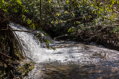
My trip photos are in its own album on Flickr, or you can go through them below:

.jpg)
Comments
Post a Comment