Back in August I read about a new website,
open parks network, providing searchable access to digitized records of a number of parks, historic sites, and other areas. This website contains records of a number of South Carolina parks, but the one park I was most interested in was Wildcat Wayside near Cleveland, SC in northern Greenville County. I've been here many times, but I've never seen the original structures when they more than ruins. I came up last Sunday to take another look at the park to find the ruins I already knew about and some I didn't.
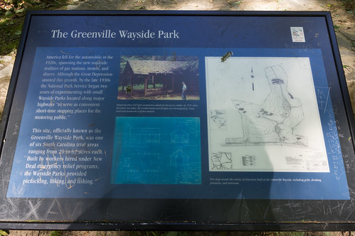
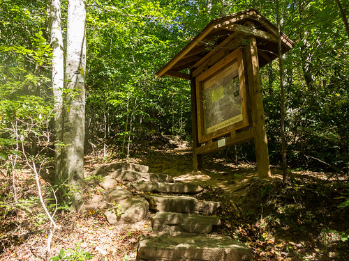
This infoboard, installed sometime in 2013 or 2014, summarized the history of the park, a 1970s photo of the picnic shelter, and
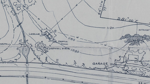
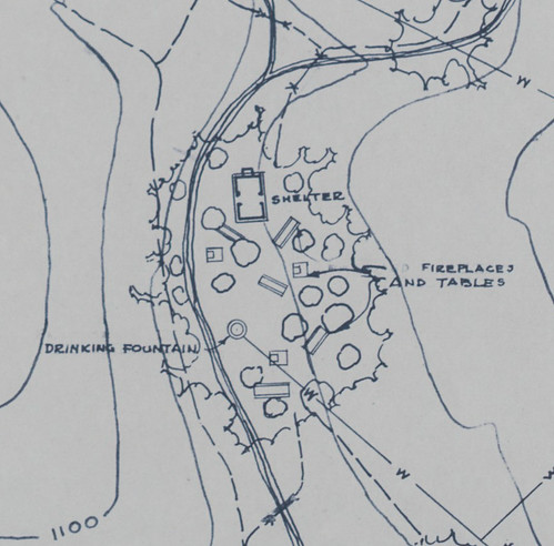
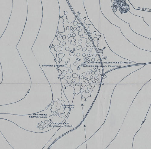
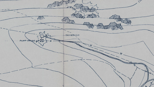
the revised 1940 plan of the park.
This infoboard confirmed the information I had found in this
1940 book in PDF format about South Carolina State Parks, produced the Works Progress Administration. Only one page is devoted to the wayside parks (page 42 in the book, page 44 in the PDF) with this summary of the wayside park amenities:
...and contain picnic shelters, fireplaces, combination table and benches, sanitary facilities, parking area for cars, and a caretaker's dwelling.
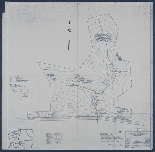
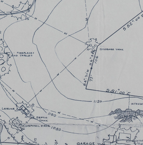
The
revised 1940 plan for the park, seen on the right side of the infoboard, has all these features. Since it's public domain, I made some changes in Lightroom (corrected the yellowing, added some clarity) and the result is this:
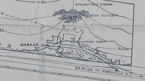
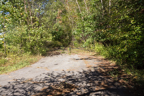
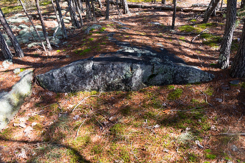
This plan points out features now abandoned and proposed features never implemented. I started with the caretaker's cabin area shown on this part of the plan:
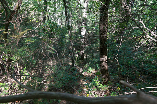
The caretaker's cabin is long gone, but it was located down this abandoned asphalt road:
A few trees have grown up through the asphalt, making the road tough for vehicles to pass through, but it's still easily walkable. The caretaker area is much more overgrown though.
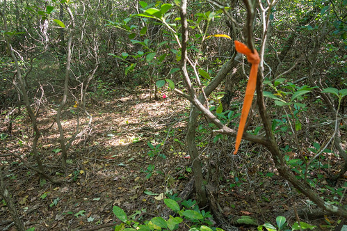
What wasn't shown on the master plan was this overgrown, unmaintained but clearly visible path leading away from the caretaker's cabin area:
This path wasn't marked on the master plan, but also makes sense that it's here so the caretaker can do his job without having to walk back to the road first. This path also happens to pass by my next target, the latrine.
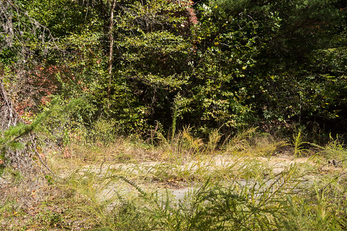
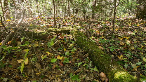
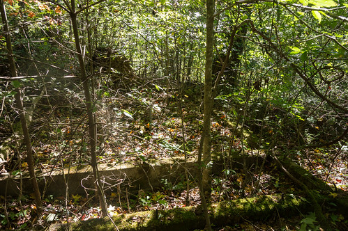
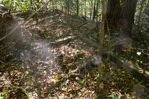
The latrine has long been abandoned, but the concrete foundation remains. Sorry about the quality of photos below. The site is completely overgrown now, so I had to make do.
open parks network has preserved two photos of the latrine from the 1970s when some of the structure was still standing. This
archived photo is with a park ranger:
This
archived photo is without:
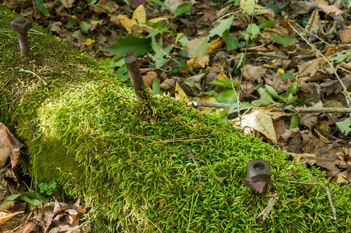
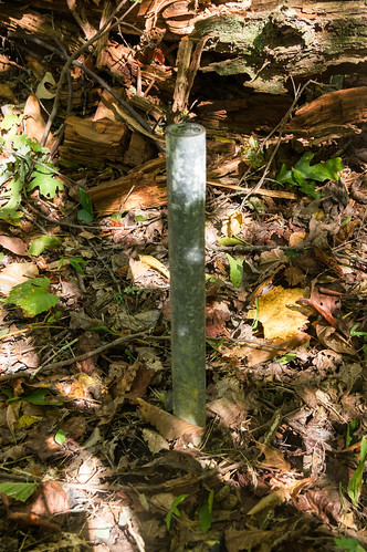
The two pipes coming up from the ground, seen in both photos, are still there. Here's one for reference:
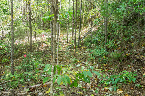
I returned to the path, determined to follow it to the end. The path passed almost right behind the park mapboard. There is a short connector trail that does connect to the main trail, Wildcat Wayside Nature Trail, shown below:
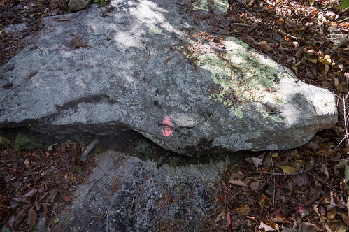
This overgrown path is way too well marked with flags and tape for an overgrown path.
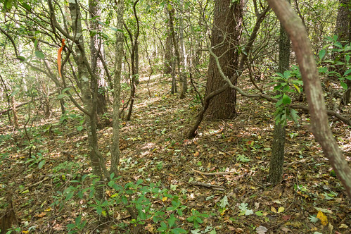
The sudden lack of flags and tape coincided nicely with the lack of a clearly visible way forward.
The path's end was within a few feet of Wildcat Wayside loop trail a few feet below, but I elected to backtrack to look for the storage tank at the edge of the park as seen in this part of the master plan:
I used a GPS app to navigate to this location. I had set the point from downloading a shapefile of the area from Greenville County GIS, converting the property lines to GPX, and setting the point based on the master plan map.
I didn't find an easy path to this location, which was my first clue I would find nothing, and when I got to the area where the tank should be according to my GPS app I found no visible ruins. I managed to lose my phone for a while when I put in my shirt pocket to get through a thicket near the storage tank location. I managed to find within 20 feet of where I discovered its loss, but only after searching my track from the trail and back multiple times. The storage tank location search was a failure.
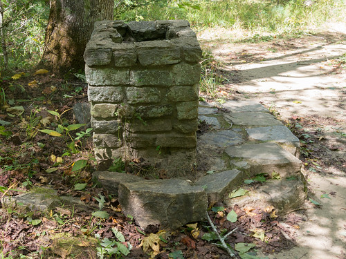
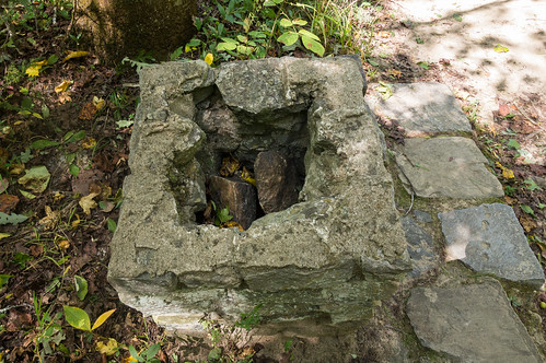
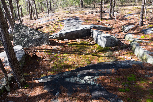
Next I moved on to the picnic area. I've been through this area several times, and now I have a better idea of what the smaller ruins were.
What I thought was a water fountain is indeed a water fountain.
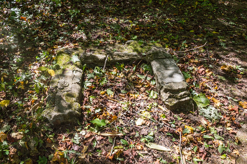
The smaller ruins were once small fireplaces.
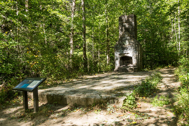
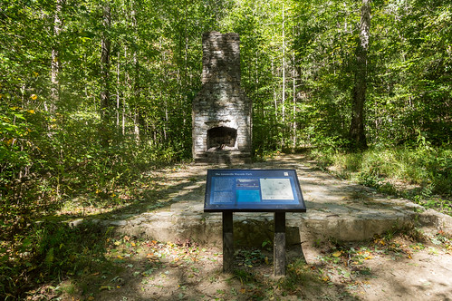
The picnic shelter was the feature attraction.
This
photo from open parks network, taken sometime in the 1970s, shows the picnic shelter in a deteriorating condition:
This second photo, also taken sometime in the 1970s, shows the picnic shelter's chimney:
I went further down the trail to the area where the proposed second picnic shelter would have been located.
I expected to find nothing but trees and vegetation, and that's exactly what I found. The proposed area is mostly flat, and would have been suitable for another picnic shelter.
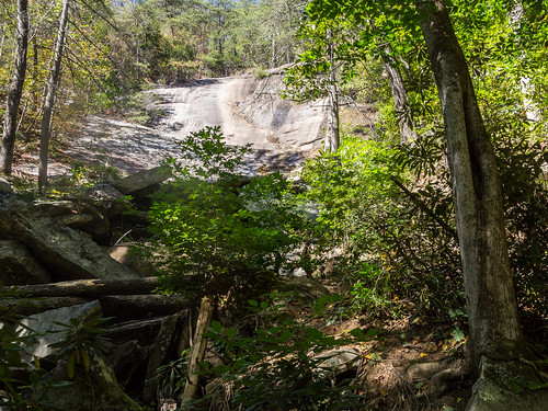
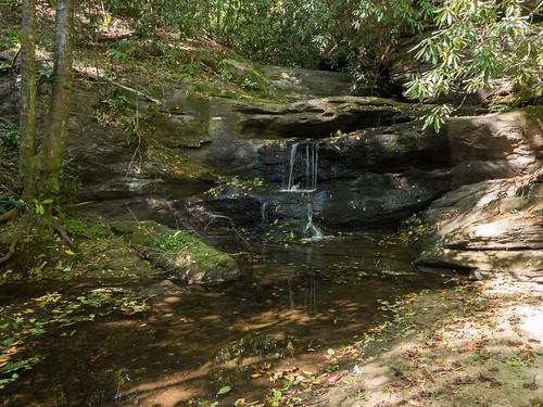
Since I was on the main trail anyway, I thought I'd pass by Upper Wildcat Falls to see how much water is flowing. The answer turned out to be not much at all.
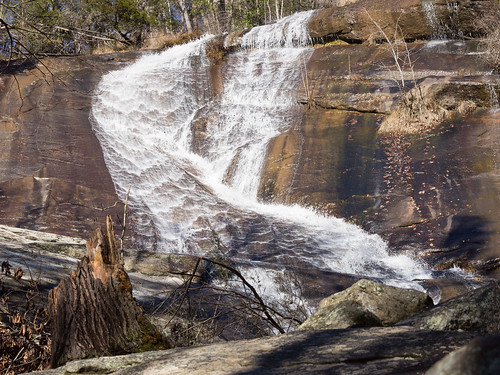
If I were here to see the waterfalls this day, I would have been sorely disappointed. Here's a more interesting photo of the upper falls back in 2014:
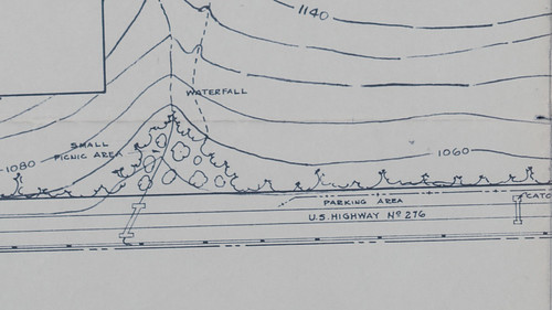
I turned my attention to the Slickum Creek end of the park. The master plan showed a picnic area...
but that's overgrown now, if it was ever there to begin with. The parking area is more of an area off the side of the road where can park and possibly not get hit by cars passing by. While the picnic area is no more, two waterfalls along Slickum Creek are still well worth seeing.
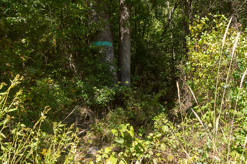
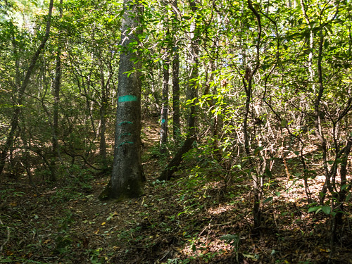
The nearly hidden entrance to a trail along Slickum Creek, and the overgrown picnic area, is marked with a green stripe on a tree.
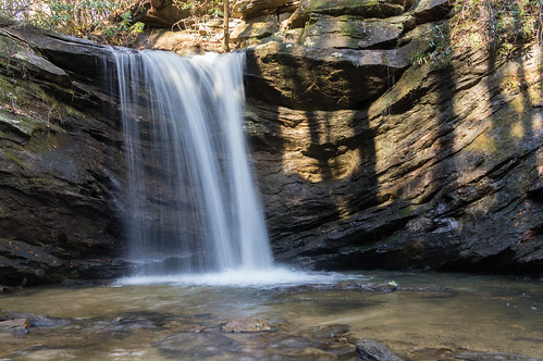
The waterfall not named on the master plan is appropriately enough, named Last Falls on Slickum. The waterflow on this creek was much better. While I did take a photo of the waterfall, I didn't put much effort into it since it wasn't the focus of my trip.
Sweet Thing on Slickum is a few minutes down the trail from here, but I didn't visit it this time. Here's what it looked like back in 2014:
I was more interested in visiting the pump house upstream from here, so I skipped Sweet Thing this time. About halfway between Slickum Creek and Wildcat Falls is a short road leading to a telephone cabinet. From here, you can head uphill on a trail, faint at first, that intersects with a trail leading to the pump house.
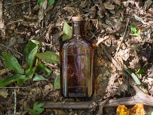
While following this trail, I came across an old path that could have been a logging road or an old trail. This path was overgrown, but still easily visible, and mostly followed a small stream that flowed into a small waterfall behind the telephone cabinet. I managed to find a bottle whose spirits have long departed, if you know what I mean.
Having followed this diversion back down toward the telephone cabinet, I reversed course and met back up with the trail, now blazed green.
I meet up with the trail heading from Wildcat Creek to Slickum Creek, now blazed orange since my last visit.
The trail markers peters out, but a faint path continues. The pump house is at the end of this faint trail.
Despite easily finding the pump house in previous years without even looking for it, however, I couldn't find it this time. Later, after consulting the recorded location from earlier visits, I found out I was looking too far north. Here's two photos of the pump house location from 2014 when I wasn't so pressed for time:
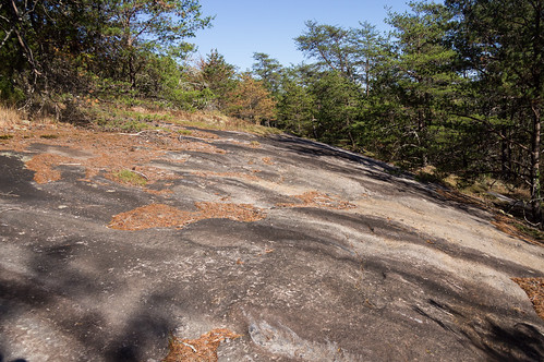
This area is rather rocky, and moss covers part of the area. In the past, the rocks have been wet and slippery, but with the drought (Hurricane Michael missed this area to the south) rocks are dry and the moss in need of water.
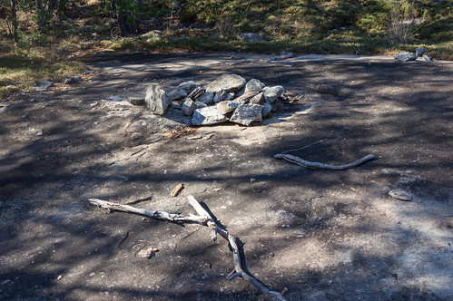
Every time I come here I usually find a campfire, or the remains of one. This time was no exception. Camping here isn't allowed, but people do it anyway:
I elected to follow the trail all the way back to the main trail and the parking. The trails were in deepening shadow with the sun getting low, but I could still see well enough to get back.
I've shared my photos to
an album on Flickr and
an album on Google Photos.
I've also created this map showing the locations of the old, abandoned features marked on the master park map:


Comments
Post a Comment