Apple Country Tour - October 2016

It's become a yearly tradition to visit Henderson County, North Carolina to explore the area and return with some apples. This year is no different (duh, or I wouldn't be writing this!). This area is currently in a drought, and recent photos I've seen of low water flow at area waterfalls were discouraging, so this year I chose to visit a few historical sites in the area. I picked some sites from a multi-county historic schools survey report I found during the summer, and some grist mills I found on Panoramio (RIP).

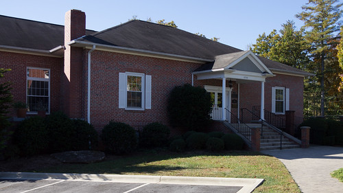
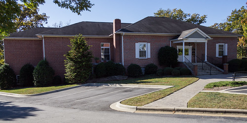
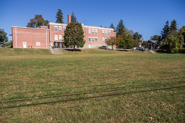
I went last Sunday, and considering some of my stops were active schools that day worked out much better than a weekday would have. The first place I visited was the site of Flat Rock High School in Flat Rock, located off highway N.C. 225 and now the mixed use complex recently renamed to Flat Rock Square. Flat Rock High School was built in 1925 and remained a high school until 1960 when the school became a junior high. On August 18, 1971 a fire set by an arsonist caused the destruction of part of the school complex. The historic school survey report documents the site's later history:
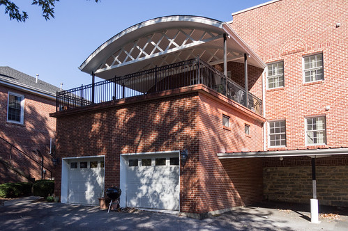
The property served as school system storage through 1993, when the Henderson County and Hendersonville City school systems merged and consolidated campuses. Flat Rock resident and developer Thomas Singleton acquired the Flat Rock School campus in August 1994 and converted the gymnasium into condominiums, the library and classroom addition into retail/restaurant space, and erected a new building.
The complex was named Singleton Centre from 1994 until its sale and name change in 2015.

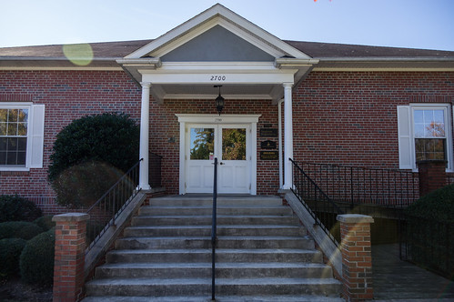
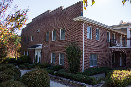
The survey report identifies the three remaining school buildings as having addresses 2688, 2700, and 2702:
The first one I visited was the 1951 addition at 2700:
Flat Rock High School 1951 addition - 1 Flat Rock High School 1951 addition - 2 Flat Rock High School 1951 addition - 3
The sun was unfortunately placed here, but that would turn out to be just as true elsewhere too. The opposite side (and downhill) houses Flat Rock Cinema:
Flat Rock High School 1951 addition - 5
The old cafeteria and library building, at 2702, is now home to the Flat Rock Gallery:
Flat Rock High School cafeteria and library building - 2
The old gymnasium, at 2688, has been remodeled into condominiums:
Flat Rock High School gymnasium building - 1 Flat Rock High School gymnasium building - 5
A few miles north on N.C. 225 is the Highland Lake resort community and Rhett's Mill.
Highland Lake sign
The Highland Lake Inn and Resort has a nicely detailed history of the site, but I'll highlight the more interesting events culled from there and other sources. John Earle built a grist mill on this land in 1789. In 1873, South Carolina Governor William Aiken bought the property, then donated it to his daughter Henrietta Aiken Rhett as a wedding present. In 1910, Highland Lake Club bought the land, sold off lots for summer houses, built an inn, and enlarged the lake. The club didn't last long though, failing after two years. In 1919, Camp Highland Lake for boys opened and lasted until 1947.

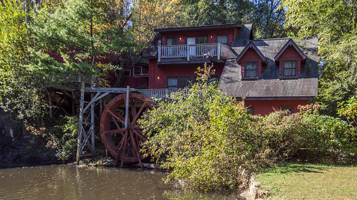
In 1940 and 1941, the Vagabond Players performed in the original grist mill building, then known as the The Old Mill Playhouse. The performances stopped during World War 2, but started again after the war ended in 1946 in a new location, evolving into today's Flat Rock Playhouse.

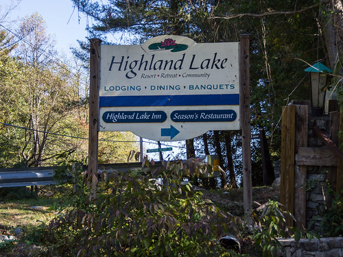
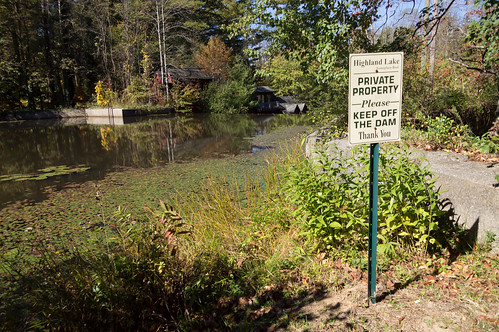
In 1947, the site became Camp Brandeis, a camp for Jewish boys and girls. In the 1950s, the site became Our Lady of the Hill’s Camp, a camp for Catholic boys and girls that lasted until the 1970s. In 1985, the Highland Lake Inn and Conference acquired the property, then becoming Highland Lake Inn and Resort in 1999 after another ownership change.

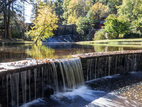
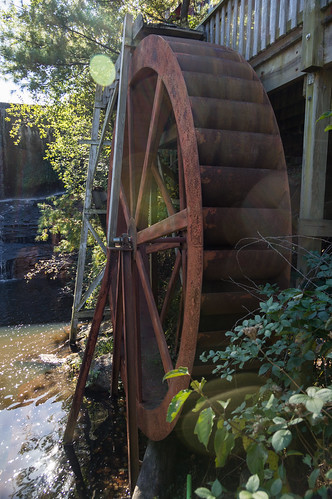
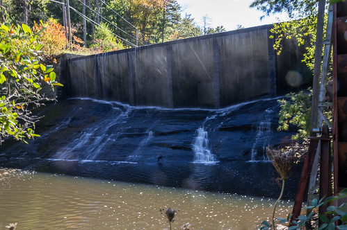
The area around the mill consists of a lower dam, a lower mill pond, a waterfall, an upper dam,
Rhetts Mill lower and upper dam
and two connected buildings built on the site of the original grist mill.
Rhetts Mill - 1
Rhett Mill waterwheel
The waterfall is sandwiched between the upper dam and the lower mill pond.
Rhetts Mill upper dam - 2
The upper dam provides containment for the 40 acre Highland Lake reservoir.
Near the upper dam
My next stop was downtown Hendersonville to visit a historical monument...
... behind the Henderson County courthouse. The monument was moved from it's original location in front of the courthouse in 2008.
This monument is one of a series of markers placed by the Daughters of the Confederacy in the 1920s along or near the old route of the Dixie Highway, a north-south oriented network of highways. This portion near the old eastern segment of the Dixie Highway became U.S. 25.

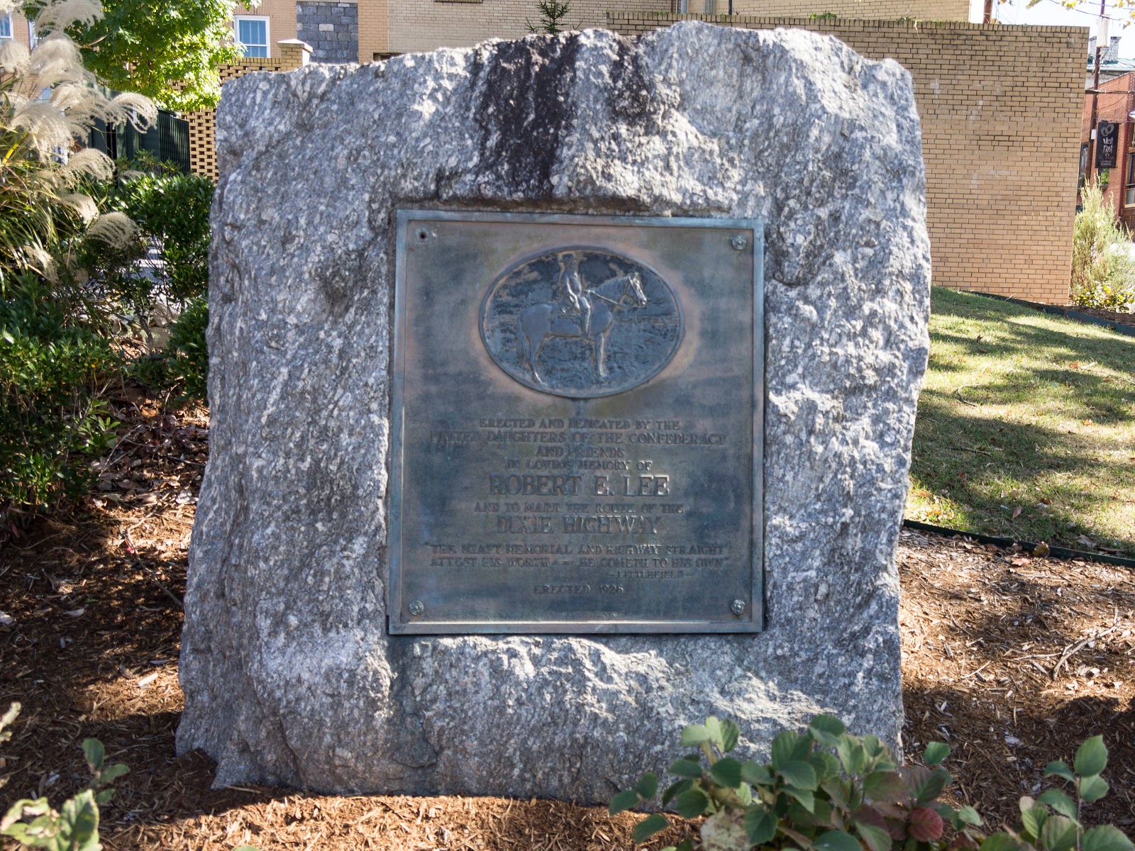
Most of the Dixie Highway historical markers are in North Carolina, but there is one on the North Carolina-South Carolina border, one in Florida, and one in Ohio. I've plotted the locations on this map:
I've already visited the one at the North Carolina-South Carolina border on Old U.S. 25:
Dixie Highway Memorial at border
and also the one in downtown Greenville erected in 1935:
Dixie Highway Memorial - 1
I found this interesting piece of information about these monuments found at the Documenting the American South website:
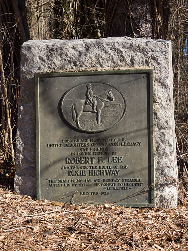
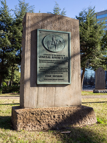
The efforts to mark the Dixie Highway in North Carolina were led by Mrs. James Madison Gudger, Jr. of Asheville who also designed the plaque. The North Carolina Division of the United Daughters of the Confederacy raised $800 to have the die cast for the plaque and then loan it to other states for marking their highways. Other states do not appear to have taken advantage of the die aside from an example in Greenville, South Carolina. It is thought that 10 total were made from this die leaving several unaccounted for.
Actually, the plaque in Hendersonville is actually identical to the one on Old U.S. 25. The one in Greenville has the same image of Robert E. Lee on horseback, but uses a different quote and is physically larger.

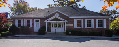
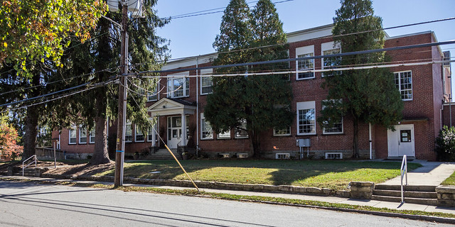
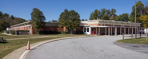
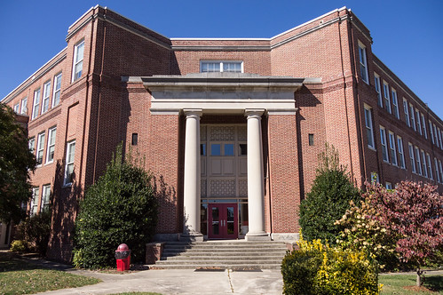
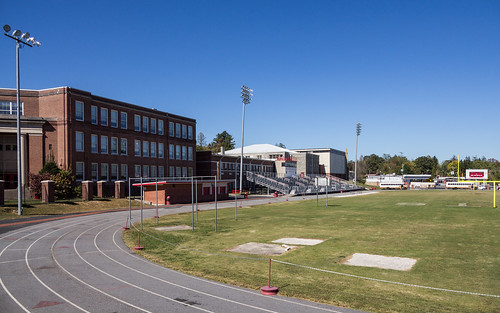
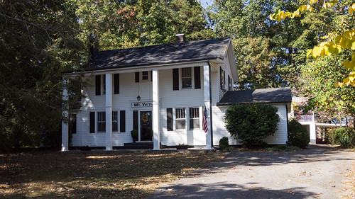
To get back to the main story, I walked around the block, taking a few photos, but then I moved on to four of Hendersonville's historic schools, the first one is now the administration building for the Henderson County school district.

According to the historical school context report, this school building was built in 1912 to house Hendersonville Graded School.
Henderson County Public Schools building - 1
During the 1933-34 school year, the school was renamed Rosa Edwards School in honor of a former principal, Rosa Edwards.
Henderson County Public Schools building - 6
Additions, including an auditorium, were added in 1951. The school building has served as district offices since 1974.

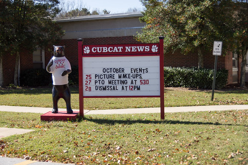
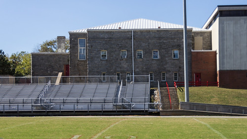
Next I visited Hendersonville Middle School and Hendersonville Elementary School, both within sight of each other.

The Hendersonville Middle School building was built in 1951 as Eighth Avenue School for black students during the era of segregation and the supposed "separate but equal" doctrine that in reality was not so.
Hendersonville Middle School - 6
The elementary school students were taught on the first floor, the high school students on the second.

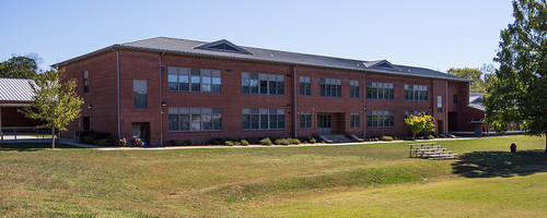
When desegregation came into effect in 1966, the school became a middle school which it remains today.

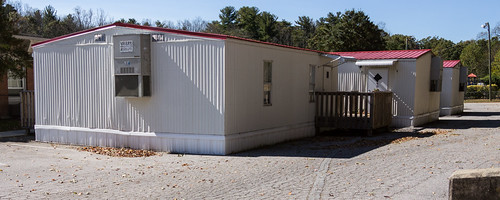
The elementary school is relatively recent, built as Hendersonville Middle Grade School in 1972.
Hendersonville Elementary School - 2 Hendersonville Elementary School - 1 Hendersonville Elementary School - 3
When the city and county school systems merged in 1993, the school transitioned from a middle school to an elementary school.

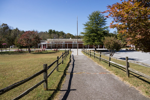
Judging by these portables, the school is well attended.
Hendersonville Elementary School - 4
Next it was on to Hendersonville High School, built as Hendersonville School in 1926, with additions and changes since then. According to the historical school context report, the original 1926 buildings occupy the southwest portion of the campus.
Hendersonville High School - 9
Additions include a 1951 cafeteria, a 1974 band room, a 1937 stone gymnasium, a 1976 gymnasium, and 1980s classrooms.
Hendersonville High School - 7 Hendersonville High School - 2
I hadn't originally planned on stopping by the Hendersonville Depot off Fleming Street, but I couldn't resist the opportunity.
Hendersonville Depot - 2
This depot, replacing an earlier one, was built in 1902 and expanded in 1906. Passenger service ended in 1968. The railroad line itself went inactive through the area to Saluda and Landrum in 2002 when coal shipments decreased and other traffic was rerouted to other lines. In 2014, the line down to Zirconia was reactivated after being purchased by a short line railroad.

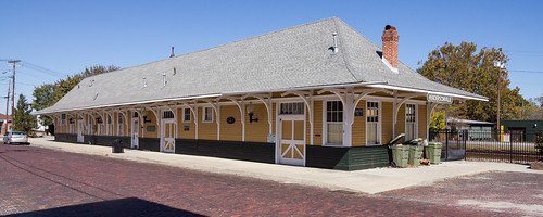
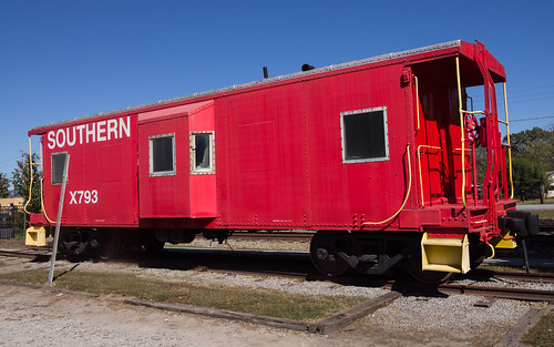
Next door to the depot is a caboose, Southern X793, on permanent display.
Southern caboose X793 - 4
Next it was on to Mountain Fresh Apple Orchard off busy U.S. 64.
Mountain Fresh Apple Orchard - 2
Mountain Fresh Apple Orchard - 3
I like many kinds of apples, but my favorites klnd are the nice and tart Granny Smith apples.
Granny Smith Apples
U.S. 64 was quite busy with traffic, and turning left was not really a good option.
Highway 64 traffic backup
Fortunately my next stop was Mount Vernon School off Old Dana Road which thankfully involved taking a right turn instead of a left.
Mount Vernon School
The Dana Community Plan from 2011 describes Mount Vernon School simply as:
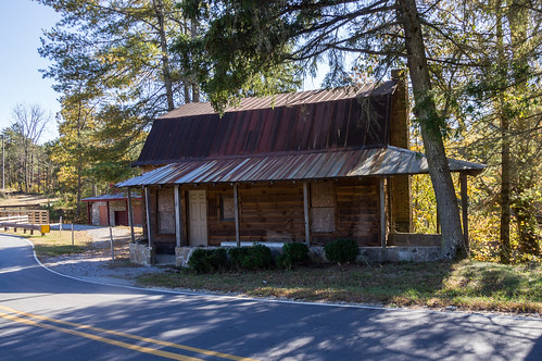
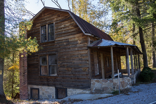
a two-room school house located on Old Dana Road on the hill above Haunt Branch (referred to as “Dry Hill School”)
It's now a private residence, so I stayed by the road, took my photo, and went on to Dana.

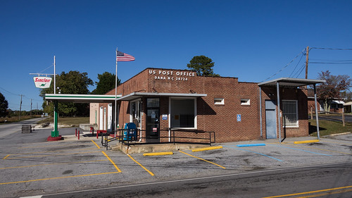
Dana is a small community with a few businesses, some homes, and a post office.
Dana Post Office
The post office is in a former gas station, judging by the architecture and the Sinclair sign.

A short distance away behind Dana United Methodist Church and near the cemetery is the ruins of a former Dana school, the Blue House Academy (or Old Blue House) built in 1866 (replacing one built in 1860).
Blue House Academy / Old Blue House School
The Dana Community Plan describes the Blue House Academy as:
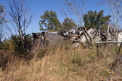
named for its paint color, the largest of these three (3) early schools was established in 1866 and served as an educational hub attracting students from Rutherford, Transylvania, Polk, and Buncombe Counties.
The house is in ruins now, but I found this photo from a 2015 Henderson County board action request:
Then it was down Stepp Mill Road, past an apple orchard, to Stepps Mill. The mill complex consists of an old homes...
Stepps Mill - 1 Stepps Mill - 3
...and the grist mill.
Stepps Mill - 5
Henderson Heritage details a short history of the mill:
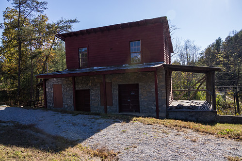
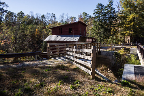
In 1913, Benjamin Merrell bought a mill site on today’s Stepp Mill Road, where his wife established the post office named Saconon. ... Dulus Stepp will buy this grist mill in 1933. This is the only grist mill in today’s Henderson County still standing.
I didn't get a photo of the mill wheel because of a "no tresspassing" sign I spotted. The road was recently realigned while replacing a one lane bridge with a two lane bridge, and I was uncertain where the private property line was located.
Stepps Mill - 7
A check of Henderson County's online GIS map viewer shows the private property boundary runs along the edge of this foot bridge facing the mill runs, where the sign is hung, which is also where the old road alignment also went. It turns out I could have taken a legally taken a photo of the mill, but I didn't know that at the time. Instead, here's a photo taken by Flickr photographer michael anthony back in 2009:
Stepps Mill
As usual, I've uploaded my photos to an album on Flickr and an album on Google Photos. I've also updated my incomplete but growing map of Western and Central North Carolina Historical POIs with the locations of the sites visited this day.


Comments

Popular posts from this blog

A tour of Lake Summit

First visit to Andersonville Island

Forgotten Taylors railroad history: the P&N railroad