Posts

Reedy Falls composites and Wilkins house
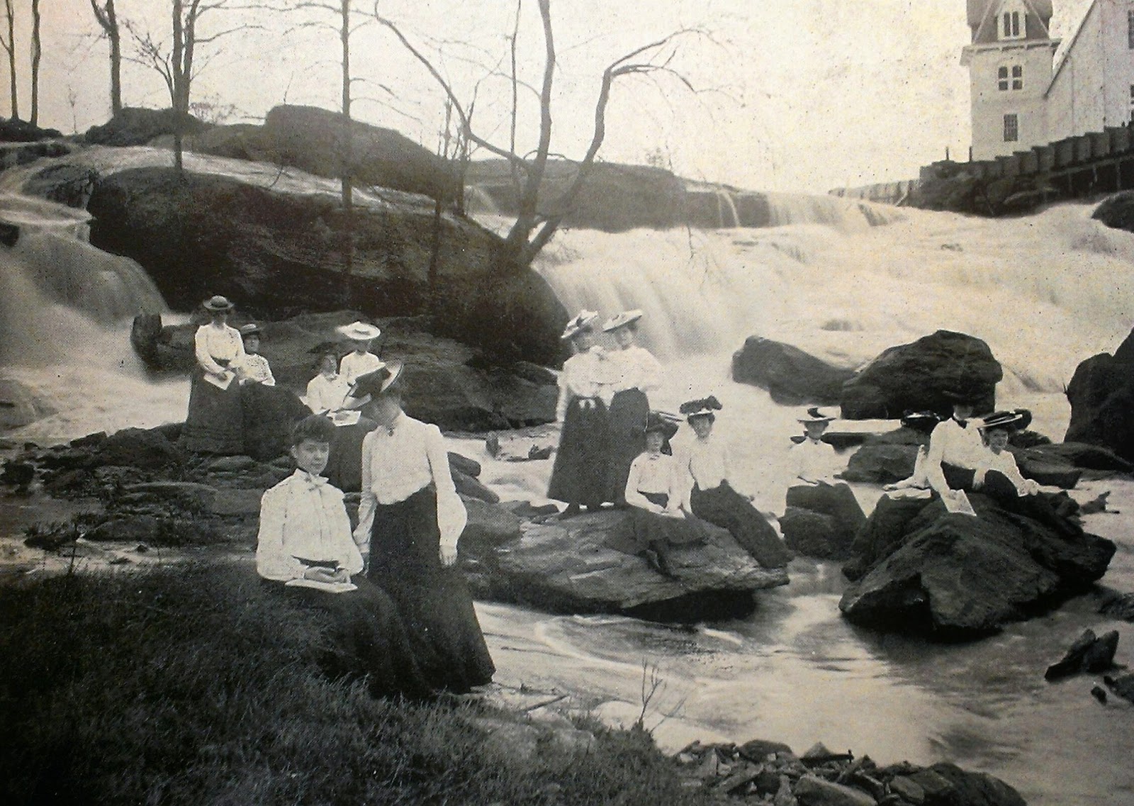
Image
Now that I know how to make composite photos with a photo editor, I had to find another subject. Going through the old photos posted by Greenville History Tours to their Facebook page , I found several I thought would make good subjects. Three photos involved students from Greenville Women's College sketching at Reedy Falls , now part of  Falls Park on the Reedy . I had to try one of these photos next. While I was plotting this adventure, the campaign  that began in late January  to save the Wilkins house from demolition became a big story. Whatever it's eventual fate, I had to check it out and it was only a short distance away from the park. Reedy Falls I chose this 1903 photo of students from a Greenville Women's College sketching class at the waterfall to composite. The building at the top right is Camperdown Mill #2 . I shot many potential backgrounds different slightly in position and focal length, using a "hard copy" as a "low tech" g...

Composites of Taylors depots

Recently, Tom Taylor wrote two blog entries about superimposing a building from an old photo over a present day photo to create a composite. These two blog entries are titled Plantation Ruins and a Cursed Tree and Composite Greenville History . His blog entries reminded me I took photos of two locations back in 2011 with the idea of making my own composite photos, but I didn't have any way to create them back then. Or so I thought. I was wrong. I had bought a scanner a few years ago (only Amazon knows when) that came with a copy of Photoshop Elements 8, the simplified cousin of Photoshop. While Elements 8 doesn't directly support layer masking (the feature needed for making composites quickly and easily), it can be simulated in Elements 8 and can also be added by a plugin. Nice. It's doable and I don't have to spend any money. Even better. The two locations I visited in 2011 were the two Taylors, SC depots. The first location, the Southern Railway depot,  was lo...

Falls Creek Falls

Image
With some time off this week and no bad weather to go with it (for once), I'm finally able to head out and visit a waterfall. I chose Falls Creek Falls in  northern Greenville County  because I knew from a previous visit a few years ago this one would not disappoint. And it certainly didn't. From my previous visit, I remembered the trail being steep and strenuous most of the way. My memory can be faulty at times, but not this time. The parking area and a small trailhead are located off of Fall Creek Road. I made sure to register at the kiosk first, just in case. I followed the stairs and began the uphill climb. This trail is well marked with purple blazes. Eventually, the trail leveled off and then began trending downhill as I neared the crossing over Little Falls Creek. Soon, the steep uphill climb resumed through a series of switchbacks. At one switchback turn, I heard a waterfall over on Little Falls Creek, now some distance away to the east. Budding trees...

Wildcat Wayside, now with improvements

Image
Last Sunday was a perfect day to explore waterfalls after the heavy rains of the previous day. For this adventure I chose Wildcat Wayside, located off of U.S. 276 and S.C. 11 near Cleveland, SC. I've been there before several times through the years, the last time in December 2012 . Every time I've visited in the past, I haven't seen much water flowing over the waterfalls. This time I knew I wouldn't be disappointed. The first thing I noticed was the boiled peanut vendor taking up too much space in the parking area. The second thing I noticed was a prominently placed sign naming the park, the first of several changes I would notice this visit. Lower Wildcat Falls is right at the roadside, and the rains of the previous day helped with the water flow. This is a photo from December 2012 showing how little water normally flows: Sstone steps head up to the middle falls. At the top are two memorials to people who died from slipping and falling from the upper ...

Tracing the Swamp Rabbit Railroad in River Falls

Image
Swamp Rabbit remnants in Cleveland For some time now, I've been sporadically researching and documenting the path of the Swamp Rabbit Railroad from Greenville to Cleveland to River Falls, all in Greenville County, South Carolina. The result of this research is Abandoned Railroad: Greenville and Northern Railway (Swamp Rabbit) , a map drawn with Google Maps Engine Lite. Recently, I came upon two plats recorded at Greenville County Register of Deeds that resulted in a revision of the path around River Falls. The path from Greenville to Travelers Rest was abandoned in 2005 to become the Swamp Rabbit Trail and is easily traced. The path from Travelers Rest to Cleveland was abandoned in the 1960s and is traceable from historic maps and from a satellite map view such as Google's or Bing's. This part I investigated in Tracing the Swamp Rabbit . The path north from Cleveland to River Falls was abandoned much earlier (later than 1920 but before 1940) and is much harder to tr...

Boxing Day adventures

Image
With some extra free time this week thanks to the holiday, I went up to northern Greenville County for some adventures. Tracing the Swamp Rabbit - December 2013 edition First I stopped by McCarson Road in Riverview  to investigate a possible trestle ruin I had spotted sometime back on Google Earth. Turns out it wasn't a trestle ruin at all, but a storage tank of some kind. But below it, I found a cutting heading toward the Middle Saluda River, an area previously explored . This matched up well with my map of the Swamp Rabbit. Nice. The path of the railroad crossed McCarson Road heading south toward Cleveland. Rainbow Falls The bulk of my time this day was hiking to and from Rainbow Falls. Rainbow Falls is located on property of Camp Greenville, but it also accessible from Jones Gap State Park . To get there, follow Jones Gap Trail (blazed blue), then follow Rainbow Falls Trail (blazed red) to the waterfall. This part of Jones Gap Trail is rocky and wet with a few i...