At The Tall Pines And What We Found There

While I was adding the area to OpenStreetMap, I could see some some lakes, disused agricultural fields, old logging roads that all looked interesting, but not a high priority to visit. That changed when I examined a topo map from 1961, and found an old church and a cemetery located in the new WMA.


Last Wednesday, I met up with Tom Taylor at the Moody Bridge Road access area to see what, if anything, remained of the church and cemetery.
Most of what is now the Tall Pines W.M.A. was named Tall Pines Farm, owned by George Jr. and Mildred Wilkinson. The Wilkinson parcel, and other parcels, were bought by the Burroughs & Chapin Company, operating as Tall Pines Investment, in 2007. In November 2006, before the sale was finalized, the Burroughs & Chapin Company Inc. proposed a subdivision with an 18 hole golf course to be named "Tall Pines". From the November 6, 2006 edition of The Greenville News:
A Myrtle Beach-based company is considering turning the property near State 11/U.S. 276 and Moody Bridge Road into a residential golf community. A draft submitted by Burroughs & Chapin Company Inc. to the Greenville County Planning Commission for preliminary viewing showed 990 lots, a village center and an 18-hole golf course in a development called "Tall Pines."In February 2008, the subdivision plans were changed to reduce the number of homes. Again from The Greenville News archives:
The 1,700-acre former timber farm in northern Greenville County may have fewer home sites than initially proposed.Plans for the golf course were scrapped.
Owners of the Tall Pines farm are considering about 600 home sites for the property, located at U.S. 276/State 11 and Moody Bridge Road, half of the 1,200 in the original plans...
In May 2008, plans for the subdivision changed yet again and announced in The Greenville News. The name was changed for some odd reason:
The planned Copper Lakes community in northern Greenville County would have approximately 550 home sites, a working farm and market that would be open to the public.Later in the article more about the revised plans was revealed:
Copper Lakes will be gated and offer its homeowners amenities that include a craft village, lakeside pavilion, fishing piers, a mountaintop pavilion with hiking trails, riverside campsites with fire pits, community gardens with greenhouses, a swimming hole, and underground utilities.The plans for the subdivision came to nothing. T.D. Bank foreclosed on the property in 2014, then sold the property to The Conservation Bank in 2015. The Conservation Bank officially turned the property over to the South Carolina Department of Natural Resources on January 28. The news conference and press release about the acquisition took place a few weeks later on February 15th.
Rain, a frequent visitor around here the past few months, was falling yet again at my house as I stepped out the door last Wednesday. Fortunately, local radar showed the rain band would be east of the Tall Pines WMA by the time we got there.
Tom and I accidentally timed our arrival so well he pulled in right behind me as I entered the semi-muddy parking area. As expected, the rain had departed. One pickup truck was there and its owner was out by the lake fishing. The parking area overlooks the more interesting of the WMA's lakes, with an interesting island containing a stone tower topped with a lantern. We both suddenly wished we had brought our kayaks to explore this island.


We were here to visit the old church and cemetery, about a half mile down the road from the parking area, so we walked down the side of the road toward our targets. Before the visit, I had marked the location of the old church and cemetery online and downloaded the locations to my phone.


Tom spotted some field stones, and then I found some others:


We were also looking for signs of the church foundation or some other remnant. The only thing we found were some broken remnants of some milk colored glass globes from a light fixture:


We found some metal grave markers, but the actual names were gone. I noticed the letters on the stand were reversed, but that was easily reversed in editing:

The location we found for the cemetery was a bit off the location on the topo map so I suggested we head on just in case there was more graves to be found. We didn't find any at the location on the topo map, but we did find a small path leading down the hill.

We walked back down Moody Bridge Road to the parking area, then crossed over the road down a dirt road to take a closer look at the building ruins we had seen earlier.


Tom had some other business requiring his attention so he had to leave, but I wanted to explore the area a bit more before heading home. We said our goodbyes and I walked around a bit. I'd love to report I made some astounding finds, but I didn't.
Down a road heading toward two more lakes, I found some rusty cans, rusty fencing, and a rusting barrel among other things.


I wanted to know more about the church and the cemetery, but information about both was hard to come by. Find-A-Grave has no listing for the old cemetery, but the Greenville County Cemetery GPS Cemetery Project does give its location, but I already knew that.
I moved on try finding some info about the people buried in the cemetery. I couldn't find anything about the people either until I used HeritageQuest, accessible my county's local library or from home with a library card.
I found this record about Blythe Williams from a 1910 census record search:

Some writing on his tombstone interested me in particular:

I also found William and Mattie Keith's records, and Mack and Mary Carr's records in the 1910 census. They were all listed as married black sharecroppers. This means the church members were African-American.
I found a story about Mack Carr in the Greenville News on Newspapers.com. The library's access to Newspapers.com doesn't grant access to The Greenville News, but someone made a clip about his death I could access. The clip uses cringey language, and goes into unnecessary level of detail on how he died:

I found a deed for a church matching the location in book SS, pages 834 (on page 2 of the PDF) and 835. I'll transcribe enough for you to get gist of the deed:
I, Lizzie Hagood, ... have granted, bargained, sold, and released ... unto the Deacons of South Saluda Ridge Colored Baptist Church ... on the waters of South Saluda River containing two acres. ... Witness my hand and seal this 13th day of August in the year of our Lord one thousand eight hundred and eighty six.The deeds provides a three important pieces of information. One, the church land was bought in 1886, and possibly organized then too. Two, the church was named South Saluda Ridge Colored Baptist Church in this deed. And three, the denomination was Baptist. The few references to the church I could find omitted the words "ridge" and "colored" so I'll just go with the name "South Saluda Baptist Church".
However, I found map that shows the church may have been founded earlier. This 1882 map of Greenville County at the Library of Congress shows a church in the same area as South Saluda Baptist Church, so it's likely the same one:

The 1882 date also matches information about the charter members of the Oolenoy River Baptist Association I found on a web page about area Baptist associations. South Saluda Baptist Church is listed as a charter member in 1882. In 1982, it's listed now as a historical member:

I did find a listing for the church in the book Directory of Negro Baptist Churches in The United States, Vol 2 sponsored by the Works Projects Administration that showed the church as active in 1942.
So the church was organized in 1882, four years earlier than I originally thought, but the area we explored wasn't bought until 1886.
Thank you Tom for coming along! We had a good time exploring and preserving some forgotten history of South Saluda Baptist Church, the cemetery, and the people that once worshiped there. I know we both would like to come back sometime and explore some more.
Now the SCDNR owns the property and is under public ownership, perhaps they could help organize a cleanup of the cemetery? If not, at least Tom and I preserved in photos what we could.
Tom has already shared his photos in an album on Flickr, and his post about the visit on his blog.
I uploaded my photos from the visit to an album on Google Photos.


Thanks for the historical info! Knew I could count on you to fill me in - it's all in knowing where to look. Will be waiting until it's a little drier for my next visit. Think that stone structure on the island is purely ornamental?
ReplyDeleteI think so, but I'd still like to get an up close view and see for myself.
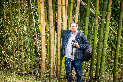
DeleteThanks for all the research you did on South Saluda church and cemetery. I found out a lot about the property from the granddaughter of a previous owner, who I ran into in the parking lot picking up trash. Her grandfather purchased the property in the early 1900's, and it was his gentlemen's farm and vacation home. The main house stood right where you said, in that grassy field in front of that huge bamboo. There's a story behind the bamboo. He was a doctor who worked as a missionary in China for awhile, and he brought back the bamboo from China. That's why this bamboo is so much larger than the native bamboo you see growing along the rivers in SC. His primary residence was on the hill behind the Greenville zoo, and his bamboo spread down the hill and into the zoo property, so you can find it there today too. The state wanted to build Moody Bridge Road right through the through the middle of his property, so in return for giving up the right-of-way for the road, the state built the 5 dams for him and the lighthouse. There was once a small caretaker's house on the top of the hill where the lighthouse is now. There were grandiose plans to build hydroelectric stations at the dams, but that never happened. The ruins you see right across from the parking lot were supposed to be the one of the power stations. It was logged in the 1980's which is where the old roads came from. A couple of generations later, the family could no longer afford to keep up with all that land, so they sold it to a developer right before the great housing crash of 2008. The developer went bankrupt, and the property was in limbo for about 10 years. Although the family was sad to lose the property, they are glad it was not developed and that now it is preserved for us all to enjoy.
ReplyDeleteThe ruins you saw are a grist mill. I don't know how any outdoorsman wouldn't know that.
ReplyDeleteI don't know what being an Outdoorsman has to do with a grist mill. Maybe a historian knows more about gristmills LOL. The former landowner told me it was built to be a hydro power station, built in the mid 1900's when the lake was built, long after grist mills were used.
DeleteThank you so much for locating South Saluda Church Cemetery. We have an 80 year old friend who attended this church as a child and would love to visit the cemetery. Mary Carr is his great great grandmother. Can I please ask for directions? I saw you parked at the Moody Bridge Rd access but how did you get to the cemetery from there. I would like to take him this fall. Thank you again.
ReplyDelete