The Renno Ramble

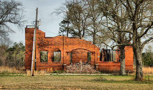
I recently bought Luminar 2018 as an alternative to Lightroom 5 which I've been using for a few years now. I strongly prefer owning software over renting, making paying a monthly fee to keep Lightroom working not an option for me. I tried ON1 Raw 2018.5, but found the interface a bit clunky and unintuitive for my taste. So for now, I'm using Lightroom 5 for its library functionality and Luminar 2018 to process most of my photos. I've also chosen a few of my older photos to process with Luminar 2018, one of which happened to be a February 2012 photo of Bell's Store in the ghost town of Renno in Laurens County.
I decided to post the newly processed edit of Bell's Store to the Facebook group South Carolina Picture Project. My adventuring friend Tom Taylor, in a comment, wondered if the remnants of Bell's Store were still there. I was wondering the same thing, so we decided to go visit Renno to see what, if anything, was left. The ramble was postponed once out of concern for evacuation traffic escaping Hurricane Florence, but last Wednesday we successfully visited Renno, and other places along the way.
I made the short trip to his house, made friends with his fluffy orange cat Cosmo, then soon enough we were heading south down Interstate 385 toward Laurens County.
We left the interstate to check out the community of Owins and the town of Gray Court. Tom grew up in this area and knows the area well. He pointed out interesting places along the way, some with connections to his family, including his old family home.
Gray Court
We took no photos here, except at this former Northern and Western Railway caboose just off of West Main Street near downtown Gray Court. Tom was kind enough to let me take a few photos while he waited in the car:

Tip Top Store
We left Gray Court and wandered through Martin Crossroads, through Ora (past the old Ora School), through Tylersville, by Duncan Creek Presbyterian Church, then down to the Tip Top community to visit a vine covered old store where SC 72 meets Renno Road. Tom explored this area back in 2013, but this store was new to me

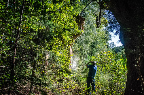
Renno
Off Seymour Road near where it intersects with Renno Road, ...


Looks like Tom caught me in the act of taking that photo:
This is the South Carolina School Insurance Archive photo of the school:


Stomp Springs
We went over to Stomp Springs, the site of a mineral spring and health resort in the mid-1940s to 1950s. When I last visited during the winter of 2012, the spring was clearly visible but the water looked icky and not healthy. This time the spring was overgrown, so we just kept going. At least some of the trash strewn around the place seen in 2012 had been cleaned up.Sardis Methodist Church Cemetery
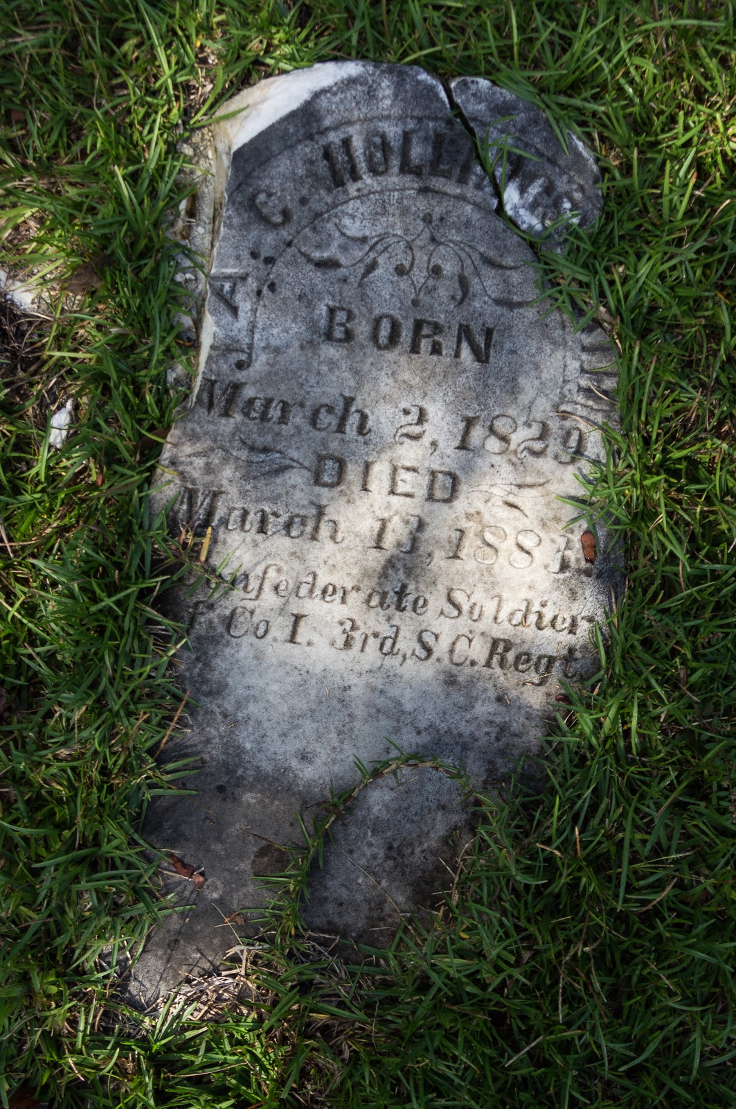
We circled back to yet another site Tom has been to, but I haven't. Near the intersection of SC 72 and Stomp Springs Road is Sardis Methodist Church Cemetery, a cemetery once associated with Sardis Methodist Church that once stood nearby.


Whitmire
We were both in the mood for some lunch so we headed for Whitmire. Before stopping for lunch, I asked if we could stop at this former equalization school off Satterwhite Road so I could get a photo.Carver School was built in 1951 as an equalization school as a segregated elementary and high school for black students. Carver became an elementary school in 1954, a middle school in 1970. then back to an elementary school in 1979, closing in 1996. I photographed the part of school I could without trespassing, stitching together multiple photos later on to make a composite:


The Whitmire Cafe, at 153 Main Street, was doing good business when we entered:


Walking back to the car, we took photos of the sidewalk advertisements. This one is intact...


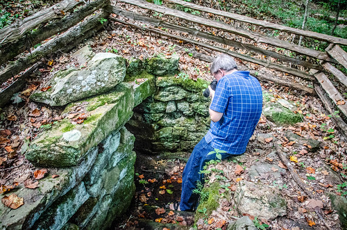
Jew's Harp Spring
Then we made our way down Maybinton Road to Jew's Harp Spring Trail. Tom found a place to park by the roadside and we walked the short distance back to the entrance.


I walked down the set of steps first, giving Tom another opportunity to catch me in the act again:


Alrighty then, so what is a Jew's Harp? A Jew's Harp is a small musical instrument with a reed attached to a frame. The reed is placed in the performers mouth and plucked to produce a note.


Wrapup
It was a nice surprise to see Bell's Store look about the same as it did few years ago. I also enjoyed learning about Jew's Harp Spring and the Orange Hall Plantation. It was also great to go on an adventure with Tom again, as we have a few times in the past, and take advantage of his knowledge of the area.All my photos from this trip are on an album on Google Photos.


Comments
Post a Comment