I had planned on visiting the top of Table Rock Mountain this fall when it was cooler and less humid, but when I found out
a Meetup.com group was
planning on going up there this past Sunday, and since I was available, I made plans to attend the meetup. Three of us (out of seven at one time) ended up going, Helen (the organizer), Victor, and myself (duh!).
The hike was scheduled to start at 8:30am, which is too early for this night owl, but I made it up to the Nature Center right on time. The three of us waited until 8:45am for any others that might show up, and when they didn't we began the journey.
Table Rock Trail is 3.6 miles long, blazed red, very strenuous at times, and its uphill almost all the way up to the trail's end at the Table Rock Reservoir overlook. For a more detailed description of the hike itself, you will want to read
this more detailed trip report blog post by Jeff Clark (read it after you finish reading this one, of course).
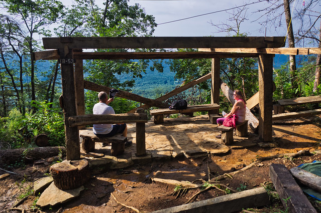
I didn't take any photos on the way up so I didn't fall behind. I did take a few photos at Halfway Shelter (about 1.5 miles up the trail), built by the Civilian Conservation Corps and damaged by Hurricane Irma, yet somehow not destroyed by the fire of 2016. We got here about 10am:
An overlook a few feet away was occupied by some younger people. One of which lost his phone down the rock face. Ouch!
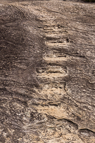
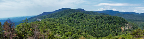
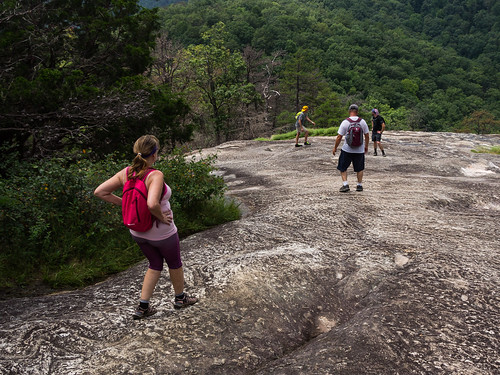
About 11am, we made it the overlook known as Governor's Rock at about 2800 feet elevation.
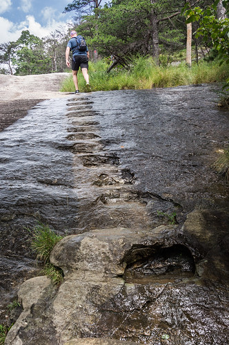
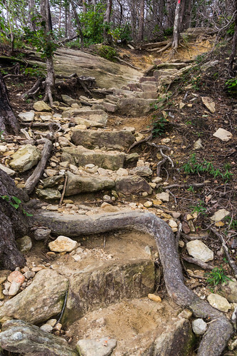
But not until a steep climb up some slippery steps chiseled out of the rock (photos taken on the way back down):
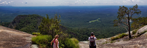
The Governor's Rock overlook was plenty worthy of a panorama (I suggest clicking through for the bigger size):
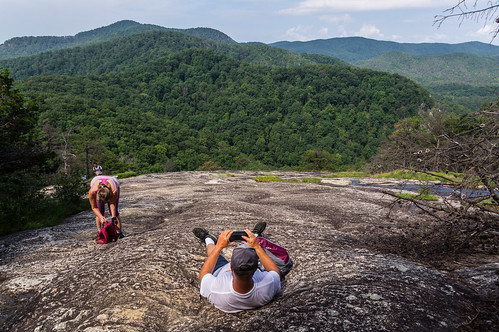
We took a bit of a break before moving on:
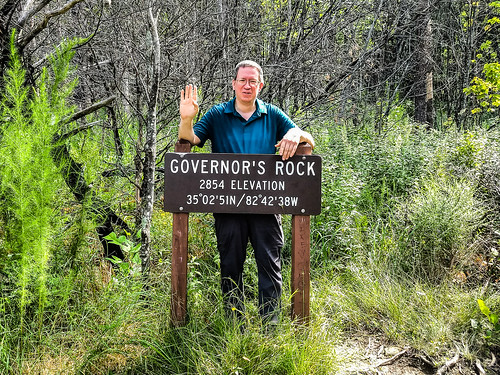
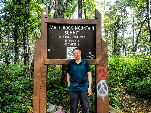
The next place where we stopped and took photos was at a sign just below the summit. We arrived here about 11:25am:
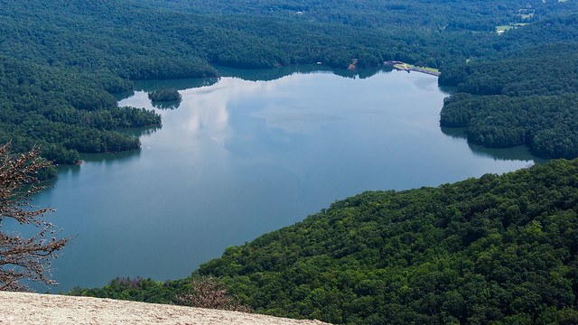
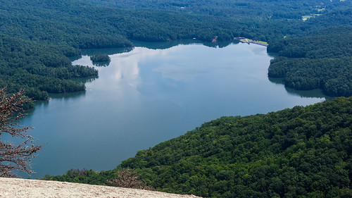
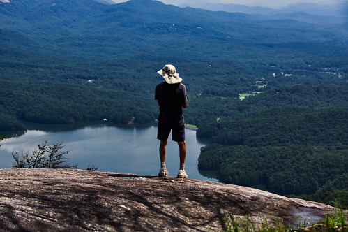
We continued on the the Table Rock Reservoir overlook, arriving about 11:45am.
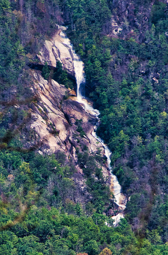
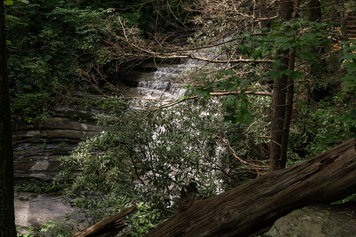
We could hear and see Slicking Falls on Slicking Creek, on the City of Greenville's Watershed land. My zoom lens wasn't zoomy enough to get a good photo, but at least I got one:
The overlook commands an excellent view of the Table Rock Reservoir, at least if you're willing to risk getting out far enough on the rock face to risk a fall:
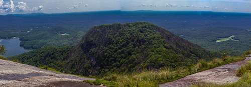
This was, of course, another excellent opportunity to take a panorama. This one is features the mountain known as "The Stool":
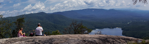
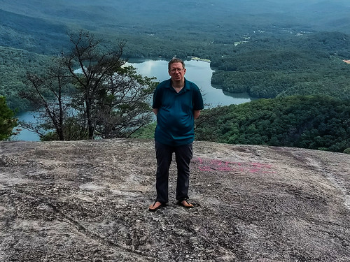
We rested here and ate our lunch. A perfect excuse to take another panorama:
People came up, took their pictures, and left to go back down while we rested:
Of course, we had to take our own:
About 12:20, we started heading back down.
We stopped at a nearby overlook where I took one more panorama from up here. I didn't notice until later the mountains didn't quite stitch together correctly on one spot. Oh well!
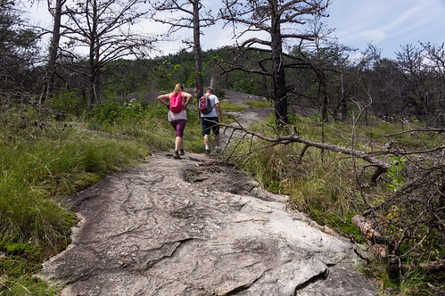
As we descended, we would run into a few groups of hikers:
The many steps were much easier to take when going downhill.
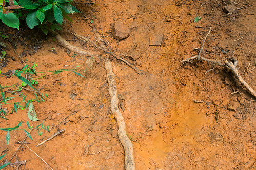
Coming up, parts of the trail were muddy. On the way down, those muddy parts were also slippery.
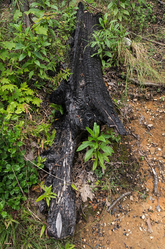
Coming up and back down, I also noticed evidence of the 2016 fires:
Eventually, one of my knees starting bothering me so I had to slow way down. But then it stopped bothering me so I could move faster again. I knew I couldn't possibly catch up so I didn't rush.
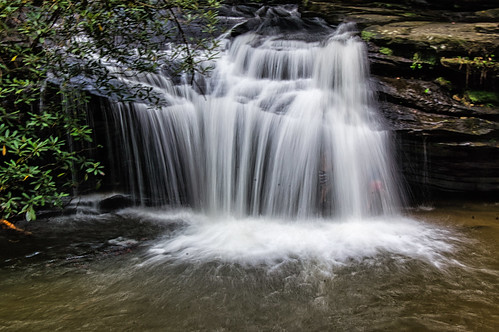
I was tempted to go down to the base of this waterfall hidden by the tree from view, but by the time I got here I was too exhausted and sweaty to care. Next time.
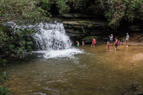
When we passed by Carrick Creek Falls on the way up, nobody was around. Now the pool at the base was filled with children playing around and behind the waterfall, with parents keeping watch.
I managed to get one good photo of the waterfall. Look closely and you'll see see two children behind the waterfall on the right side.
I met up back up with Helen at the Nature Center a few minutes later and we walked back to the parking area. Both Helen and Victor are both good people. I hope I can hike either one or both of them again sometime.
I've
shared my track to uMap. For your viewing displeasure, I've plotted a graph of the elevation plotted against time.
The graph is brutal, and there's no way to make it look easy, which is fine since it wasn't anyway.I went through all four water bottles I brought along and helped myself to a half bottle of Gatorade I brought along in a cooler back in my car.
I've uploaded my photos to
an album on Flickr where my panoramas are best viewed. Or you can click through them below:
The views were wonderful, but getting there was brutal. It will be a while before I attempt this trip again. I hope to hike with a Meetup group again sometime. Meetups are difficult to go to when they're mostly scheduled on weekends when I'm mostly not available, but maybe I'll get lucky again sometime.


A favorite hike of mine, despite how crowded it seems to be getting. Isn't it amazing that the shelter survived the fire? Hadn't noticed the graffiti - it'll start looking like Bald Rock if that keeps up. I'll have to look for Slicking Falls next time, didn't know it was there. Lovely photos!
ReplyDeleteYep, brutal is the right word. I understand about the knees - mine gave out on my coming down on my last hike up there a couple of years ago, before the fire. In my younger days I'd hike up the trail quickly then run it coming down. Don't think I'd try that now. ;-)
ReplyDeleteFWIW, the 2016 fire did destroy the halfway shelter. What is there now is reconstruction. That is new since Spring 2018.
ReplyDelete