I've been on three outings this week. The first was
a walk on the Swamp Rabbit Trail, the second was
my third visit of the year to Dupont State Forest. My third and last outing of the week is a paddle out to Laurel Fork Falls
on the Toxaway River arm of Lake Jocassee. There are two options for reaching this waterfall. The first is an 8 mile hike on the Foothills Trail. The second is a 6 mile trip over water. I went with the second option, going in my kayak.
I got off to a relatively early start (for a night owl like me, anyway), but I got delayed by road construction.
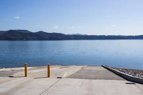
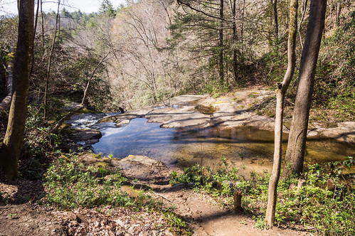
I went through the gate, stopping to pay my fee at the payment box. I stopped at the ramp where I dropped off my gear, then parked up the hill. An orange van was the only other automobile in the parking lot.
I took this photo before I dropped off my gear:
I went back down the ramp, applied my sunscreen, got my kayak ready, snapped together my paddle, stored my dry bags, took off my sandals and stored them away too.
I knew ahead of time this was going to be a long journey, about 6 to 7 miles, so I didn't take any photos along the way. Along the way, I listed to the end of a
Those Were The Days podcast from a previous week, then started on the the following week's podcast. I had downloaded them both ahead of time.
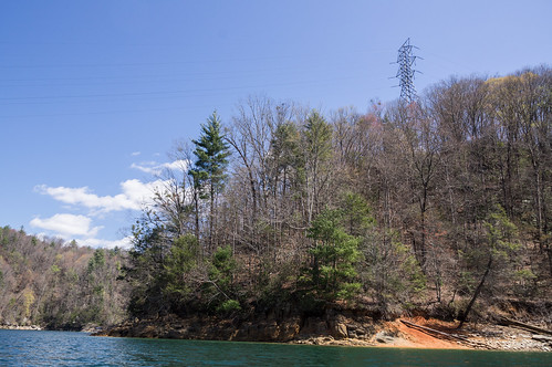
My next photo was of this high voltage transmission line near the waterfall.
I just thought it was interesting contrast with the undisturbed nature I had been passing by the last few miles.
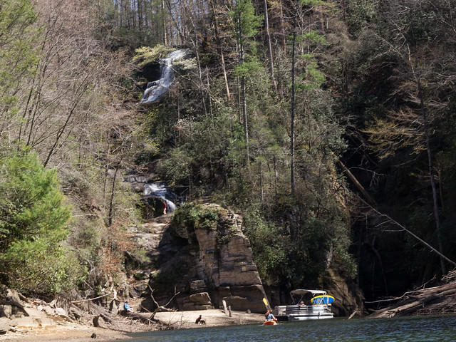
As I was getting close to the cove where the waterfall was located, I noticed a boat head into that same cove. A group of people were at the waterfall climbing the rocks, frolicking, and having fun. Their dog stayed on the beach.
Before heading that way, I decided to check out a creek, Jackies Branch, emptying into the lake near where the spur trail from the Foothills Trail ends at the shoreline.
While I was checking out the creek, the group in the boat left. As I headed toward Laurel Fork Falls, another boat with one person approached, but didn't stick around.
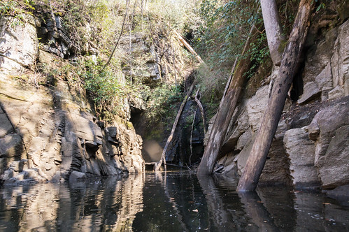
The view of the waterfall from up close wasn't that great. I went around the right side to see if I could get closer. The view here seemed almost dystopian.
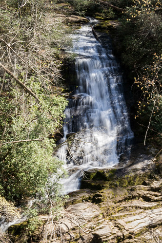
But around the corner, I got an interesting close up view of the waterfall you cannot get by boat or by hiking.
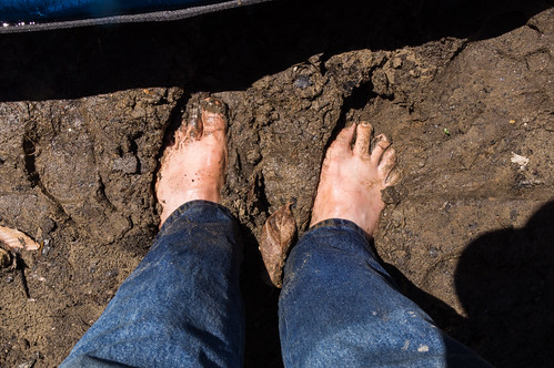
I went back and landed on the beach. I stepped out into the mud, and it felt pretty good.
The group that left a few minutes ago climbed these rocks,
but I decided not to take that risk without someone else around in case of an oopsie. I was far more interested in getting a good view of the waterfall anyway, and I was too close for that. I had read there was an overlook up the trail, so I paddled back over to and made my way over the the big sign.
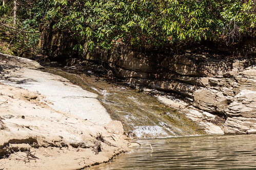
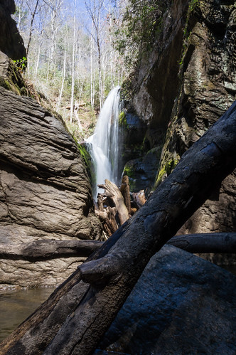
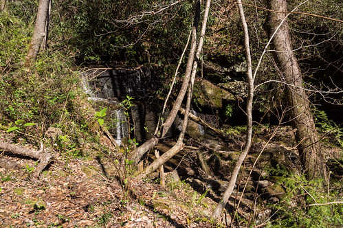
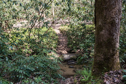
The trail mostly follows a small creek, Jackies Branch. The creek is rather sluice-like in its decent into the lake from above, although one small waterfall does interrupt the sluice. I didn't a good photo of the sluice, but I got a decent one of the waterfall.
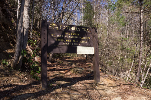
In a few minutes, I made the ascent to the join the Foothills Trail.
The upward grade continued until I reached the overlook. I took one with a fast shutter:
then a series where I bracket the shutter speed. Later on I'd see which one I could make useable in Lightroom.
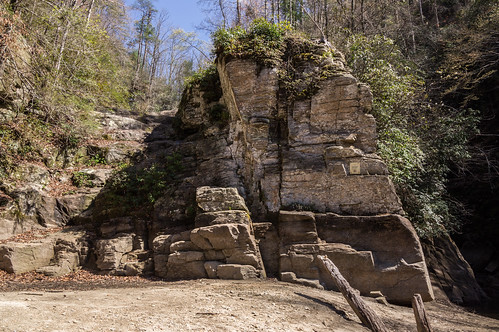
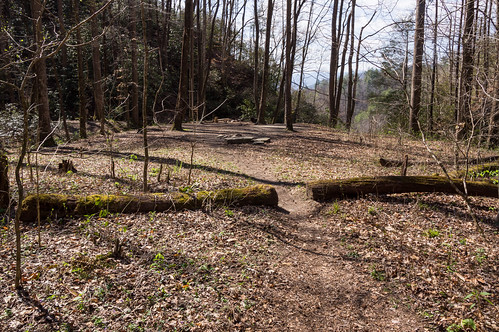
My map app showed a spur trail ahead, and I decided to explore that while I was here. This turned out to be the entrance to a camping area.
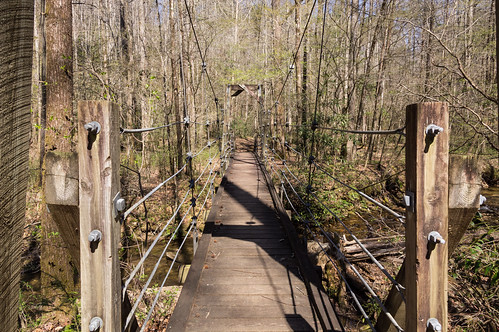
Down the trail was a bouncy suspension bridge:
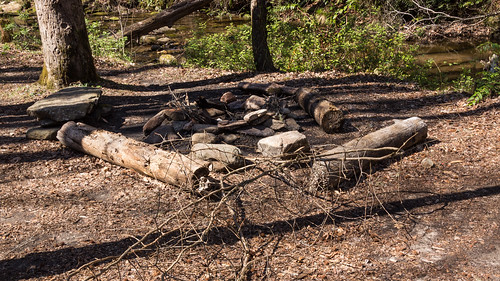
At least two camping areas were present:
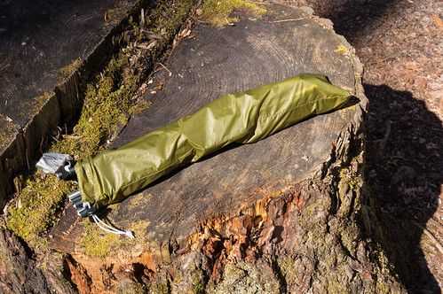
Someone also left this behind:
I stopped at the top of the waterfall:
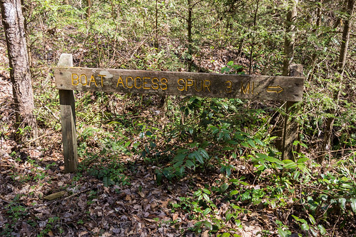
then I backtracked back to the Boat Ramp Spur Trail. On the way out, I spotted one more camping area:
Then it was long trip back to the boat ramp. I didn't have to consult my map as much this time now that I had my incoming track to trace the twisty way back. Like on the inward journey, I didn't take any photos. I did get a bit frustrated because I wanted to speed up at times, but then the south westerly wind would start blowing hard right in my face.
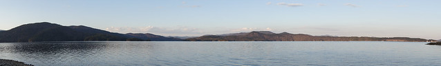
Nearing sunset, the wind died down, but since I could see the boat ramp even from a mile or so out, and I knew now I'd make it back before it got too dark, and I just cruised along.
The sun was going down behind and to the left of the ramp, and here it was only dimly lighting the other shore. I took a panorama shot I was forced to crop later on to hide the pixelated mess made by the waves close to shore.
I had a good time at Laurel Fork Falls. By kayaking in, I got to see views of Lawson Fork Creek from both the water and from the overlook. If I had hiked in, I would have only seen the waterfall from the overlook.
I made a map of the trip from the boat ramp to the waterfall and back:
I've uploaded my photos to
an album on Flickr.


Comments
Post a Comment