First paddle on Lake Jocassee
Lake Jocassee is located in the northern part of South Carolina in the mountainous part of Pickens and Oconee counties. The lake is impounded by a hydroelectric dam, in the southeast corner of the lake, built in 1973 by Duke Power. Four rivers flow into the lake: Whitewater River, Thompson River, Horsepasture River, and Toxaway River. A number of creeks also feed into the lake, some as waterfalls.
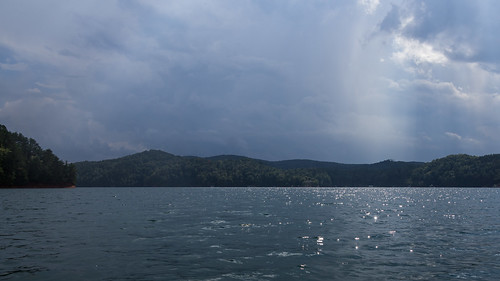
Lake Jocassee is mostly free from development along the lake, unlike Lake Summit in Tuxedo, NC I visited earlier in the month.
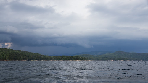
I paid a visit Lake Jocassee yesterday by way of Devils Fork State Park ($5 for a day pass), on a day whose weather forecast promised a likely chance of late afternoon thunderstorms. I had planned to be back well before then, however. I parked at the northern most boat ramp in the park to save some paddling time.
I brought along the Android phone I use as a media player and GPS device to guide me in my travels.
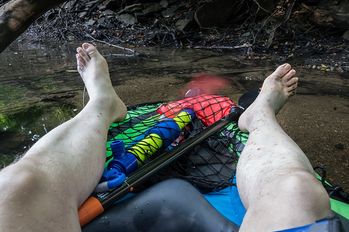
The Intex Challenger K1 is not a fast boat (I estimate my moving average even with the improved paddle is 2.5mph), and the included aluminum breakdown paddle fatigued me during my recent visit to Lake Summit.earlier in the month.
I fixed the paddle fatigue issue with a carbon fiber shaft two-piece paddle. The kayak still needs to be replaced with something better, but I hope to upgrade to a much better inflatable kayak in about a month or so. Until then, my slow cramped kayak will have to do.
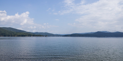
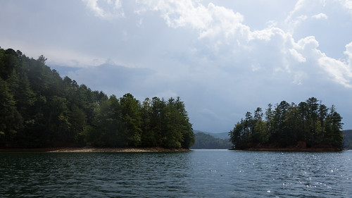
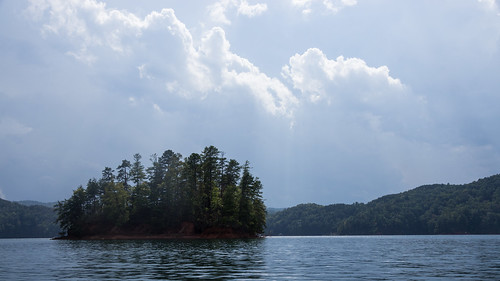
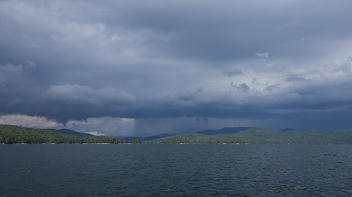
The view from the boat ramp is outstanding with those mountains in the distance.
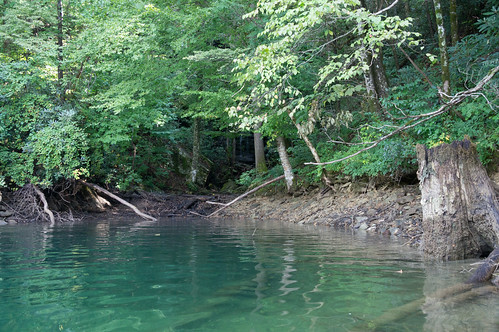
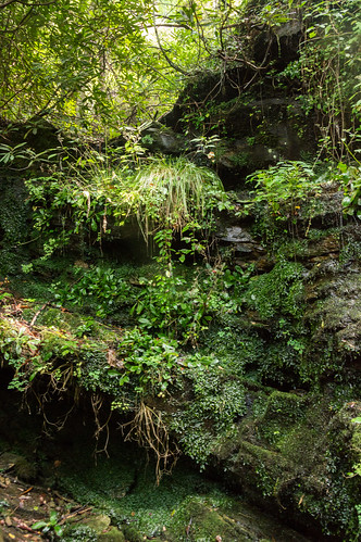
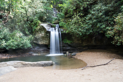
Double Spring Mountain Falls is a waterfall in an cove whose presence is given away only by the sound of rushing water.
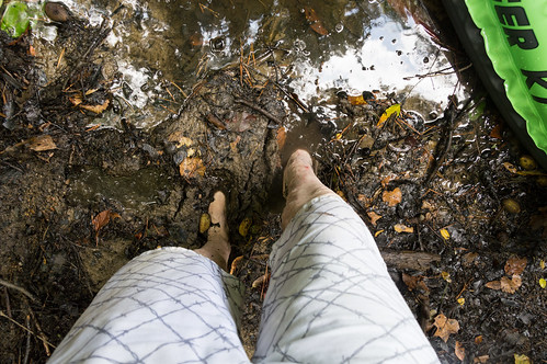
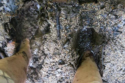
Before heading to the waterfall, a short rest to let my feet recover from being in a cramped space.
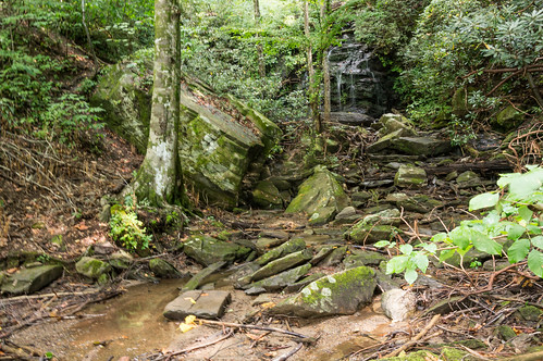
I took a short video of the waterfall in action:
I spotted two steep paths that lead upward to the upper portion of the waterfall, but I didn't feel taking a chance on hurting myself or worse that day so I skipped that option. In 2010, the writer of the blog Adventures of SCJack, Jack Thyan, visited this same waterfall and climbed this path to the upper section and made it out alive and uninjured.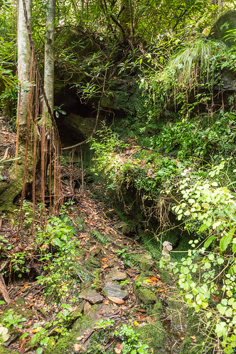
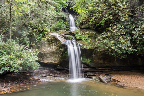
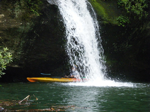
Youtube user Reliable Ron posted this video of him paddling to Wright Creek Falls, and in this segment he paddles behind the waterfall:
I would have liked to stay longer, but some loud obnoxious folks with an even louder obnoxious dog showed up in a pontoon boat, and I didn't feel like putting up with them, so I headed out.
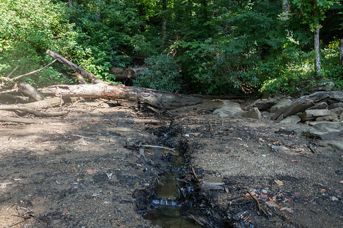
I had skipped over exploring another stream in yet another cove in case I had to make a quick exit because of thunderstorms. I went back to check it out, but this one had no waterfall, just more stinky muck.
As I was pulling my kayak out of the water and back to the car, sprinkles began to fall even though the sun was out. Those sprinkles didn't last long though, not even long enough to wet the ground.
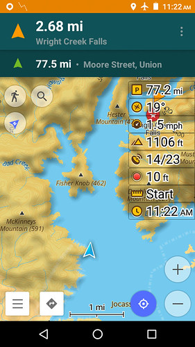
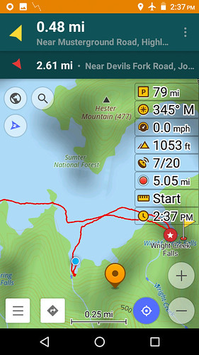
I made a map of my journey, and I also marked the locations of the two waterfalls:
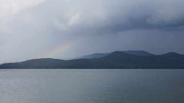
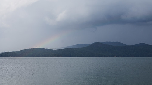
On the way back, I saw more rainbows along the way than I've seen in many years. If I weren't busy zipping along hilly rural highways, I would have snapped some photos.
I had a great time today. I look forward to coming back again, this time with a faster kayak and no chance of thunderstorms.
All photos from this trip are in an album on Flickr and an album on Google Photos.
Update: Tom visited Lake Jocassee the very next day, also visiting Wright Creek Falls. An interesting almost coincidence!


Between your blog and Tom Taylors I have more than a bit of interest and envy! I would love to get up to some of these spots, but three kids and a kayak don't mix... it'll be a few more years until I get to these falls. In the meantime, thanks for the virtual tour!
ReplyDeleteThanks! Speaking of Tom, he went to Lake Jocassee the day after I did. I would think his blog post about his trip should be up in the next day or two.
DeleteJust now catching up on my blog reading. Thanks for the shout-out. That post is up.
DeleteI've updated the blog with the link. I find it interesting the coincidence that almost was.
DeleteSounds like you had a good first experience on Jocasse. It's one of my favorites. The weather can be really tricky, and I've learned not to rely on forecasts.
ReplyDeleteI did have a good time, thanks! I plan to be back sometime after I get the faster kayak.
ReplyDelete