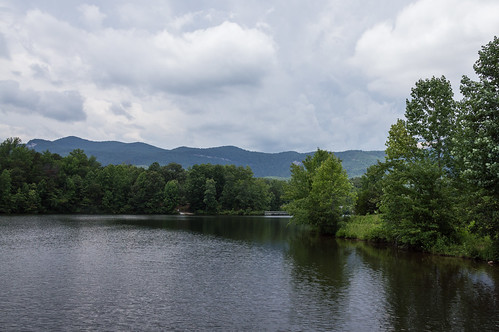
Lake Oolenoy is one of two man-made lakes in
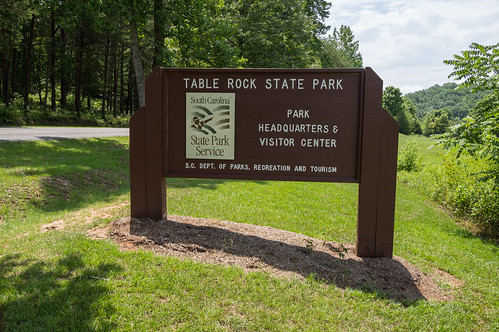
Table Rock State Park in northern Pickens County in northwest South Carolina on the south side of Highway 11. A parking area, a pier, and a boat ramp are located on the west side of the lake. Another parking area, a visitors center, primitive campgrounds, another pier, and the Roper House Complex (later Camp Oolenoy) are located on the east side.
Just after the July 4th holiday, I had ordered a small inexpensive inflatable kayak from Amazon, the Intex Challenger K1, along with some other related accessories. The package had finally arrived a few days ago via their free super
slow saver shipping and I was ready to take it for a ride.
I selected Lake Oolenoy for several reasons. It's an opportunity to explore more of Table Rock State Park, it's home to the Roper House Complex (later Camp Oolenoy), and because multiple experienced kayakers recommend this lake for beginners like me.
I left much later than I had planned (something came up), and didn't get there until about noon. I decided to explore the east side of the lake first before heading over to the boat ramp on the other side.
The visitor's center was the closest place to check out. For some unknown reason, my camera strap got in the way of the second photo.
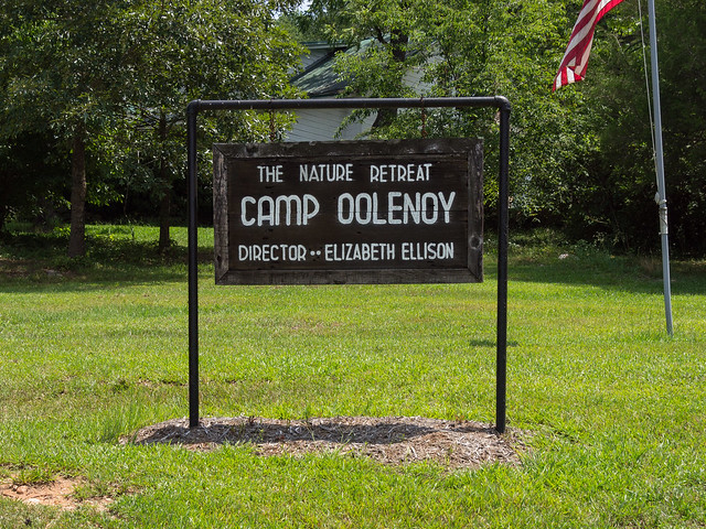
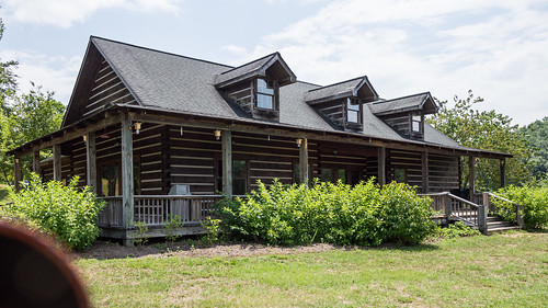
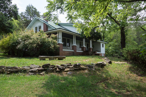
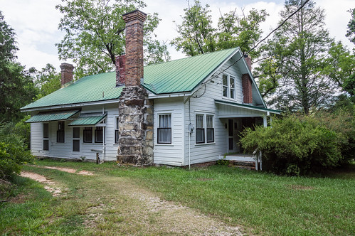
I was far more interested in the Roper House Complex, later becoming Camp Oolenoy.
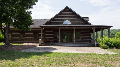
The land around here and what's now under Lake Oolenoy once belonged to the Roper family. The Roper House was built in 1856, then expanded and remodeled in 1937 with help from the Civilian Conservation Corps crew constructing Table Rock State Park.
The owner of the house in 1937, Manning Roper, was an assistant foreman and later the first superintendant of Table Rock State Park until his death in 1944.
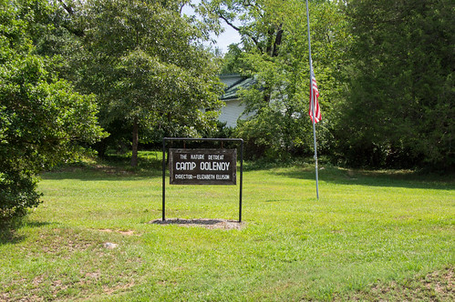
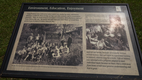
Elizabeth Ellison, a school teacher, bought the property in 1952, naming the site Camp Oolenoy.
Camp Oolenoy became a destination for 7th grade students at Greenville Junior High School to study conservation. During the summer months, Camp Oolenoy became a private camp for students ages 7-11.
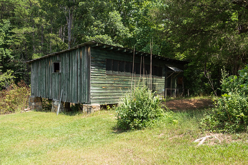
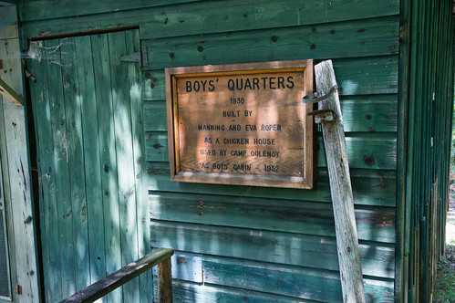
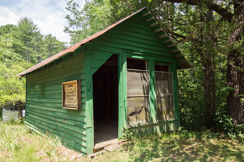
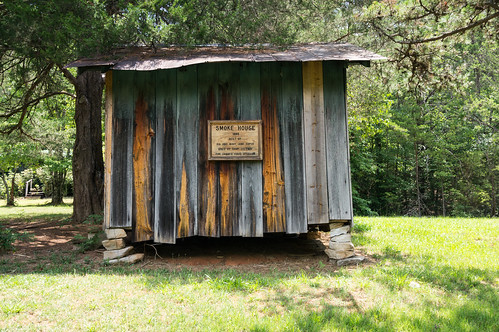
The Roper family chicken coop was remodeled and repurposed as a cabin for boys.
The old Roper family garage became the arts and crafts cabin.
The Roper family smokehouse was also repurposed.
In 1990, Elizabeth Ellison
donated the land to state of South Carolina while retaining the right to live on the property. She died January 1, 2004. A copy of her obituary can be found at
FindAGrave.
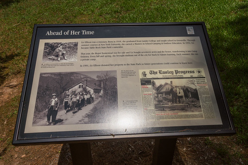
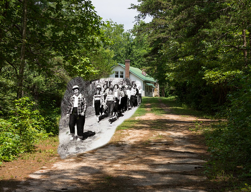
I found
this October 1952 photo of her leading a group of children on the Facebook page belonging to the National Archives at Fort Worth.
You will find a cropped version of this photo (cropped from the red box in the photo) on this signboard near the Roper House:
Of course I had to make a composite of this, so I made one using Photoshop Elements 8 (yes this version is outdated, I know):
I took several photos to use as background here, but they ended up being too close to the house. The present day photo is from the following day where I shot from a greater distance, then cropped to get as close to the correct alignment as possible.
The Roper House Complex / Camp Oolenoy site joined the National Register in 1989.
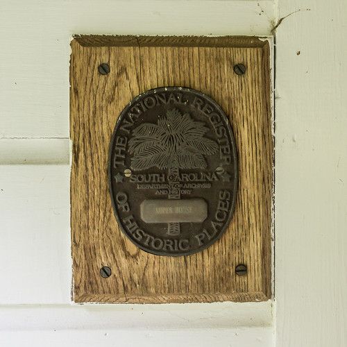
I summarized the history of the Roper House Complex from the
nomination form.
With the historical part of the trip done, it was now time to head to the west side of the lake to paddle the lake. When I got there, I discovered I forgotten to pack my
pfd. Then it began to thunder.
This day's paddle was just not meant to be. I couldn't risk a paddle on the lake, but that's fine I would just try again tomorrow!
The rest of my photos from this trip are in
an album on Flickr and
an album on Google Photos.
I created this map to show the lake and its points of interest:


Comments
Post a Comment