Glendale is a mill village a few miles east of Spartanburg, South Carolina by Lawsons Fork Creek in Spartanburg County. The center of village life once centered around Glendale Mill, a mill with a long history
dating back to the 1830s. However, in 1961 the mill closed permanently, and in 2004 a fire turned the mill into ruins.
Before visiting Glendale a few days ago, I had a few stops to make first along the way.
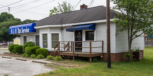
This income tax business at
1450 Union Street on the southeast side of Spartanburg...
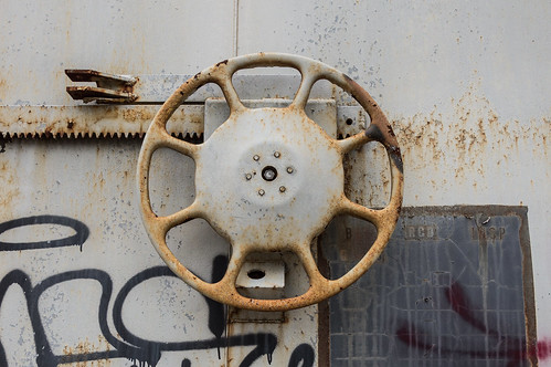
was once the Lyman Depot, moved here from the town of Lyman in 1981.
As an archived story from the Spartanburg Herald-Journal explains, Peggy West and her husband bought the depot from Seaboard Coastline Railroad in 1981. They had the depot moved to this spot, and turned it into a craft shop. M&M Tax Service now owns and operates the building.
The Lyman sign, mentioned in the story, and seen here in this photo by John Jones from the
Lyman page of
scdepots.com, no longer hangs off the rear of the building.
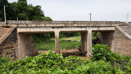
Behind an Ingles grocery store
off Country Club Road is a railroad trestle over an abandoned railroad right-of-way.
The railroad that once passed underneath this bridge was
an electric trolley line that traveled to Glendale, then north up to Clifton. The trolley line was discontinued in April 1935 due to declining use. It's replacement was a bus system.
The railroad branched off from an Norfolk Southern railroad line, dating from 1849, that once headed into downtown Spartanburg. This line has first cut back to Henry Street, then to here at Country Club Road. The abandoned line between Country Club Road and Henry Street is now the
Mary Black Rail Trail, although a small part of the line remains for use as railroad car storage for a few hundred feet.
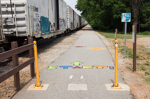
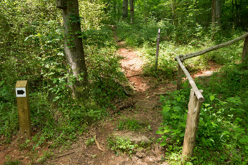
I parked at the trailhead, l
ocated off Country Club Road very near the Ingles mentioned above, and found the adjoining track loaded with rail cars.
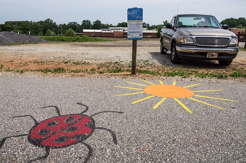
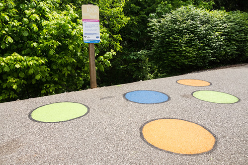
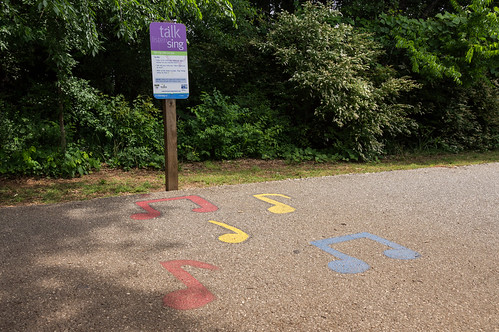
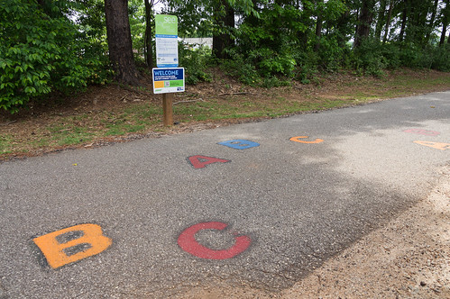
As I walked the trail, I noticed several cute, eye catching activities designed for kids.
I like this!
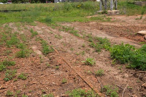
I also spotted a long abandoned old spur.
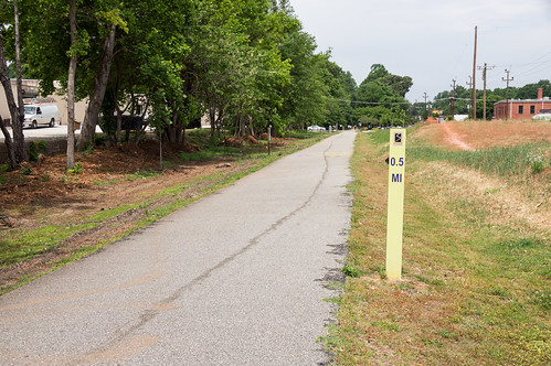
Soon enough, I made it to my stopping point, the street just beyond this mile marker...
and turned back.
This time, I payed more attention to the rail cars parked on what is now a spur.
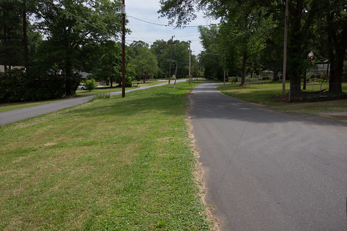
Continuing on toward Glendale, I made a quick stop on Avondale Drive off Country Club Road to trace more of the Glendale Clifton trolley line. I used a
1921 soil map of Spartanburg County to help me with this task.
Here the road is divided. The trolley line ran down the middle according to the 1921 soil map.
An electric line still runs between the two roads here as it did when the trolley came through here, but of course serve a much different purpose now.
I also stopped at the end of Trolley Car Way (love the name!) where the line continued on a short distance before bending north toward Glendale.
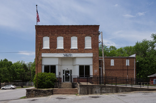
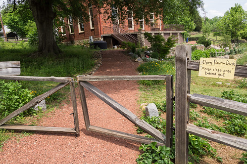
Glendale still has a small post office, located in the former mill store. Right by the post office is
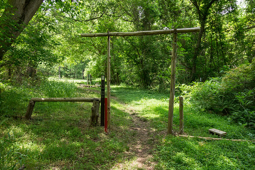
a parking area to access the trail head.
One business remains,
Lawson Fork Auto, located in the old gymnasium.
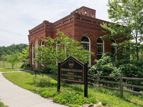
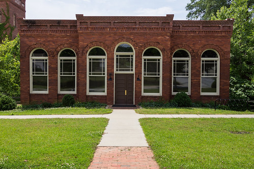
The old mill office is occupied by Wofford College, and now called The Goodall Environmental Studies Center.
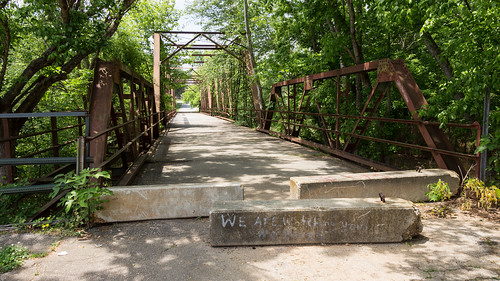
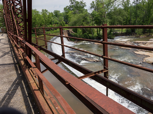
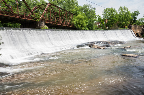
The old truss bridge no longer carries traffic, but you can still walk on it, and so I did.
On the other side of the bridge is the Glendale Shoals Preserve, where there's a nice view of the dam.
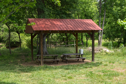
A sandy trail stays close to the creekside. The trail then bows away from the creek past a picnic area...
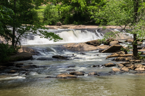
A short connector trail heads up to a parking area off Edna Cudd Road. The main trail bends back close to the creek again, with a view of a waterfall just upstream.
The trail continues on close to the creek, before ending at the border of private property.
I made my way back over the bridge and down Glendale Shoals Trail to explore the area around the mill ruins.
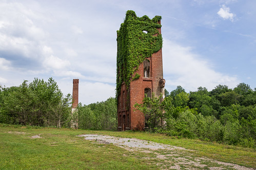
After Glendale Mill shutdown in 1961, the mill changed owners several times for use as warehouse space. On March 20, 2004, any hope of reviving the mill as the center of the community came to an end when the entire mill burned down.
Photographer Terry Gilmer took photos of the fire, and shared this one...
... and nine more viewable on the
Mill Fire page at website
glendalesc.com, a fantastic source of information about the Glendale Mill and the mill town.
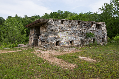
Kudzu is starting to claim parts of the ruins.
Scorch marks are still plainly visible in other parts.
I could see walking the trail where some ruins looked different than the rest, as if the mill expanded over the years.
That turned out to be true. While reading over
glendalesc.com after I got back home, I found
this annotated 1945 Birds Eye View labeling when each section of the mill was built. Fantastic!
The trail took me past the east end of the mill ruins...
and continued on, staying near the creek now. The trail eventually reaches private property and ends. I headed back and went up the connector trail to the Glendale Greenway.
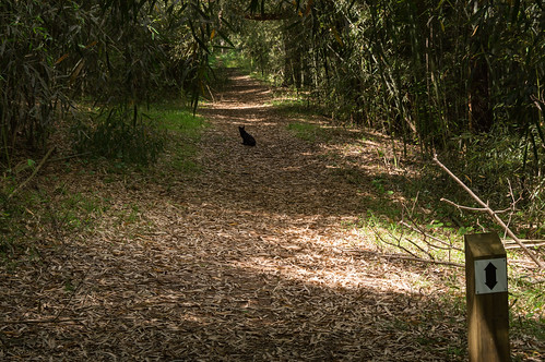
The Glendale Greenway trail, at least in this section, follows the abandoned Glendale Clifton trolley line right of way. I managed to disturb a cat, probably belonging to residents of some nearby home.
The trail here is relatively flat, with some sections on a fill, and other sections in a cut. Solid evidence this a railroad once went through here (even without a 1921 soil map showing this to be so)!
I continued on until the trail ended at Wheeling Circle road, just around the bend from this trailhead.
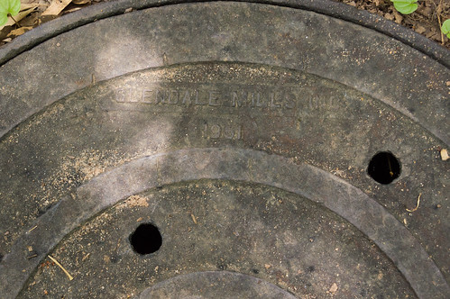
On the way back, I noticed the many sewer hole covers. Most were generic covers, but this one was more interesting than the rest with the words "Glendale Mill" and 1951 on the cover:
As I walked back toward the mill ruins on Glendale Greenway trail...
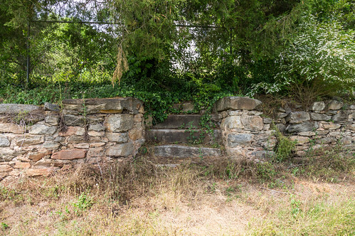
...I noticed what a set of steps leading to a fence.
My curiosity aroused, I wondered what rated these steps. A peek through the fence yielded my answer, this old, beautiful, decaying, vacant home.
When I got home later, I found out this is the
Bivins-Converse house, home of the original mill owner James Bivins, and is listed in the
National Register.
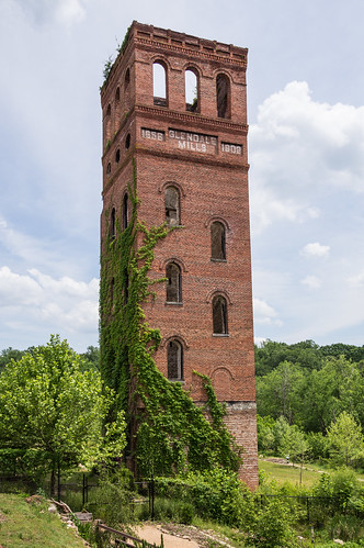
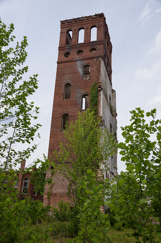
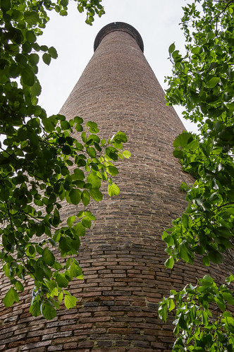
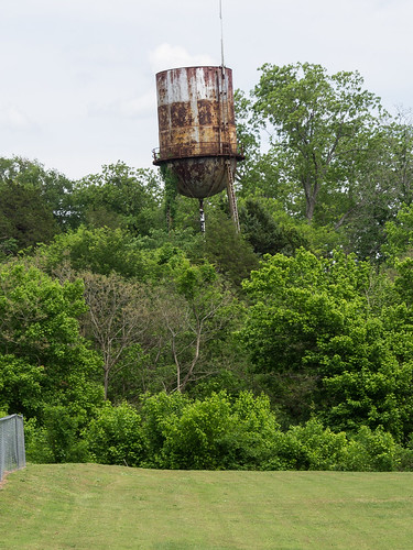
Having completed the loop, I headed for home, but not before one last photo of this distant water tower I spotted just before leaving:
This visit featured an abandoned railroad line, an old mill, an old bridge, a small waterfall, and nature trails. Any one of those would be worth a visit on its own for me, but I got them all in one place! Later research also shows there's a few more points of interest worth investigating, making the probability of my return almost certain.
I took a lot of photos this trip, and they're shared in
an album on Flickr and
an album on Google Photos. I've also tweaked my
Abandoned Railroads: South Carolina map to account for the new information I gathered this visit.
Thanks to Mary McKinney Teaster, and her contributors, for all the wonderful information on her website
glendalesc.com. If you're interested in the mill and the town, I highly recommend visiting this site.
Update: I forgot my adventure loving friend Tom Taylor had
visited Glendale a few months ago. He visited some areas around the mill not on my agenda this visit.


Comments
Post a Comment