Exploring US 221 Part 2: Lanford to Harris Springs
In Part 1 of my US 221 trek, I covered the trip from Moore to Enoree in Spartanburg County. This part covers the trek from Lanford to Harris Springs in Laurens County. In this part, I'll use Historical and Architectural Survey Of Western Laurens County, South Carolina and Historical and Architectural Survey Of Eastern Laurens County to help with some of my history in this section of US 221.
Lanford is a small community located a few miles south of Enoree, SC. All of the active businesses here are now closed, making Lanford a ghost town. Lanford, like many places by the railroad, grew around the depot. Lanford's depot was built in 1886, but was closed by 1933, the date of this unpublished Sanborn fire insurance map of Lanford:
The depot, as shown on the map, would have stood on the left side of the top photo, near the railroad track. Most of what's shown on the map above is gone, with only a few exceptions.
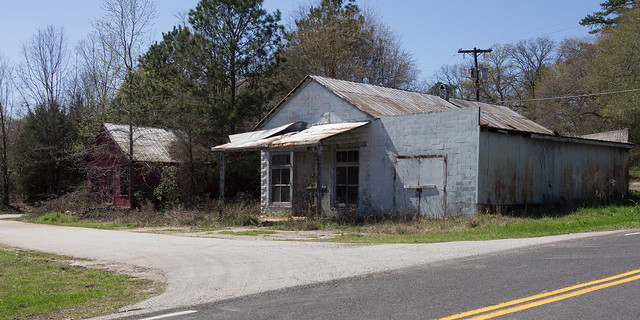
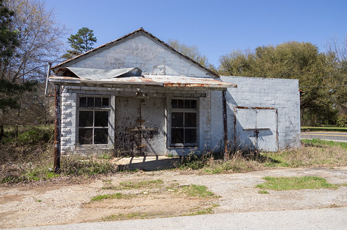
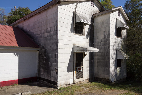
The building on the left is identified as Fleming's General Store from a comment left on Panoramio user bearden82's photo of this same building.
I found a deed at the Laurens County Register of Deeds showing a Fleming once owned this property until a few years ago, giving support to the name.
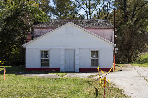
The building on the right is identified as Lanford Grocery by the Historical and Architectural Survey Of Western Laurens County, South Carolina:
My camera's battery had now exhausted its charge. When I first took my camera out of my backpack back in Moore, I found it on and recording video. My battery was already down to 20% and I hadn't even taken one photo! Fortunately, I had a spare battery back in the car, and I went back to go get it before moving on to the schoolhouse.
That's when an older couple in a golf cart pulled up. I first observed them picking up trash along the roadside back at a church just up the road. They accidentally appeared in this photo on the very left.
I didn't talk to the wife that much, but the husband seemed very knowledgeable about the history of the Lanford area.
For one, the place I had parked at, a paved area at the corner of Lanford Rd. and US 221, is where a gin once stood. A blurry 1994 satellite image on Google Earth shows this structure.
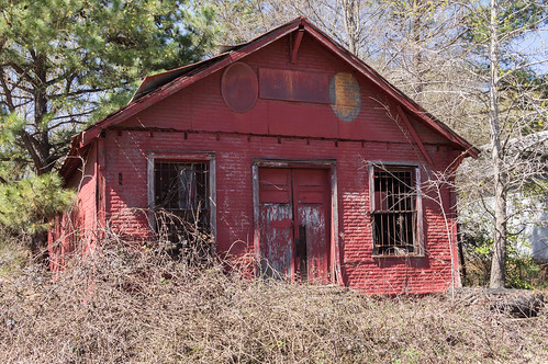
He also informed me the ruins of a building he saw me photographing....
...once was a filling station. The Sanborn fire insurance map supports him on that.
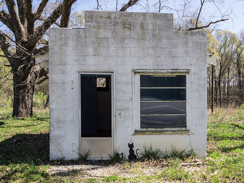
He also let me know this small building by US 221...
...once was a post office.
He also confirmed the schoolhouse building was across the road where I expected it to be. I thanked then for their time (or at least, I better have!) and headed toward the schoolhouse. I wish I had gotten their names now, but I didn't think about that at the time.
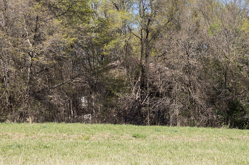
Lanford School is now rather unfortunately shrouded by trees, so I made no effort to go up the driveway for a closer view. I satisfied myself with a photo from the road.
The South Carolina School Insurance Photograph Archive has a much better view of Lanford School:
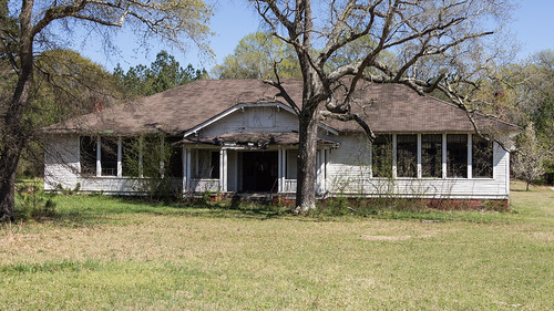
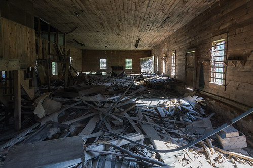
Down in Ora, I stopped by Ora School, next door to a fire station. The school isn't in good condition, but still looks salvageable:
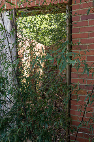
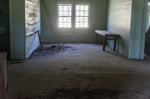
I decided to take a risk for a change, and slowly and carefully step over the creeky front porch to take this photo from a pane in the front door:
The South Carolina School Insurance Photograph archive photo for this school is labeled Ora Community House:
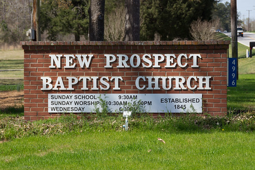
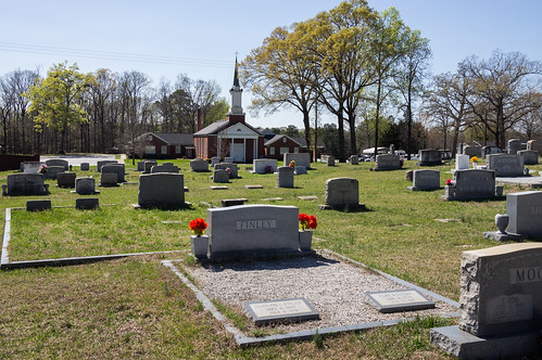
I then slowly and carefully stepped back over the creeky front porch back to the car, and then made my way down to New Prospect Baptist Church, a bit south of Maddens.
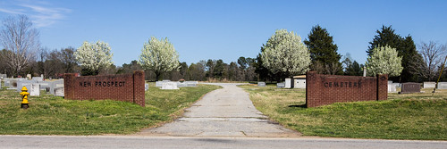
More precisely, to visit the cemetery across the street..
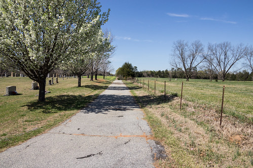
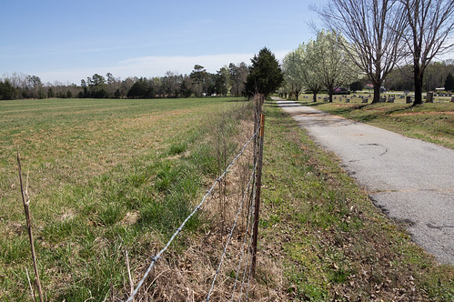
where the Atlantic Coastal Line Railway once ran behind the cemetery before a realignment to reduce the number of curves moved the railroad a short distance away sometime between the late 1950s or early-to-mid 1960s. This straightening and relocating of the railroad was done in several places in Laurens County along the fail closely following today's US 221, but I found this place to be the most accessible.
The old right-of-way is located immediately beside the this fence:
Here it's easier to see the small rise where the rails where:
The old right-of-way rejoins the current right-of-way a few hundred feet ahead.
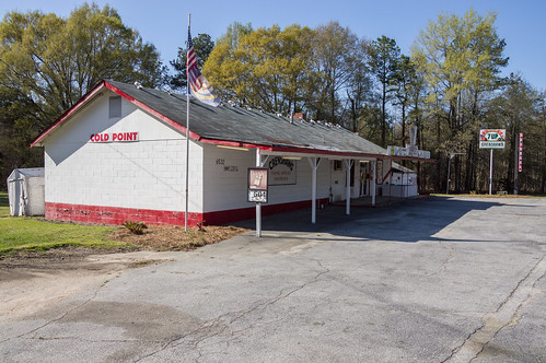
Cold Point was next, and there I was in for unpleasant surprise.
This old store sits at the intersection of US. 221 and SC 39:
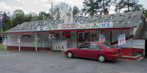
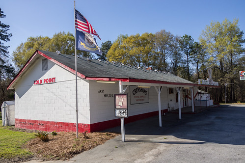
I also wanted to visit Crenshaw's, a convenience store with a memorable roof:
I missed it on the way down because I was looking for those skulls. On the way back I found the place, but found the parking area empty...
and many of the skulls missing:
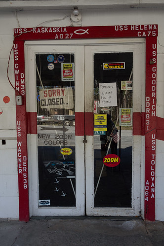
But the parking area was empty, and I found a sign on the door...
... with the words "closed due to illness".
I know the store was open as recently as 2013, so the closure must have been relatively recent.
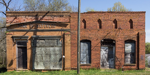
My next stop along US 221 was Waterloo to visit the same places I visited in 2012. The Bank of Waterloo and McNeill General Merchandise Store:
A third building once stood beside the McNeill store for many years to the right, the E. F. Golding General Merchandise Store, but that store is no longer standing.
The Bank of Waterloo opened in 1913, and closed in 1931 due to the Great Depression. The McNeill General Merchandise store closed in 1933, also due to the Great Depression.
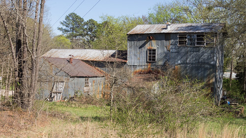
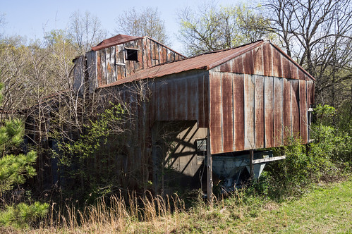
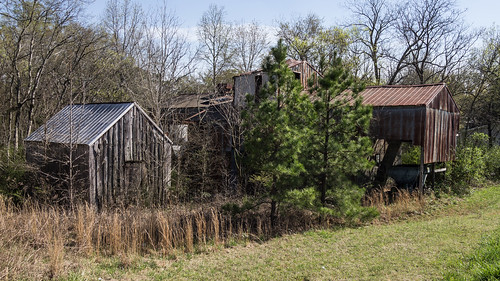
Still nearby is the Waterloo gin complex:
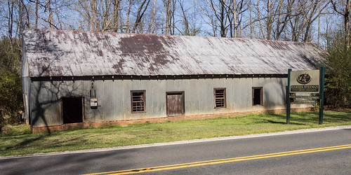
I turned off US 221 and over to Harris Springs. Harris Springs is the name of a community and a spring. The spring located on the Harris Springs Sportsman's Preserve (currently for sale).
James Teague Harris (1855-1928), better known as J. T. Harris, bought the property now known as Harris Springs, and turned an ordinary spring into a "lithia" spring whose water cured all kinds of ailments.
Famous springs like this need a summer hotel to go with the spring (like Chick Springs and Glenn Springs), and Harris followed that template by opening the Harris Lithia Springs Hotel in April 1891. From the Laurens Advertiser:
The 1891 date coincides with the increase in advertising I found in other 1891 issues of the Laurens Advertiser. By 1895, the marketing of the spring water's curative benefits is going strong:
In 1900, Harris sold out and worked his marketing magic touting White Stone "Lithia" Springs, building a hotel there in 1901.
He actually sold out to a group from Augusta, and for $100,000, but at least the part about selling out was correct.
The hotel would continue under several different managements, and later included a bottling plant:
Those health benefit claims were removed by this time because of a court judgement.
As for the hotel, it burned in 1930 and wasn't rebuilt.
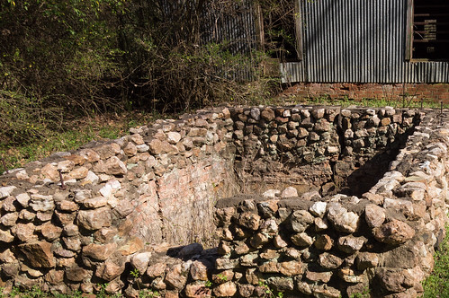
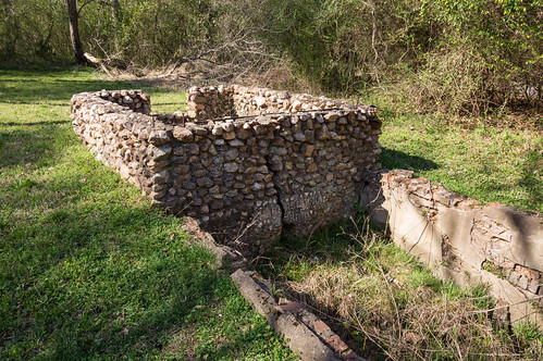
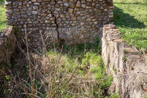
The spring itself is only a few feet off the road, next to a gutted building.
The water flow was just a trickle when I stopped by.
The hunting preserve is across the street.
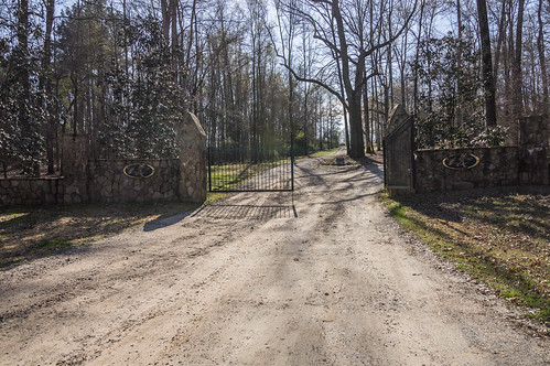
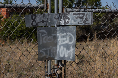
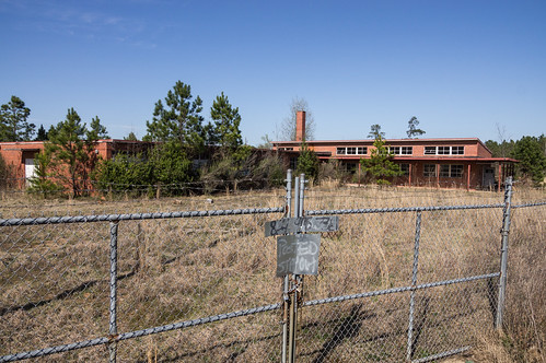
I had one more stop to make before heading north again, and that was the old Midway School, a few miles north of Cross Hill. The school site behind a padlocked gate and fence.
The fence made is rather difficult to get a shot. This one I managed by climbing on top of my car:
I don't know when the school opened or exactly when the school closed, but Laurens County property records suggest the school closed sometime in the 1980s
All trip photos are in an album on Flickr and an album on Google Photos.
Here a map of the locations I visited in the Laurens County part of the trip:








Love the History of Laurens SC. I collect Soda and Spring Water Bottles and Memorabilia like many others. Wish we could go back in “The Time Machine” and see these places in their “HayDay”. Would Love to have seen and stayed in the hotels with their “Special Spring Water” BEFORE things became contaminated. THANK YOU FOR TAKING THE TIME TO SHARE YOUR PHOTOS & HISTORY OF THE AREA WE LIVE NEAR !!!
ReplyDeleteLove the History of Laurens SC. I collect Soda and Spring Water Bottles and Memorabilia like many others. Wish we could go back in “The Time Machine” and see these places in their “HayDay”. Would Love to have seen and stayed in the hotels with their “Special Spring Water” BEFORE things became contaminated. THANK YOU FOR TAKING THE TIME TO SHARE YOUR PHOTOS & HISTORY OF THE AREA WE LIVE NEAR !!!
ReplyDelete