A few years ago, I made plans to explore U.S. 221 to visit the ghost town of Hillsville, just north of Enoree at the southern edge of Spartanburg County. I had to cancel those plans when my old car developed expensive problems. A few weeks ago, I rediscovered those plans and decided the time was right to try again. In the meantime I had added more sites to my list, making this a more interesting whole day trek instead of a nice couple hour diversion.
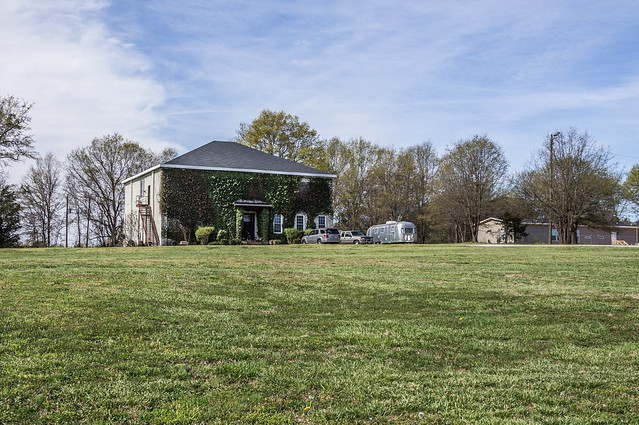
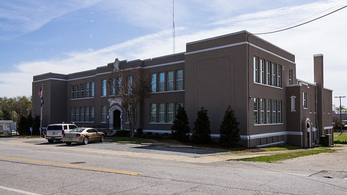
My first stop was this old school building in Moore, SC:
I couldn't find any online information on what year the school was built, but using online maps I did narrow down the date to sometime between 1940 and 1945. I found the school shown on a 1945 USGS quad map of the area, but not on any earlier maps, including
a 1940 SC DOT map of Spartanburg County.
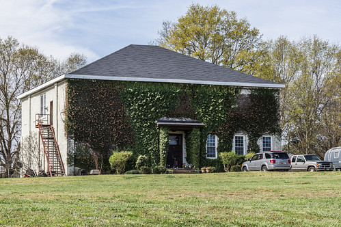
The South Carolina School Insurance Photograph database contains
this photo of the school:
This old school building was also once a recording studio run by three members of the Marshall Tucker band, according to
a 1982 story about the history of Moore in the Spartanburg Herald-Journal. I've also seen later references in Google's online newspaper archives to wedding receptions held there as late as 2004.
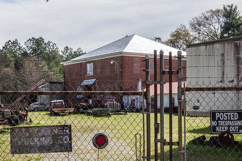
A few miles down US 221 in Switzer is another old school building that shares the same design, at least on the outside:
This building seems much less inviting somehow. According to a sign the fence, the building is home to Turner Feed and Seed, and Turner Trucking Company, although it looks like it's used more for storage than anything.
Like the Moore School, I couldn't find the exact year this school was built but I can narrow it down. A 1935 USGS quad map of Switzer shows the school in the present location.
A 1910 map and
a 1927 map of Spartanburg County both show a school on the other side of Old Spartanburg Road from this school's location. So the school must have been built sometime between 1927 and 1935.
Switzer School is also in the South Carolina School Insurance database:
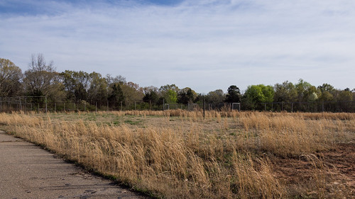
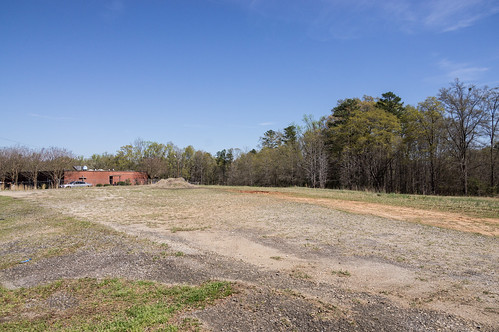
Now I'm going to temporarily jump forward to the return part of my trip, where I passed by this overgrown baseball field just outside of Switzer on US 221:
The baseball field itself doesn't interest me (sorry!), but what's just beyond it does.
A Civilian Conservation Corps camp, near Switzer, was located behind this baseball field in the mid-1930s until 1937 when the camp closed. The next year, this site was used
as a tuberculosis camp for underprivileged children.
This 1938 USGS topo map overlayed and made partially transparent in Google Earth shows better where the camp was:
Where the pitchers mound is now, there used to be a building. The camp road ran along the current tree line with the camp itself on the east side of the camp road.
The entrance was gated and locked, so I couldn't drive through. The gate isn't made to keep out people, so I could have easily gone through the gate, but the probably of finding any significant ruins back there are small. It was also getting rather late in the day. Perhaps some other time?
A 1982 story in the Spartanburg Herald-Journal explains some of the history of Switzer, including how the community got its name.
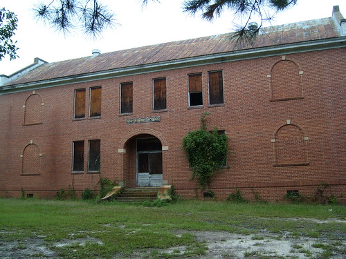
Returning to the southward part of the trip now, I traveled the few miles down to Woodruff where I visited the old Woodruff High School, now Woodruff City Hall, off East Hayne Street:
This school building was built in 1925, replacing another high school across the street, long since demolished. The school would became a junior high school in 1953, then an elementary school in the 1960s, before the city bought the building in 1978 to be used as a city hall. The school building
joined the National Register of Historic Places in 2006.
Woodruff High School is represented in the SC School Insurance database with
this photo of the left side:
I also stopped by the location of Northside School in Woodruff, but unfortunately the school has been demolished:
Fortunately, Flickr photographer Sean Green was here in 2007 when a school building stood here instead of empty space.
View the rest of his photos in his album
Abandoned School - Woodruff. Northside School was also in the SC School Insurance database:
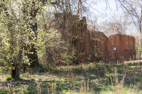
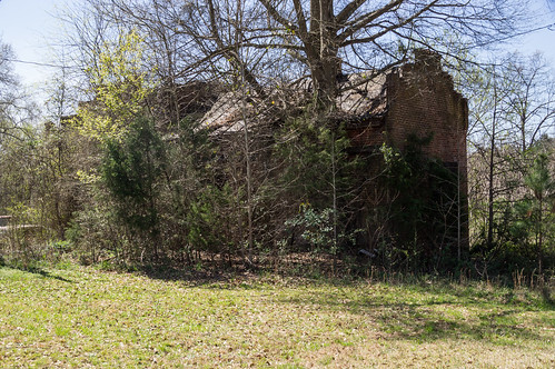
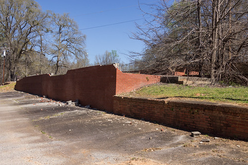
My next major stop was Hillsville, a ghost town a few miles south of Woodruff and just north of Enoree. From reading over
a 1981 story and
a 1983 story in the Spartanburg Herald-Journal, Hillsville began declining after the mill in Enoree opened in 1888. The crumbling buildings I found are all that are left. I didn't stray too far onto the property to avoid any potential unfriendly property owners, but I did manage to capture the few buildings left.
Here's the ruins of the pharmacy building:
and the rear of the bank building. I took this photo from the back of the Enoree Lodge property.
Behind this building is the railroad, where most of the remaining building ruins face.
Flickr photographer Sean Grean was also here a few years ago. Not only were fewer natural obstructions in his way back then, he was also much bolder about exploring the property than I was. His album is called
Hillsville SC on Flickr.
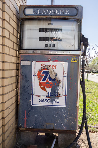
In Enoree, I stopped at a building with a lone gas pump, or should I say kerosene pump:
The price is $1.59 for the curious.
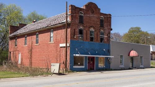
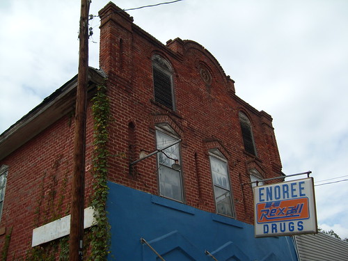
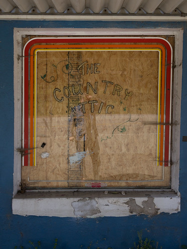
I also stopped by the old Enoree Drug Store building.
It's too bad I couldn't swing by a few years ago when the drug store sign was still up. Once again, I'm thankful to Sean Green for his photo from a few years ago:
The store is now closed, and it's most recent use appears to be as "The Country Attic":
I see a certain someone in the reflection. Reflection selfie?
I made my way into the residential area of Enoree to the location of an old school, off School St. (imagine that!). These ruins are all I found at coordinates I had:
I skipped over a few of the minor stops, but all trip photos are in
an album on Flickr and
an album on Google Photos as usual.
In
the next part, I'll cross over the bridge at Enoree into Laurens County and cover the trip from Lanford to Harris Springs.
Here's a map of the locations visited in this part:


Hi Mark. Are you still active? I was just recently going along the same route as you did in the post. Stopped at a few interesting spots, and some of the same ones. I love how you have the historical images as well.
ReplyDeleteI'm still around, but I don't have time to blog anymore.
DeleteAwesome blog. I look forward to going back through some of your stuff as I do my own travels in the area.
ReplyDelete