Waterfalls of the Clemson Experimental Forest

Todd Creek Falls - 9
I had taken some time off last week, and used one day to walk the Doodle Trail, and then the next day to chose explore some of the waterfalls of Pickens County, SC. My travels would take me back through Easley then through Liberty, Central, and Norris to two waterfalls in the Clemson Experimental Forest near Six Mile.

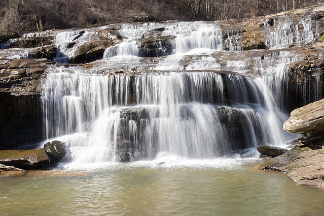
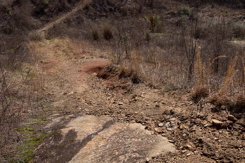
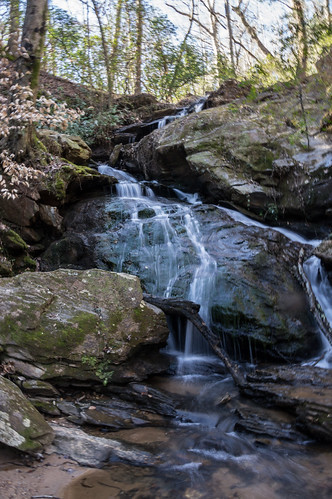
My first waterfall was Todd Creek Falls. The tiny parking area for the waterfall is on the east side of a bridge over Todd Creek on Brookbend Road. I estimate there's room for two cars here. Directly overhead are Duke Energy transmission lines.
Duke Energy power lines
The unmarked trailhead is directly across the road from the parking area. On the other side of the bridge is a dirt road, but with a large hole dug out to prevent motor vehicles from using it. You can reach the waterfall from this road, but it's far easier to stick with the trail.

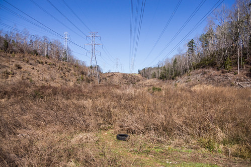
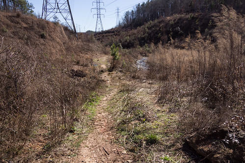
The trail is easy enough to follow for now, but in the summertime I imagine the vegetation would make following a bit harder. The power lines were a constant companion during my short journey.
Trail back to the car - 6
The trail mostly stays near the creek, requiring navigating through a rock ledge a short distance away from the waterfall.
Trail back to the car - 5
Then a descent down a side path back toward the creek.
Trail back to the car - 2
At the base of the waterfall is a swimming hole I'd like to perhaps visit again when it gets hot. I included the electrical towers in this photo:
Todd Creek Falls - 5
This one excludes the sky and the towers:
Todd Creek Falls - 6
A short distance down this same trail is this old spring I spotted on Panoramio.
Todd Creek Spring - 4
I also saw on Panoramio an old mill dam a bit further downstream, but I skipped it this time to ensure time to visit my next waterfall, Waldrop Stone Falls.

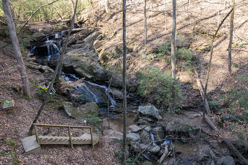
There are two ways to visit Waldrop Stone Falls, both off Waldrop Stone Road, only a short distance from Brookbend Road.

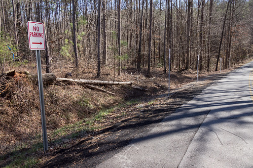
The first is to park by a service road right by the intersection with Madden Bridge Road. The road is gated, and there is room for about two cars to park by the road without blocking access to the road itself. When I went by, those two spots were filled, but I knew of another path a short distance down the road. No parking signs were posted by the alternative trailhead, so I parked a short distance away off the road where I assumed it was permitted.
No parking signs
According to this map at the trailhead, I'm probably taking the shorter route anyway.
Trail map
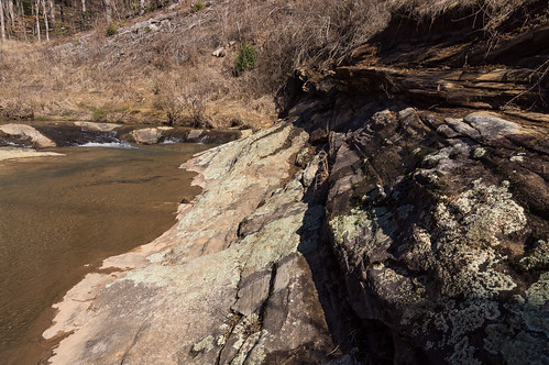
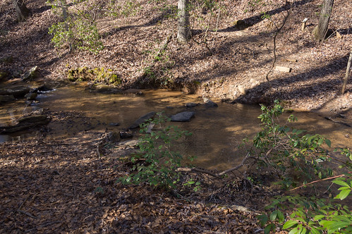
The trail is easy to follow, but does involve one creek crossing:
Waldrop Stone Falls Nature Trail - 5
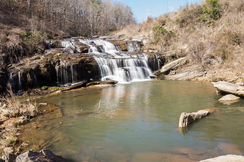
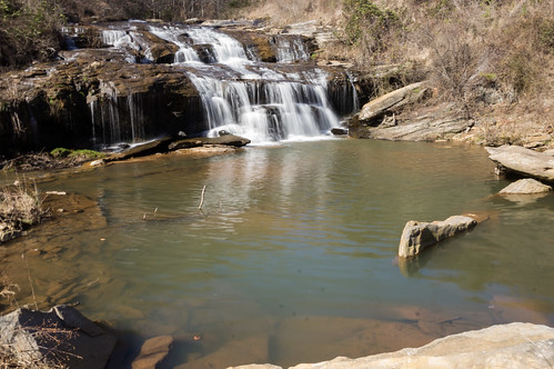
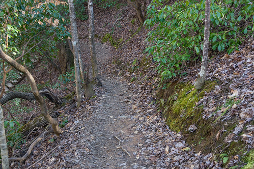
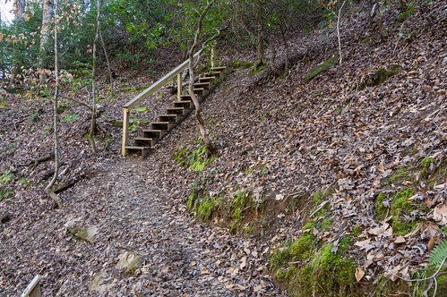
After that, a steep descent with switchbacks and stairs lead me to the waterfall.
Waldrop Stone Falls Nature Trail - 7 Waldrop Stone Falls Nature Trail - 9 Waldrop Stone Falls - 1
There wasn't much water flow today, the shadows were getting long, but I did the best I could to get something resembling a decent photo.
Waldrop Stone Falls - 2
Then it was back to the car and a long ride home back through the same towns I came through on the way over. I saw many buildings I wanted to stop and photograph, but couldn't if I wanted to keep my schedule. Perhaps another day?

Here's a map for Todd Creek Falls, the parking area, and the spring:

Update: Generate your own directions to the Todd Creek Falls trailhead from Google Maps or Bing Maps.

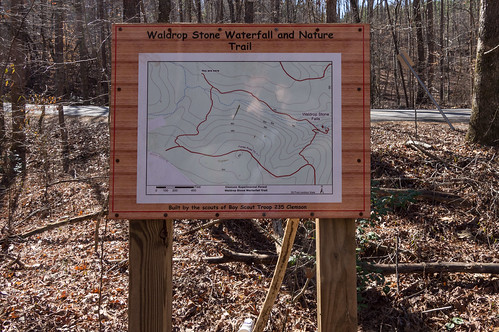
And a map for Waldrop Stone Falls:

Update: Generate your own directions to Waldrop Stone Falls trailhead #1 from Google Maps or Bing Maps, and directions to trailhead #2 from Google Maps or Bing Maps.

I've shared my photos to an album on Flickr and an album on Google Photos. I need to start taking more vacation time before I lose it, so chances are good I'll be off on more adventures very soon.

Comments

  1. Hey! This is my neck of the woods! Did you by chance record your milage? I'd like to check these out and like to know how much time to allow. hanks for posting!

    ReplyDelete
    Replies
    1. Todd Creek Falls: 11 minutes, Waldrop Stone Falls: about 25 minutes. I was moving rather slow that day, especially on the trail to Waldrop Stone Falls. Times are according to my GPX record of the trip.

      Delete

Post a Comment

Popular posts from this blog

A tour of Lake Summit

First visit to Andersonville Island

Forgotten Taylors railroad history: the P&N railroad