Rail trails, and the abandoned railroads they go over, have long been an interest of mine. Rail trails are easy to walk and easy to bicycle since railroad grades were designed to be as small as possible. The closest rail trail to me and most famous (and well trafficked) in this area is the
Swamp Rabbit Trail. Encouraged by the popularity of the Swamp Rabbit Trail, other rail trails have since been constructed in the area such as
Doodle Trail in Pickens County,
Lyman Rail Trail in Lyman, the
Mary Black Rail Trail in Spartanburg. I've visited all four of these rail trails before, and enjoyed them all. This time I chose to travel a bigger distance to visit a rail trail in Rutherford County, North Carolina in the process of being upgraded and expanded named the
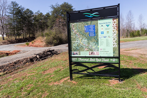
Thermal Belt Rail Trail.
The
Thermal Belt Rail Trail is a 7.8 mile rail trail located between Gilkey and Spindale in rural Rutherford County, North Carolina. The trail is currently in the process of being expanded southeast into Forest City to make a new total length of 13.5 miles. The name Thermal Belt Rail Trail is based on the railroad that operated this segment until abandonment in 2001, the
Thermal Belt Railway, whose name in turn is based on
a feature of the area's climate.
The Thermal Belt Rail Trail follows a path built by the
Charleston, Cincinatti, and Chicago Railroad, informally called the Triple C, between 1886 and 1889. That railroad went bankrupt, and after successor railroads also had financial problems the railroad would become part of the Southern Railway, predecessor to today's Norfolk Southern Railway.
By 1990, traffic had declined to the point where Norfolk Southern no longer wanted to keep the line in service. A group of shippers formed the Rutherford Railroad Development Corporation to keep the railroad going, and leased the line to a shortline operator that operated the railroad as Thermal Belt Railway.
In 2001, the Gilkey to Spindale section was abandoned due to lack of customers and converted in to a rail trail. The Spindale to Forest City section was recently abandoned in 2016, also due to lack of customers. This is the section being converted into an extension of the Thermal Belt Rail Trail to bring the total length up to 13.5 miles.
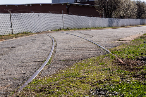
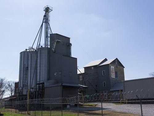
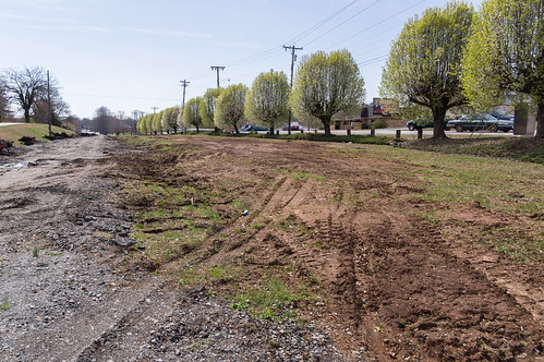
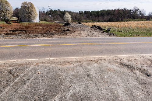
I parked in downtown Spindale where I could see right away how the upgrade was coming along.
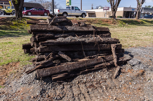
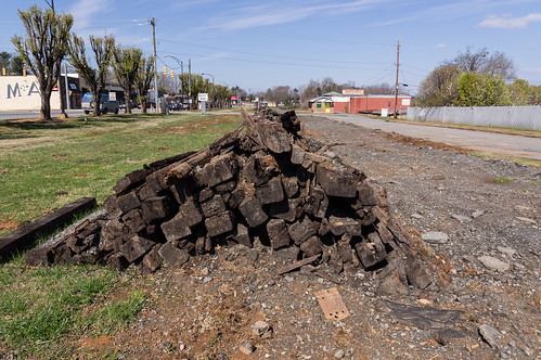
The trail
was closed from January 31 to February 9, 2018 while rails and crossties were removed. I actually had planned to visit the trail on January 31 until I found out about the closure only the day before. Paving is expected to begin in the next month or so. The trail will remain open until construction begins. I wish I could have made it while the rails were still in place, but it couldn't be helped.
The surface is no longer suitable for road bikes, but walking is no problem. Crossties are piled up along the side of the trail along its entire length.
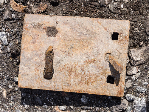
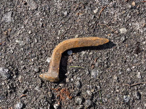
I also found plenty of railroad tie plates and several railroad nails.
In the parking area, I found some rail from a spur leading to a mill.
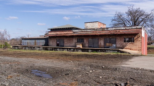
On my way out of Spindale toward Ruth, I passed by several old buildings. After I got home, I found out this is the Edwards Brothers building.
Next time, I must make sure to take a photo of the other side of the building.
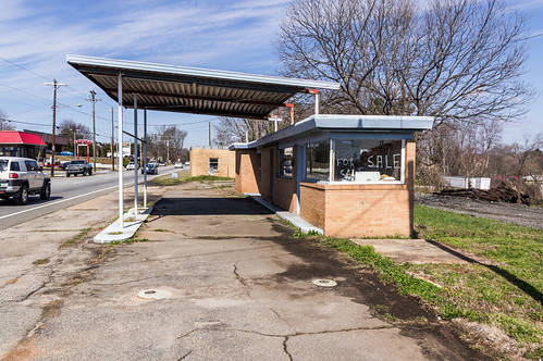
This business was a used car lot a few months ago, but the place is for sale now.
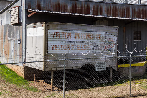
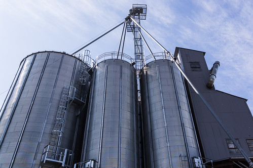
This corn mill, formerly Yelton Milling Company, is now known as
Lakeside Mills.
The mill was making plenty of motorized whirring noises doing whatever it needs to do when I walked by.
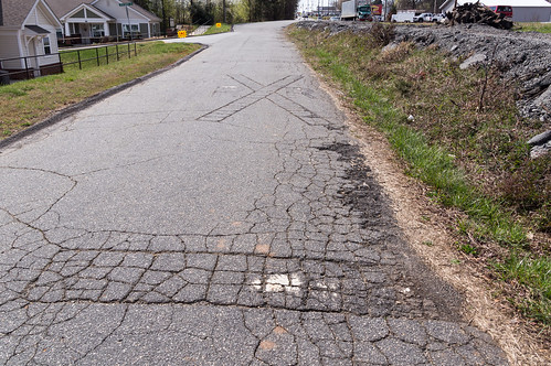
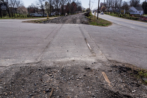
Walking on the trail by Sims Street near the town of Ruth, I noticed this railroad crossing that seems to have become part of the pavement:
A short distance further on, I spotted this old millstone in somebody's front yard. I wonder which grist mill this millstone came from?
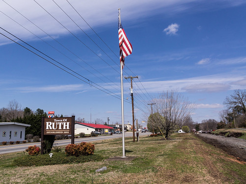
Then I passed into the town of Ruth.
I found a flat area by the railroad where I guessed a depot could have been.
A check of an old aerial does show two buildings here, and I would presume one was the depot.
Update: I found a Sanborn map of Rutherfordton that covers Ruth and shows the locations of the passenger and freight depots where I thought they were:
This poor old railroad signal sits by itself with nothing to do:
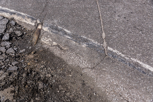
I turned around at the intersection with U.S. 64. I didn't see much of interest on my map north of here until Gilkey. As I walked back, I kept a lookout at road crossings for leftover rail embedded in the asphalt. I found a few, but not as many as I expected:
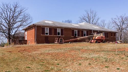
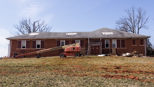
I walked back to my car, then drove up to Ruth School. I was pleasantly surprised to find it in the process of being renovated. I stayed a far enough away to stay out of the construction zone.
Ruth School was built in 1926, and opened to students in 1928. A
historical architectural survey report of schools in Rutherford County and other neighboring counties notes two additions made in 1951 and 1960:
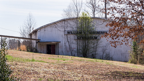
The Rutherford County Board of Education expanded the campus over the next decade with the construction of the 1951 kitchen, cafeteria, and four-classroom annex designed by Shelby architect and engineer V. W. Breeze. Mayberry Gymnasium, erected in 1960, was named in honor of principal William V. Mayberry. Ruth Elementary School operated until its 2001 consolidation with Mt. Vernon Elementary Schools at a newly-constructed campus. Deferred maintenance has resulted in extensive water damage in the 1951 annex.
The school closed in 2001, but remained as an alternative school until 2003.
The 1951 annex has been torn down due to its poor condition, but the Mayberry Gymnasium remains.
Exactly what is to be done with Ruth School is
currently an open question.
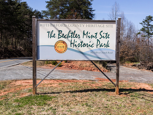
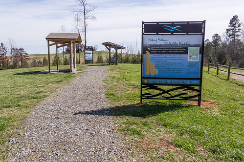
Next I made the short trip up to the
Bechtler Mint Site Historic Park near Gilkey.
The park also serves as a northern trailhead for the Thermal Belt Rail Trail.
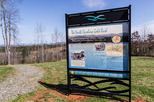
The park has some short loop trails that wind their way around the small park. Along the way, signs provide interesting information about the mint and its owner
Christoper Bechtler.
Christopher Bechtler, along with members of his family, emigrated to America in 1829. Bechtler would soon settle in Rutherfordton, North Carolina in 1830 as a watchmaker. But it would be gold that made him famous and a part of
the history of gold mining in Western North Carolina.
In 1831 he began assaying gold, and minting $2.50 and $5 gold coins at his private mint
with equipment made just for the mint.
In 1832, Bechtler began producing $1 gold coins.
Christopher Bechtler continued his gold operation until his death in 1842 (or 1843 depending on the source), and the mint continued operating until ending sometime in the late 1840s or early 1850s (again, depending on the source).
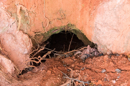
The mine entrance is secured by a gate.
The mine is mostly closed up now thanks to the effects of time, but a small hole is still visible.
I walked around a bit more, before joining the rail trail one more time. I walked a bit north, then back south toward a mill, passing under a bridge along the way. I could see where a spur once led to the mill.
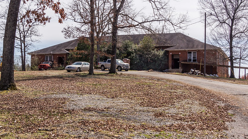
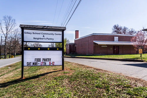
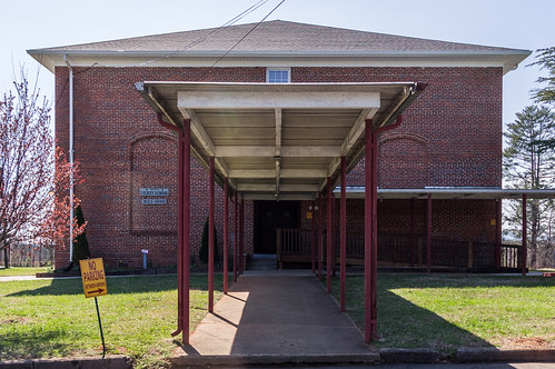
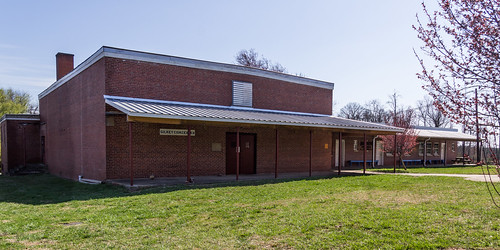
Then it was on the Gilkey, and the Gilkey School Community Center, once Gilkey School.
Gilkey School was built in 1923, operating as a school until 1999.
I managed to snap a photo of the inside from one of the door windows. I love the wood floors!
An annex, built in 1953, contained the heating plant, gymnatorium, and some classrooms.
On the same grounds is the Gilkey Community Club, built in 1952 to host school and other events.
I always like it when old buildings, especially old schools, can find a new use like Gilkey School. I hope the same happens with Ruth School.
I thought I might have time to explore the other half of the trail from Spindale to Forest City, but I just didn't have the time. I do plan to come back at some indefinite time in the future to see what the new trail improvements look like, and explore down to Forest City like I wanted this time.
My photos from this trip are available in
an album on Flickr, or you can go through them below:


Comments
Post a Comment