I had taken my inflatable kayak down to Lake Hartwell for a paddle over to Andersonville Island one day last week, but when I unpacked my car
at the Double Springs Access Area I found I had left behind one very important item. An item one simply must bring when you have an inflatable kayak: an air pump! No air pump, no kayak trip! I had loaded my car the night before and apparently I forgot to add in the pump. Rather than head back home with nothing to share after all those the miles traveled, I consulted
my list of historical POIs and quickly improvised a new plan.
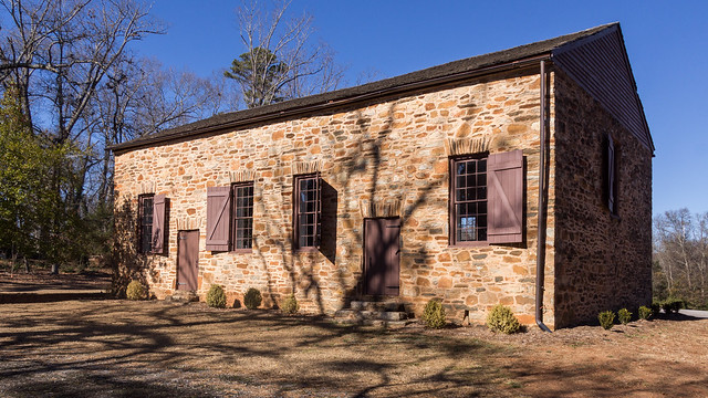
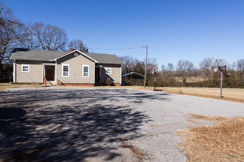
Double Springs Community Park
Double Springs Community Park is a short distance away from the Double Springs Access Area
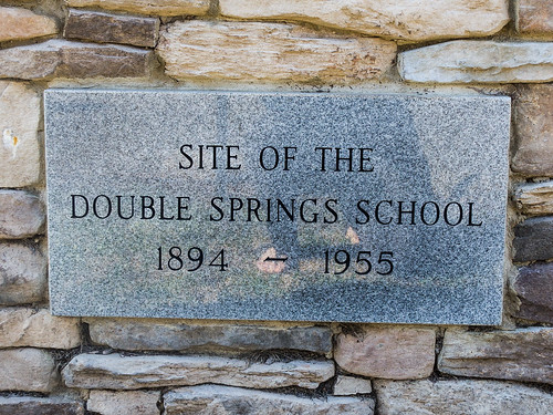
at the intersection of Double Springs Road and Hattons Ford Road. Double Springs School operated here from 1894 until 1955.
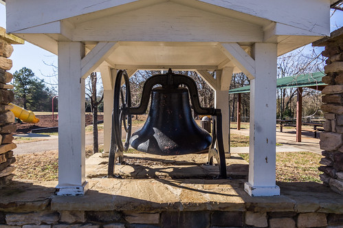
Aerial photos suggest the building, large wooden multi-teacher building, stood here until the mid 1990s, when the building was torn down and a park built on the old school land. The building stood where the baseball field is now. What interested me the most was the school bell. I wish now I had spent more time checking it out.
I do expect to be back to attempt my Andersonville Island trip once again, and perhaps I'll have the time to drop by for a more thorough look.
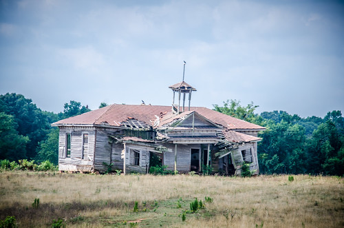
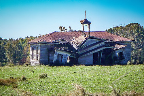
Shiloh School
Shiloh School, or more accurately what's left of it, is located in the Holland Store community
near the intersection of U.S. 29 and S.C. 412 (Rainey Road). The school building, replacing an earlier one, was built in 1885 according to this July 1885 clipping from
The Intelligencer:
Of the photos of Shiloh School I found on Flickr, I chose two of my friend
Tom Taylor's photos from two of his recent visits to Shiloh School to illustrate the rapid decay of the old school. The first one was taken in July 2014:
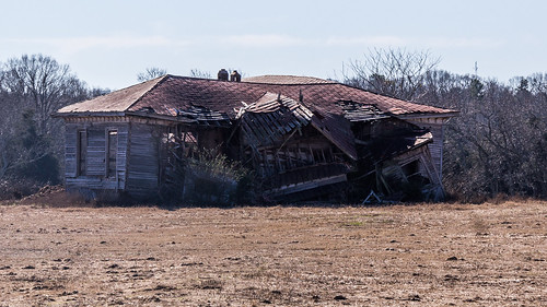
The second one from October 2015 shows the front roof collapsing:
In my January 2018 photo, the front part of the building, including the bell tower, has completely collapsed:
I didn't stray beyond the barbed wire fence and gate, but you can see others that did, along with a short history of the school, from the South Carolina Picture Project's
page about the school.
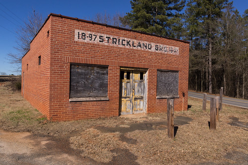
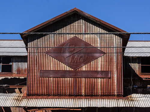
Strickland Grocery
Strickland Grocery is
at the intersection of S.C. 412 (Rainey Road) and S.C. 187, a short distance away from Shiloh School. As the store building itself indicates, Strickland Grocery operated from 1897 to 1947.
But before that, the building served as general mercantile according to
a page about Starr at the South Carolina Picture Project.
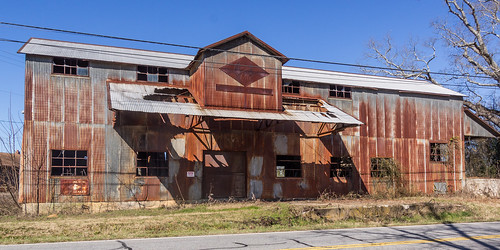
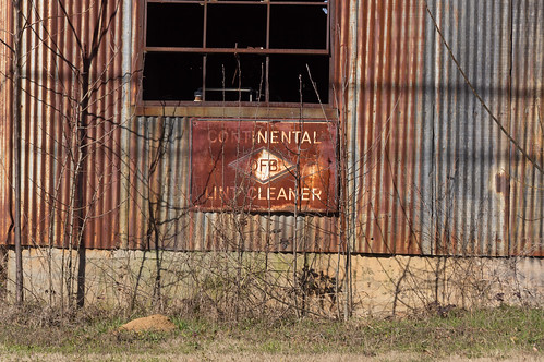
Center Rock Gin
I headed back north to visit the Center Rock Gin,
located at the intersection of Dobbins Bridge Road and New Hope Road in the Center Rock community, in earlier times known as the Rock Mills community.
My internet research found no history of the gin. An aerial view from 1959 shows the gin was standing then. Property records do show a
William Major Bolt owned the .554 acres of property during this time period, but the property deed suggests the gin may possibly have been there years before then.
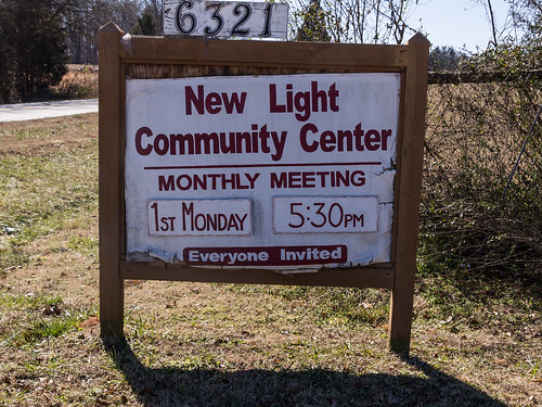
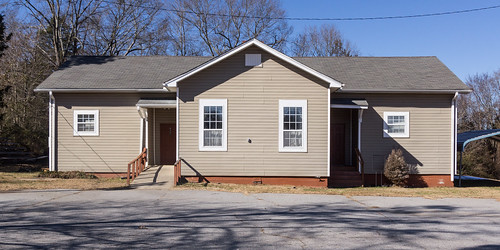
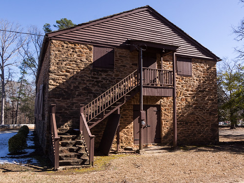
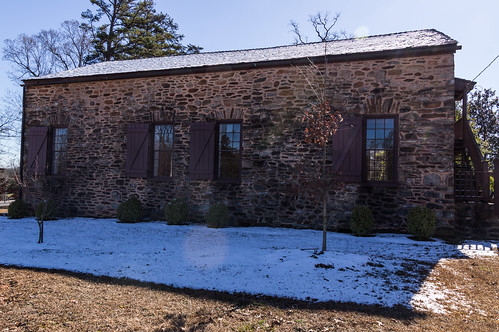
New Light Community Center
Still continuing north, I stopped at the New Light Community Center in the New Light community
off S.C. 187.
What drew me here is the building's history as a school. The
State Historic Preservation Office's
directory of Anderson County Rosenwald schools lists this school building as a two teacher school built between 1929-1930.
Old school buildings are rare these days, Rosenwald schools even rarer, and well preserved Rosenwald schools are rarer still. I'm pleased to see this building remaining in such good shape and that it's found another use.
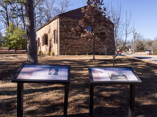
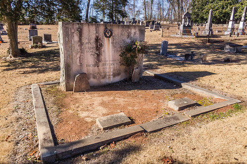
Old Stone Church and Cemetery
My last stop of the day was
Old Stone Church, as its known as today, and the adjoining cemetery, now located
inside the city of Clemson in Pickens County.
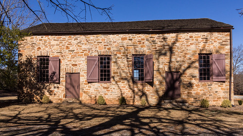
The Old Stone Church, known early on as Hopewell Presbyterian Church, Hopewell Meeting House, Stone Church, among others I've found, was built out of flagstone between 1797 and 1802 by John Rusk, now buried in the nearby cemetery. The church replaced a nearby log meeting house that had burned.
Regular services continued here until about the mid or late 1820s when the congregation shifted to a new Presbyterian church was built in nearby Pendelton. According to the 1903 book,
The Old Stone Church, Oconee County, South Carolina, a movement began in 1893 to begin repairing and maintaining the church and cemetery. That movement culminated that same year in the formation of "The Old Stone Church Cemetery and Improvement Association", now more simply named
The Old Stone Church Commission.
On the sun lit side of the church...
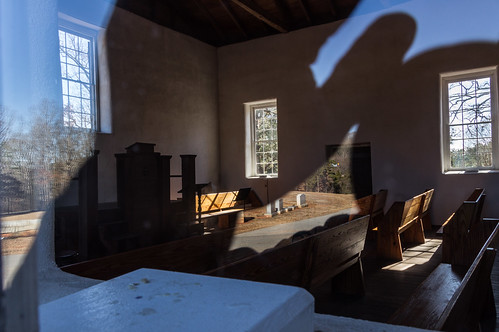
I tried to look inside, but the sun didn't want to play nice.
The glare did make it unintentionally seem like a few tombstones were inside.
In back, stairs led to the slave gallery.
On the shaded side, some leftover snow from a recent winter storm remained.
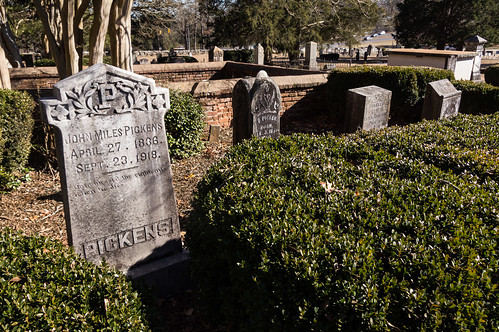
I ventured out into the cemetery. Maps are available, but I didn't pick one up for some reason.
Among the graves that piqued my interest, I found the grave of John Rusk, the builder of Old Stone Church.
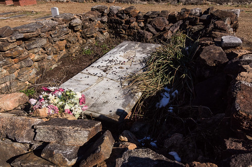
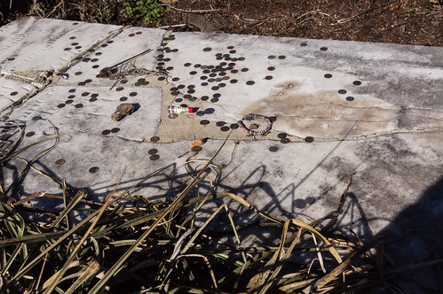
I also was intrigued by the grave of Eliza Huger. Why were people tossing coins and other objects on to this grave?
Apparently the legend is that Eliza Huger, a member of a prominent Charleston family, ran away from home and fled to New Orleans. Two of her brothers followed her to New Orleans where they found her in the act of prostituting herself with a client, and promptly shot her dead. No church would allow her to be buried in their cemetery. Old Stone Church finally agreed only on condition a stone wall was built around her grave to keep her sin within. This plot seems paper thin, but on the other hand I did
find some members of the Huger family buried in Charleston County on
Find A Grave so someone at least made the story somewhat plausible.
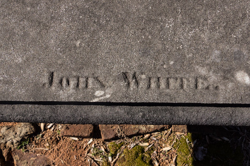
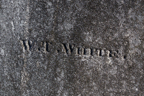
Other gravestones that piqued my interest were "
signatures stones" where the carver signed the gravestone. I found the names John White,
his relation W. T. White,
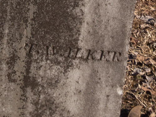
T. Walker,
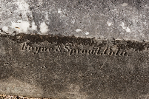
Boyne and Sproul,
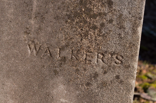
and Walker's.
Two other tombstones stood out to me. I found out later this one is laser etched, the lastest and greatest thing:
This one is also etched, but with color painted in:
I do have to wonder how long the color will last?
One of the more notable "residents" of the cemetery is
Andrew Pickens, the Revolutionary War general and early officer of the church. I didn't come across his grave, but my goodness I must have been very, very close:
Wrapup
I enjoyed my improvised trip very much. I hope to return again for my paddle back to Andersonville Island in the next few weeks, and perhaps take a closer look at the school bell. This time with an air pump!
I took far more photos than I've shared here, but they're all in
an album on Flickr, or you can go through them below:

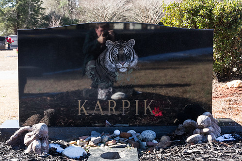


The etched tiger marker is for Chris Karpik who died as a very young man (early 20s) in a boating accident on Hartwell about 15yr ago. I went to the same elementary school as him a year or two removed.
ReplyDelete