The day after
hiking to Hospital Rock, I paid a visit to Lyman
in western Spartanburg County to explore some of town's mill history. Since
my previous trips to Lyman, I've gained more tidbits of Lyman history thanks to the informative members of the Facebook group
Days At Pacific Mills A Lyman Group. Lyman, unlike some other mill towns in the area, is doing well with a residential area full of well maintained homes, and a small but vibrant. From reading over posts in the group, I found several points of historical interest to visit.
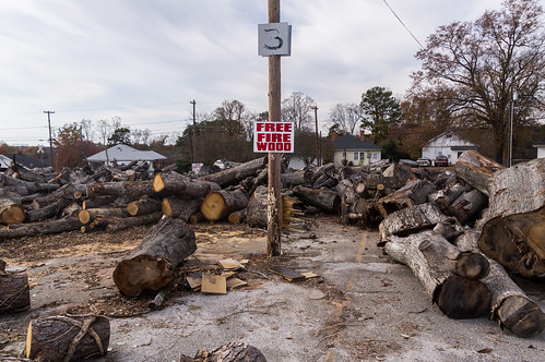
I parked in the large parking lot once belonging to the now demolished Lyman Mill across the street. The town of Lyman bought the parking lot, and uses a small part of it as a recycling center, and another part is where free firewood is available.
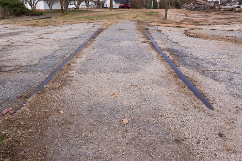
Along the edge of the parking lot is a long abandoned railroad spur. Part of the spur's right-of-way
has recently become the
Lyman Rail Trail. This section should become part of the rail trail once plans and financing received.
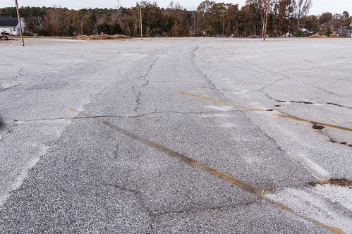
Another section of the abandoned rail spur through the parking lot has long been paved over.
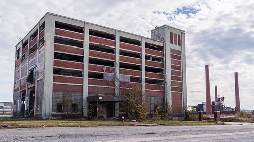
The old mill office building still stands across the street. The old boiler section of the mill still stands off Little Street.
The older part of the mill was
demolished a few years ago, but the newer part, built over the Lyman Mill's baseball field, is currently home to
American Foam and Fabric.
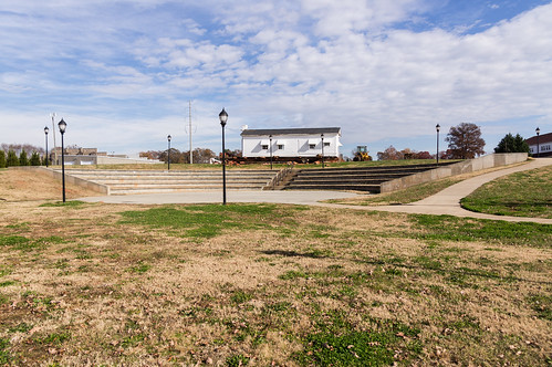
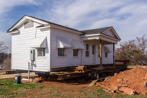
Over in Lyman Park, the building that was once the town's first library is in the process of being moved a short distance away to make room for more improvements to the park.
The new site is still in the process of being graded, so for now the building sits on some beams.
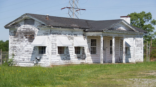
The building certainly looks much better than it did back in 2012 when I first visited Lyman:
According to members of the
Days at Pacific Mills group,
this photo in the Spartanburg County Library's Digital Collection is the first known photograph of the building:
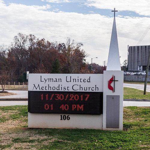
I had already loaded my points of interest on to my phone, so all I had to do was make my way to the points on my map. I headed over to the Lyman's Methodist Church to visit my first target, the church's cabin.
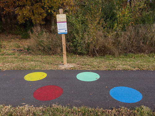
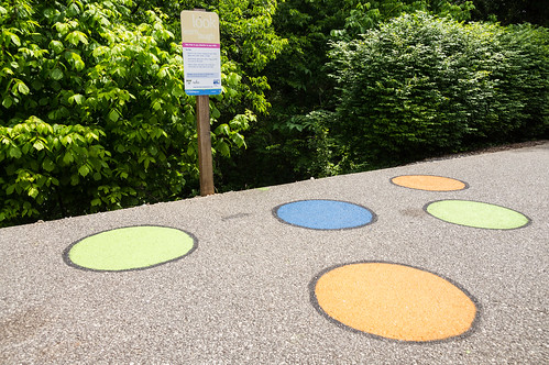
But first I just had to follow the church's asphalt walking path. Scattered along the path were some educational displays for families I thought maybe I had seen someplace else.
Turns out I was right (it does happen on occasion!). Displays similar to these can be found along the
Mary Black Rail Trail in Spartanburg:
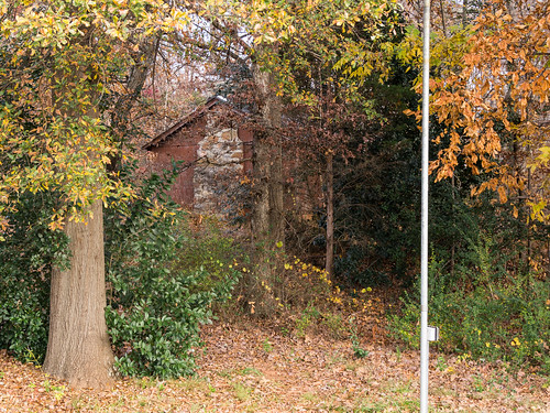
The cabin I was looking for is right by the church. But I could see school was in session so I stayed away to avoid disturbing them. I did take this photo to have something to show for my trouble:
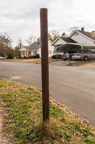
Over on Ridge Road, I found two property survey markers. The first one I found is near the Baptist church:
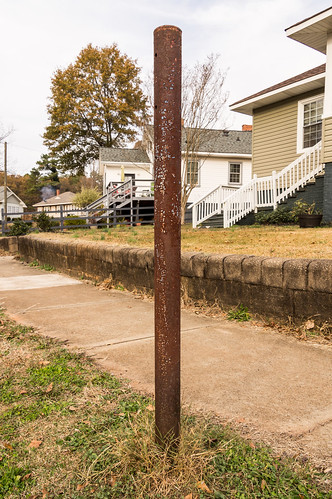
The second one is a bit further south on the opposite side of the road:
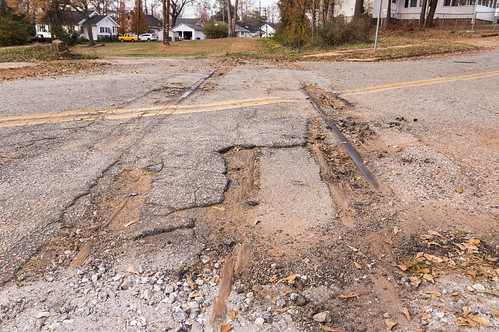
Over on Piedmont Street, I found abandoned rail that once connected the Southern Railway with the Piedmont and Northern Railway.
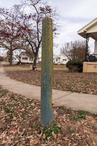
I looked for a post for a
mail drop at the corner of Pacific Street and Little Street. The mail drop post was visible in Google Street View, but the mail drop post was gone when I walked by. The sidewalk looks very much like it was recently redone. My guess is the post was removed during the process of redoing the sidewalk.
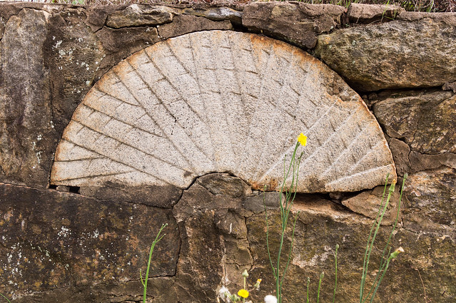
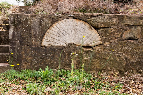
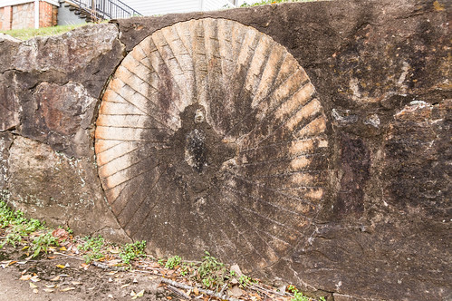
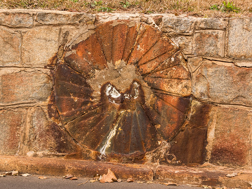
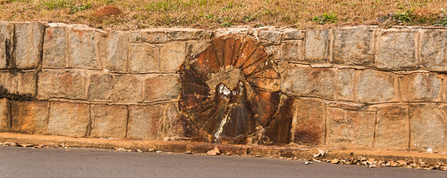
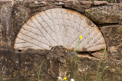
On Upland Street I found two half millstones and one complete one, all three embedded in a stone wall along the street. Here's the first one I encountered:
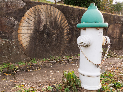
The second one I encountered is the complete millstone.
A fire hydrant made getting a straight on shot impossible though.
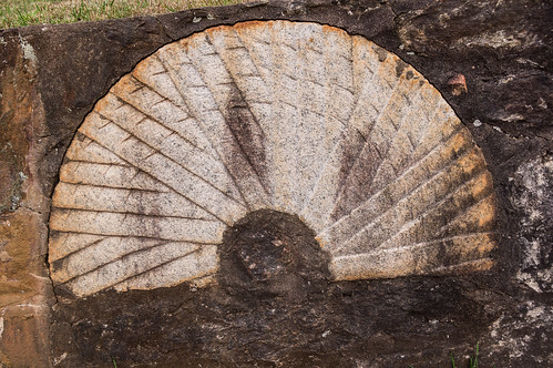
The third and last one on Upland Street is other half millstone.
I'd love the know where these millstones came from and why they were embedded in the stone wall, but I suspect this mystery will never be solved.
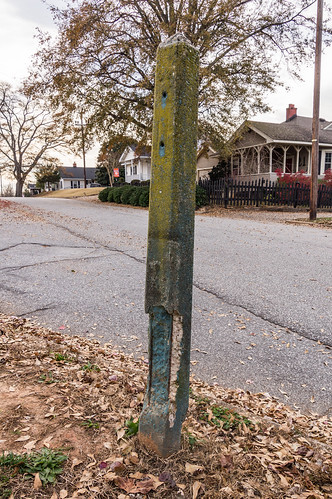
At the corner of Lawrence Street and Crescent Street I found what's left of a post for a mail drop.
Continuing down Lawrence Street, I found a fourth millstone. This one was also embedded in a stone wall:
This millstone looks a bit angry from a distance:
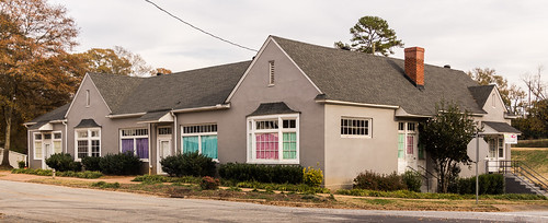
At the corner of Lawrence Street and Station Street is the former company store, now an
after school kids center.
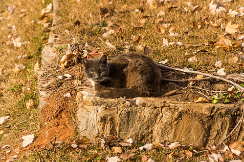
Continuing down Lawrence Street toward Crest Street, I spotted this bi-color kitty relaxing near the road in someone's yard.
I found a second post for a mail drop box at the corner of Lawrence Street and Crest Street.
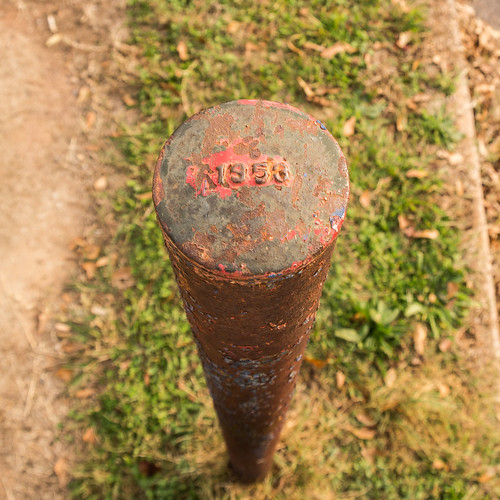
This one is a bit different with a date stamped on the top.
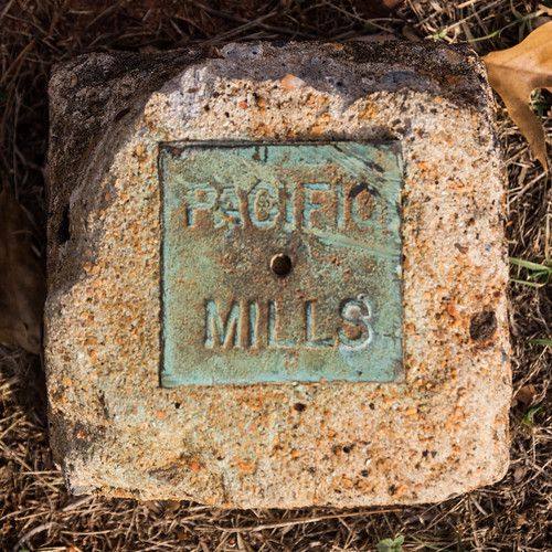
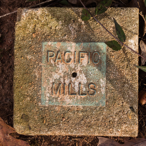
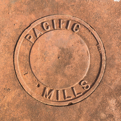
At the corner of Spartanburg Road and Community Street, I found a reminder of the original owners of the Lyman Mill.
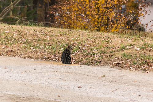
Back in the parking lot, I saw this tabby kitty near the edge of the parking lot. This one seemed rather wary so this time I kept my distance.
Adjacent to the Middle Tyger Library off Groce Road is
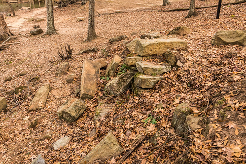
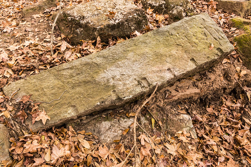
River Place Park. In the park near the Middle Tyger River is a pile of rocks,
as described in a video by resident Rick Hellams, that were once part of a mill.
This rock has some highly visible man-made cuts:
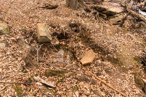
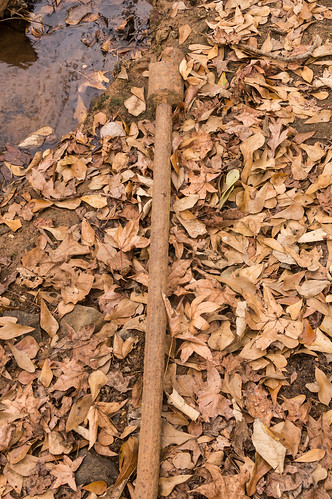
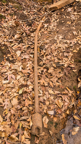
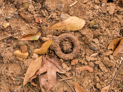
Near the water I found the waterwheel axle Rick Hellams found:
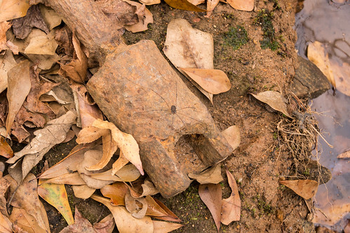
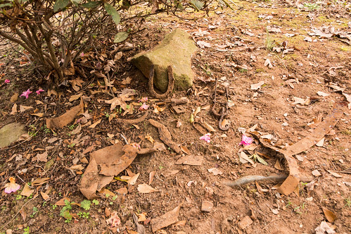
Rick found some artifacts uncovered by the heavy rains from Hurricane Irma. I found a few myself. Here's one of them:
I also found the horseshoe from the video
he posted:
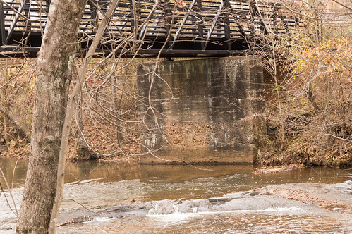
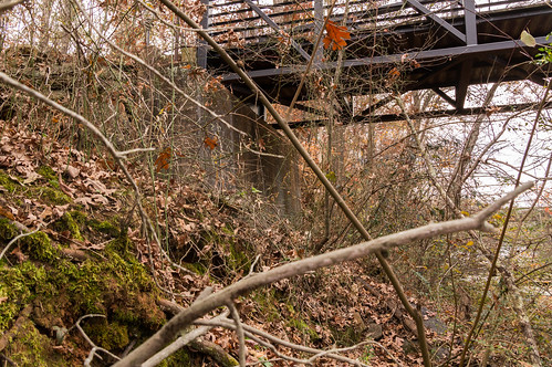
River Place Trail begins at Groce Road and follows the old pre-1955 alignment of Groce Road. The old alignment had a truss bridge over the river while the new alignment has a concrete bridge.
The pedestrian bridge over the Middle Tyger River reuses the old bridge abutments left in place after the 1955 realignment:
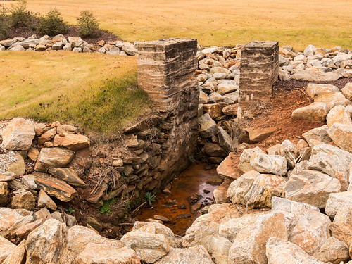
Where the trail meets back up with the road the remnants of a grist mill are clearly visible on the other side of Groce Road. The remnants, mounts for a waterwheel, are just off the road at a water treatment plant for the
Startex-Jackson-Wellford-Duncan Water District.
I found all my targets except that one mail drop post. I had an interesting time looking around at the improvements that have been made since my last visit. I look forward to coming back to Lyman sometime to explore more of Lyman's history and check out what else has changed. Thanks to the members of the Facebook group
Days At Pacific Mills A Lyman Group for their sharing their knowledge!
My
album from this trip is available on Flickr or you can also scroll through them below:


The mill wheels / fragments embedded in the wall are an interesting way to reuse and preserve an old mill wheel.
ReplyDeleteMark - have you explored an area off of Gap Creek Rd just north of Duncan - an old spur comes across the rd in front of the LKQ auto parts and dead-ends into the forest. There is a Duke Power substation on the property now, however, if you venture off into woods where the spur used to run, you can find ruins of a drag scrapper system, old dam, pump valves, lots of old brick, etc. Im assuming it was a coal fire power plant maybe but cant find any record of the place. If youre familiar, would love to get your take on it.
ReplyDeleteI know of that area, and the spur, but I've never explored there. I've heard there was a coal fired power plant there, and the property has been owned by Duke since the early 1920s. This PDF document on page 5 gives an overview of the substation's history, and confirms there was a power plant there that was decommissioned in the 1960s:
Deletehttps://cdn.selinc.com/assets/Literature/Publications/Technical%20Papers/6169_DropInControl_DA_20041019_Web.pdf?v=20170327-062930
Awesome, thanks!
Delete