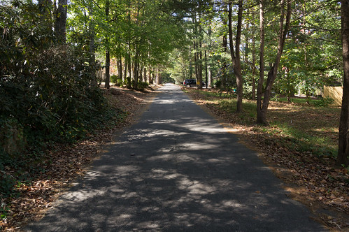
Every October I like to head up to North Carolina, buy some apples, then do some exploring. This year I decided I wanted to head west of Hendersonville, and the town of Laurel Park seemed like an intriguing place to explore.
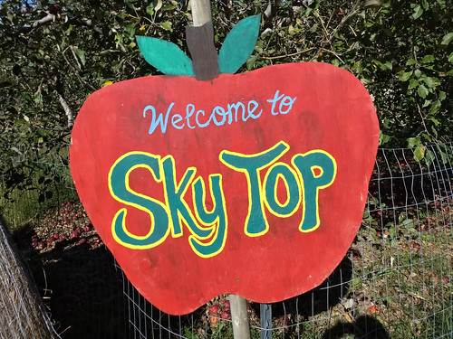
Sky Top Orchard
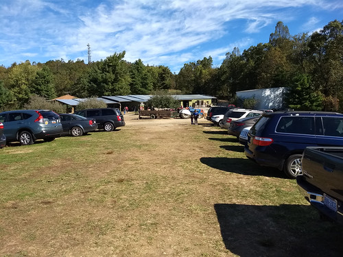
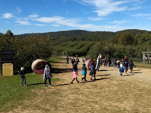
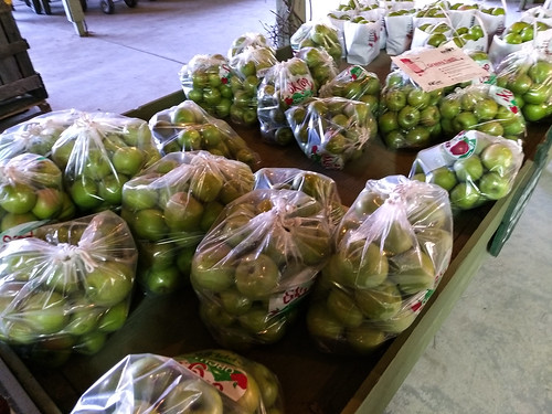
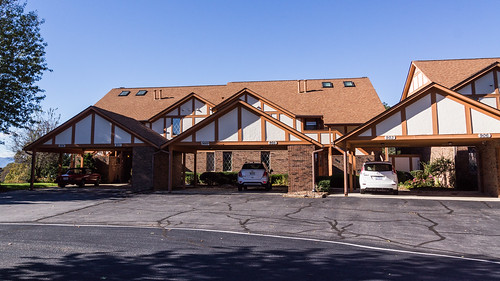
Sky Top Orchard, on Pinnacle Mountain near Zirconia, was along the way to Laurel Park so I stopped here rather than seek out the many orchards east of Hendersonville along US 64. I had hoped the orchard wouldn't be too crowded since it was a weekday.
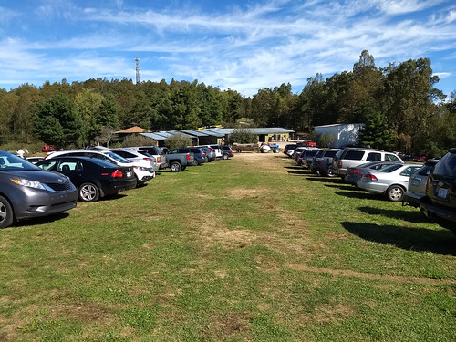
Wishful thinking! The parking area in front were full so I had to park in the overflow area.
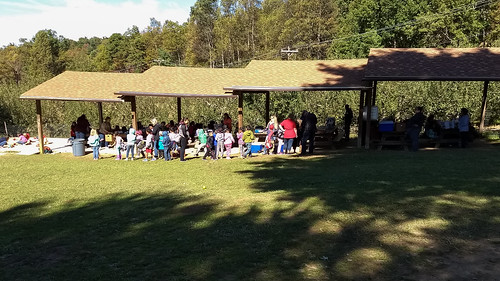
Several school buses from South Carolina, North Carolina, and Tennessee were parked out front. School children were busy playing, eating, and touring the orchard.
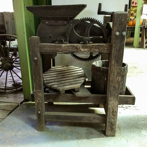
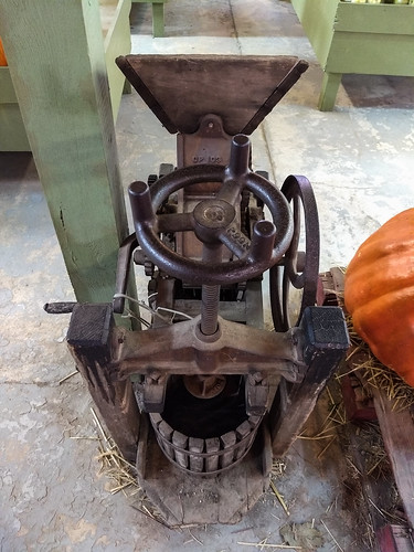
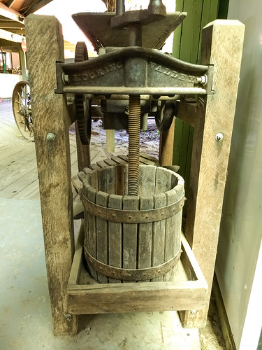
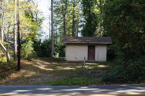
Inside the shed I admired their antique apple cider press machines on display.
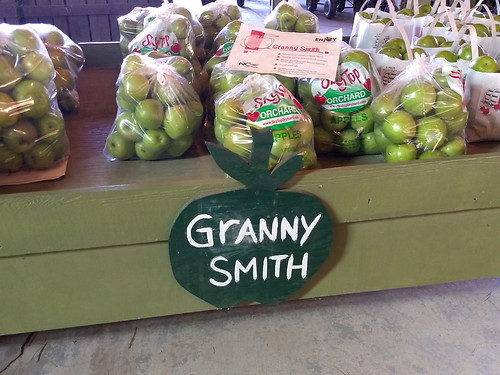
I selected a half bushel of Granny Smith apples (my favorite!) and paid the cashier .
When I made it back out to the overflow parking area, I noticed even more people had arrived while I was away.
Laurel Park
W. A. Smith (
1858-1922), along with his partners Columbus Pace (
1845-1925) and James Waldrop (
1825-1907), began developing Laurel Park as a summer tourist and entertainment destination for Floridians in 1888. In September 1905, a rail line began operating between today's Fifth Avenue West and Laurel Park to help increase access to the many entertainment options that Smith had been busy adding. Smith remained involved in developing Laurel Park until a few months before his death on October 22, 1922:
Laurel Park's era as a summer tourist destination would end in the mid 1920s when the
land speculation bubble in Florida began bursting in 1925. With the flow of money from Florida investors dwindling, Laurel Park's economy faltered. Laurel Park would begin its transition away from being just a tourist destination by
becoming a town in 1925. Currently, Laurel Park is looking
at US 64 for future development.
Below are the places in town I explored.
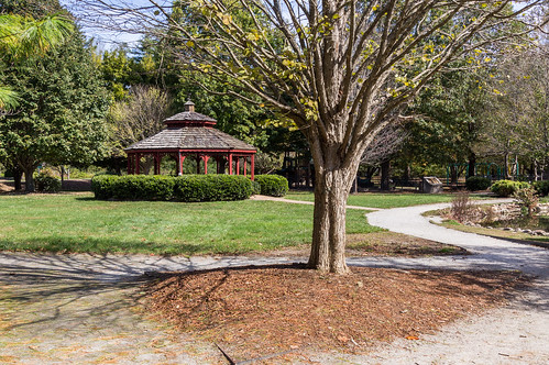
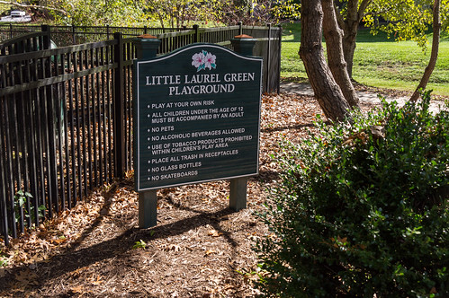
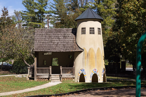
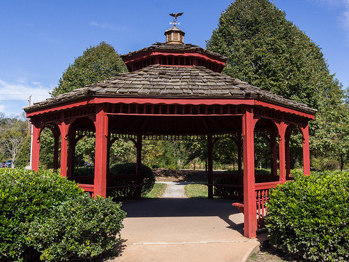
Laurel Green Park
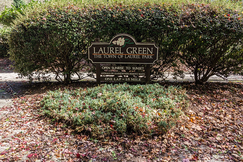
My first stop was
Laurel Green Park, built in the late 1990s, is located across the street from the Laurel Park townhall on White Pine Drive.
Inside the park are three circular walking areas, a playground (added in 2003), and a gazebo.
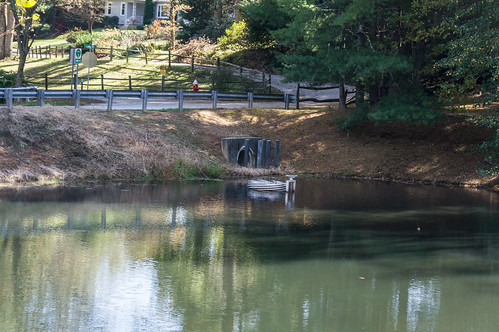
Rainbow Lake
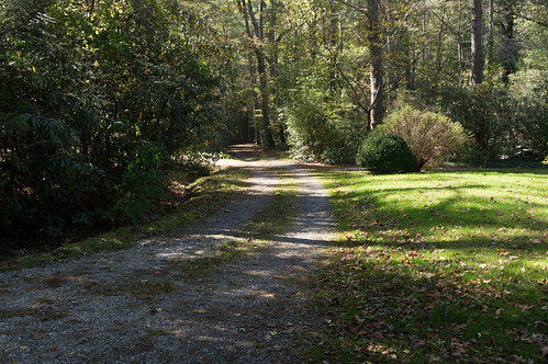
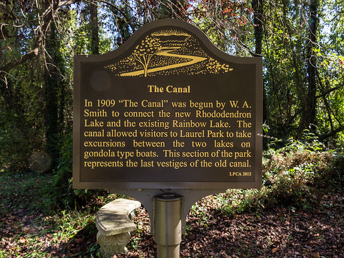
I walked down Canal Road toward Rainbow Lake.
Rainbow Lake was the first of two lakes built by W. A. Smith, the other being Rhododendron Lake a short distance away. A canal was built between the two lakes in 1909 when Rhododendron Lake was made.
The lake was once home to a dance pavilion and a casino. Today the lake is in private ownership and off limits.
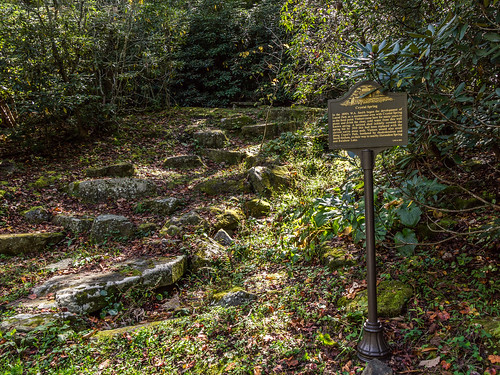
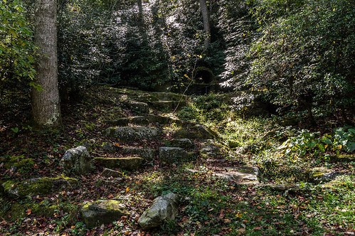
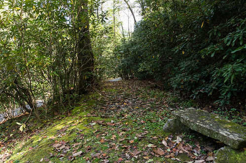
I walked down Crystal Spring Road and in a few minutes reached the spring.
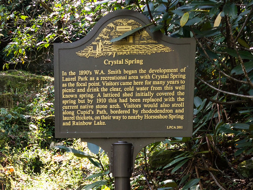
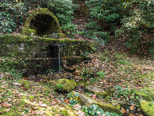
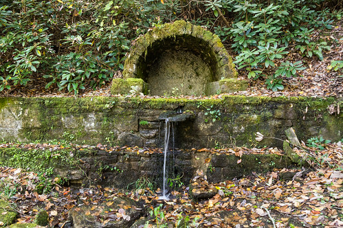
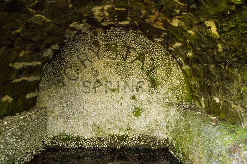
Crystal Spring
Crystal Spring (also once called Crystal Springs) once was a star attraction in the early days of Laurel Park.
A prominent historical marker sits by a short path leading to the spring.
The short path is rather rocky but easily manageable.
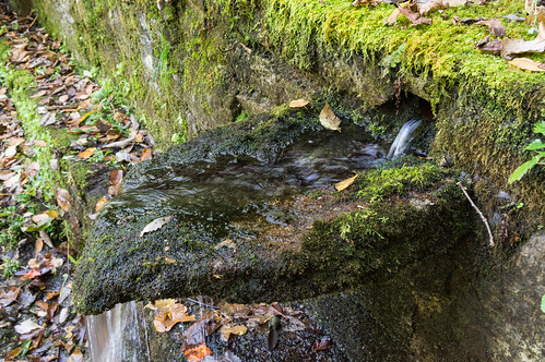
The spring is rather mossy, and contains water I wouldn't want to drink, but does look to still be in good shape:
The remnants of Cupid's Path, also called Lover's Lane, run by the spring.
This
old postcard in the North Carolina Postcards digital collection shows what the spring looked like back in the day:
This other postcard in the same collection shows some steps immediately to the left of the spring leading up and then to the right behind the spring.
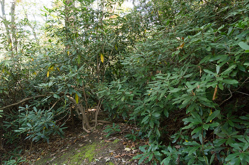
I did happen to head up that very way, but didn't spot an on obvious path until I got a bit further up the hill where I did find a partially overgrown path.
I wish I had to the time to investigate this path more thoroughly. Something to check out next time!
Railroad Drive
In 1904, W. A. Smith chartered a stream powered trolley railroad between what is now Fifth Avenue West and Rainbow Lake that began operating in 1905.
The railway was officially named the Laurel Park Railway, but was commonly known as the "Dummy Line" because the locomotive had to run backwards out of Laurel Park because the locomotive had no place to turn around.
This postcard, also from the North Carolina Postcards Collection, shows what the "dummy" looked like:
The line would later be extended to make a loop around a fountain below Rhododendron Lake during the late 1912/early 1913 off season while the railway was being electrified.
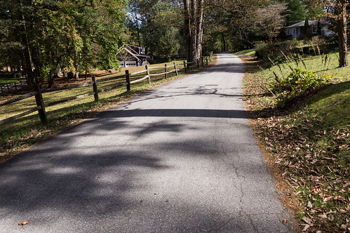
I carefully made my way down Laurel Park Highway down to Railroad Drive, built on top of the old railroad right of way. Across the street is where the old right of way continued (and a small strip is still shown on the county's GIS map) toward Rhododendron Lake.
The trolley ceased operating after the 1917 summer season, and the tracks were torn out in 1921.
Although one piece of the old railway was unearthed
during road construction in 2012.
A bus line took the place of the electric trolley by 1919:
Searching for the Canal
I walked down Lake Drive toward Rhododendron Lake where the old canal once ran beside the road. I tried to find signs of the canal...
...even though I didn't expect to find anything.
This newspaper clipping from 1922 explains when the canal was filled, Lake Drive was widened over the old canal to make more room for cars.
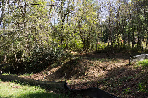
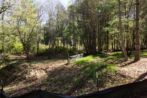
Rhododendron Lake Park
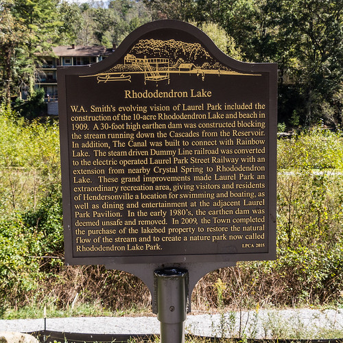
Rhododendron Lake was built in 1909 by W. A. Smith along with a canal connecting the lake to its sister Rainbow Lake.
Today, the lake is also known as Laurel Park Lake. A movie theater and music performances drew people here in the 1920s. The lake was also popular as a swimming hole until the 1980s when its earthen dam was determined to be unsafe. The lake had to drawn down, reducing its area from nine acres to one.
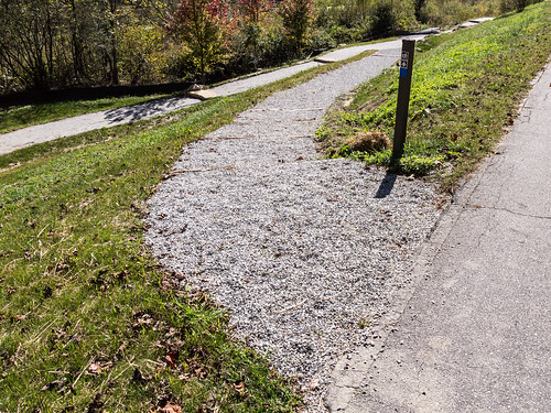
The town is currently building
Rhododendron Lake Park, now in its
final phase of construction.
While the park was expected to be completed by Labor Day, it doesn't appear to be finished yet.
Swiss Railway
On Smith Drive just off the north end of a sharp right turn on Smith Drive is a historical marker for the Swiss Railway (also known as the Swiss Incline Railway).
W. A. Smith made plans in 1907 to build the Swiss Railway (or Swiss Inclined Railway), but it didn't become operational until 1910.
The railway consisted of a counterbalanced cable and two tracks and two passenger cars, as illustrated in
this postcard:
The starting point was somewhere off Crystal Spring Drive near Crystal Spring. The ending point was approximately where the historical marker is placed.
This 1911 newspaper snippet from the French Broad Hustler touts the safety of the railway:
At the upper end of the railway, about 2600 feet in elevation, was once an observation tower first called Park Heights Tower, then Mount Echo Tower, and now called High Point Tower. The tower was built in 1908:
The tower looked much like this one on Mount Hebron:
The Swiss Railway lasted until 1921 when a road was built to the tower.
A newspaper story in 1922 noted the railway's passing:
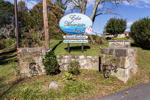
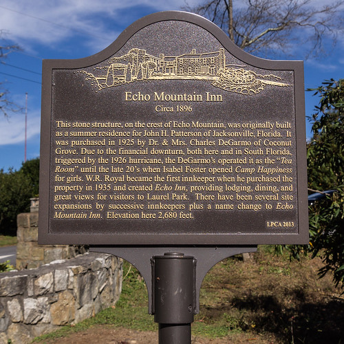
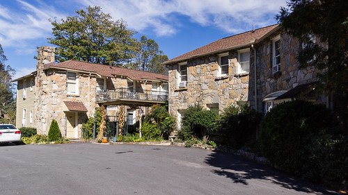
Echo Mountain Inn
Echo Mountain Inn is off Laurel Park Highway along the way to Jump Off Rock overlook.
A few feet away is a historical marker summarizing the history of the inn:
The
Echo Mountain Inn website goes into
much more detail and shows some interesting old photos of the inside.
I didn't spend much time here because it was getting late in the afternoon, but I did get a photo of the original stone structure.
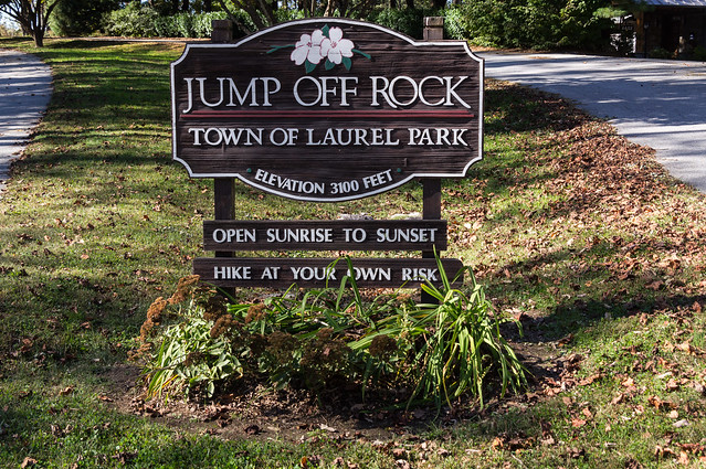
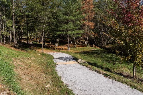
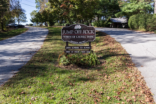
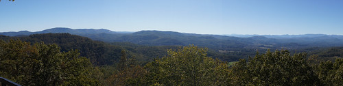
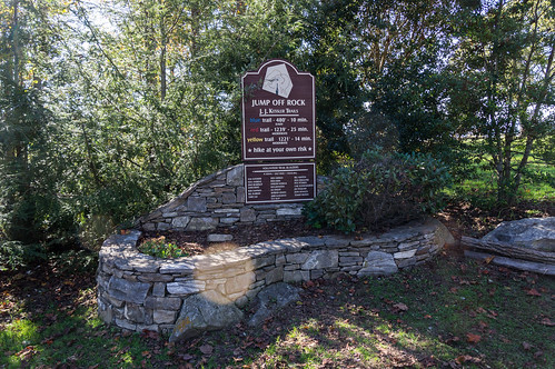
Jump Off Rock Overlook
At the end of Laurel Park Highway is
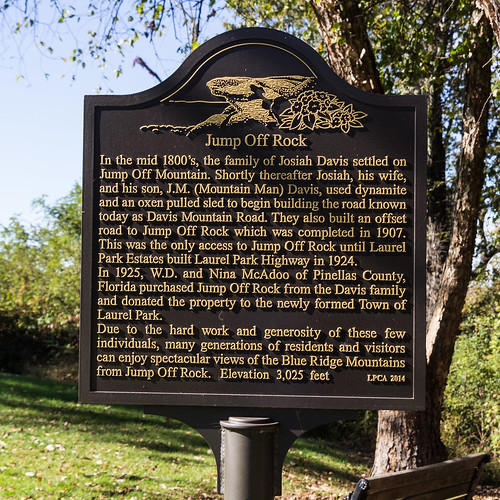
Jump Off Rock Park at the top of Jump Off Mountain (also known as Echo Mountain) long known for its lovely panoramic view.
A road, later to become Laurel Park Highway, was extended to Jump Off Rock in August 1922 to reach a planned hotel by W. D. McAdoo at the summit of Jump Off Mountain a half mile away (soon to be the site of the ill-fated Fleetwood Hotel).
The town of Laurel Park acquired the property from W. D. McAdoo in 1925.
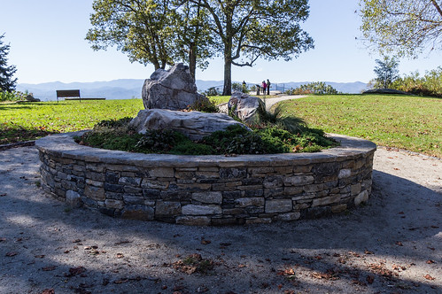
The overlook is just a short walk down a concrete path.
The trees here had just started changed colors.
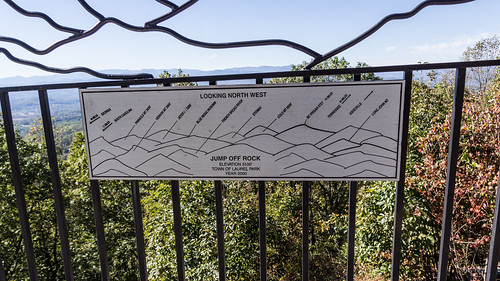
This handy sign explains which mountains are visible from the overlook:
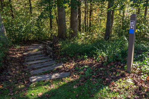
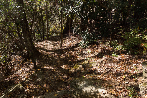
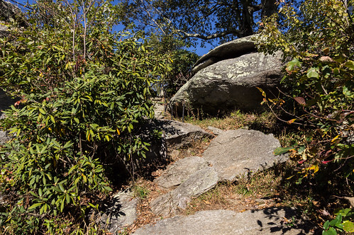
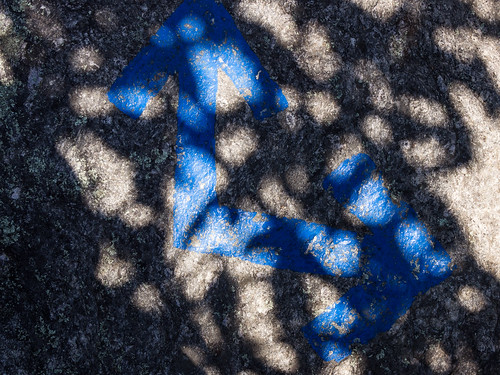
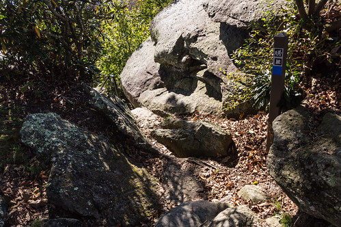
I had seen this sign on the way to the overlook and I decided I had time to explore one trail.
I chose the shortest one, the blue blazed trail, to conserve time. The trail wound downhill, then came back up out by the overlook.
Fleetwood Hotel
A half-mile back down Laurel Park Highway is the site of the Fleetwood Hotel where Fleetwood Plaza Condominiums now sit.
In 1922, W. D. McAdoo (
1878-1947) announced plans to build a hotel on the summit of Jump Off Mountain.
After the reporting of this announcement though, I couldn't found any more mentions of a hotel on this site until July 1925 when J. Perry Stoltz (
1870-1945) announced his intention to build the Fleetwood Hotel:
Work on the hotel in early 1926 was coming along nicely.
But by late June 1926, reports had come out construction had stopped on the hotel due to lack of money. It would come out later construction was halted in May.
I skimmed over many newspaper reports over the following years that promised that construction on the hotel would be resuming "Real Soon Now", but nothing ever came of those promises.
This is
a photo of the hotel, taken close to when construction stopped, from the D.H. Ramsey Library, Special Collections, University of North Carolina at Asheville:
This 1934 story laments the decaying hotel:
After being sold several times and promises of construction, the Fleetwood Hotel was finally sold for scrap in 1936:
This postcard is likely what the Fleetwood Hotel, if completed, would have looked like:
Fleetwood Plaza Condominiums now stand on the former hotel property. The hotel was located about the condominiums are behind the circle.
Wrapup
Before going on the trip, I made a map based on two plats,
Cabinet B page 255a, and
Cabinet B page 257, so I'd have a rough idea of where the older features in town were located. I've cleaned my map up a bit and made it available here:
I made a few tweaks when I could account for reality.
I found two interesting videos about Laurel Park related to this post. The first is
a video about the "golden age" of Laurel Park with some highly interesting images of the spring and the canal. The second is
a video report from WLOS showing a concrete pillar from the Swiss Railway.
I've shared my trip photos in the album
Apple Country Tour - Oct 2017 on Flickr, or you can click through them below:


Comments
Post a Comment