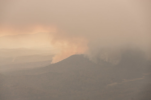
Pinnacle Mountain fire burnout
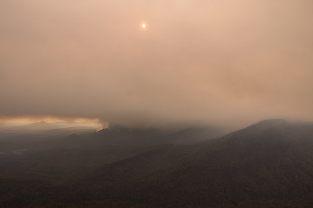

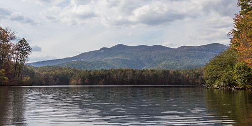
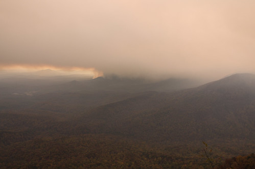
Also on November 9th, an escaped campfire near the Foothills Trail on Pinnacle Mountain spawned a fire that's grown to over 5100 acres as of November 18th. When I went out on Lake Oolenoy a few days ago, this is what Pinnacle Mountain looked like then:
This fire, along with smoke from other fires in North Carolina, have resulted in poor and at times unhealthy air quality in the Upstate area over the past several days. The most widespread poor air quality day, so far, was on the 14th, when a blanked of smoke covered the entire area as seen from this satellite image from NASA's Worldview:

The SC National Guard's most visible role has been for its use of their Chinook and Blackhawk helicopters to scoop water from Lake Oolenoy (in Table Rock State Park) and dump that water on hotspots on Pinnacle Mountain. The SC National Guard's Flickr account is posting photos of their efforts to fight the fire, and so far they have shared three related albums: 1, 2, 3.
WYFF's Mandy Gaither shared a live video on Facebook of a helicopter warming up and taking off for the lake. The SC Forestry Commission also posted photos of this helicopter scooping up and dumping water to a photo album on Facebook. Actually, state and local officials have done an excellent job so far keeping the public informed via social and local media on what's being done to fight the fire, keep people safe, and protect structures.
The weather forecast calls for winds to increase from the southwest, then from the northwest. This threatens to spread the fire to populated area to the south and east of the mountain. In response, a large scale 1400 acre burnout was conducted yesterday. The original plan was to light up 400 more acres today, but it looks like that phase is no longer required. The forestry commission posted this map of the plan to their Facebook page showing the area involved:


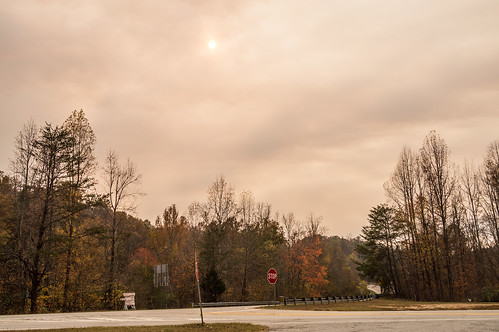
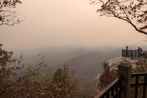
Smoke was obscuring the sun at the parking area:


This morning's forestry commission update started out with this positive statement:
Fire managers at the Pinnacle Mountain Fire were pleased with the results of the 1400-acre burnout conducted on Thursday.So far, no lives have been lost
Once the fire is contained and extinguished, it will very likely take quite a while for the park to open again although I would think the Lake Oolenoy portion could open up again fairly quickly.
Another other wildfire that has my interest, but is beyond the scope of this post, is the Party Rock Fire threatening Chimney Rock, Lake Lure, and Bat Cave just up the road in North Carolina. This fire is still growing, mostly to the north, and is up to about 6700 acres now. Updates about that fire are posted to Inciweb and to the North Carolina Forest Service Facebook page.
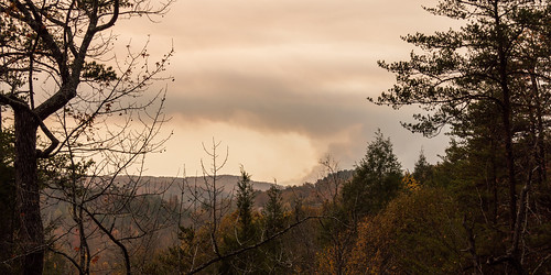
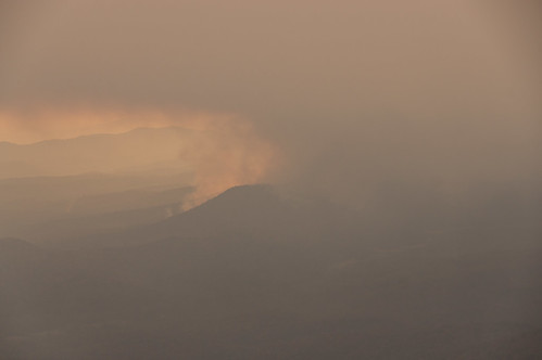
A rainy day would be most welcome to extinguish this fire, but unfortunately the weather trend is still not our friend:

Update 2016/11/24: The United States Forest Service has now taken over command of the firefighting. Their updates on the fire can now also be found at the Pinnacle Mountain fire section of InciWeb. The fire broke containment in one small area, and is now heading through a finger of Greenville County and is now approaching the North Carolina state line.
Also, it's looking more and more likely a wipespread rain event may arrive early next week to help put an end to the area fires.
Update 2016/12/06: Recent rains have done much to help control what little is left of the fire, and 100% containment has been achieved. The park has reopened, but portions of the interior trails remain closed while they are repaired.


Historically, the southern Appalachians burned in years of drought. 100 years of fire suppression results in wildly unpredictable fires, and it is important to look at the big picture. In this case, with no lives lost and only the one structure (sad, I believe this is the CCC shelter on the Table Rock trail?), this could be considered a beneficial event for Table Rock State Park. Fuel loads have been released, fire-tolerant species released while non-natives hopefully burned back, and the forest re-invigorated for a new season of growth. I can't wait to get up there in the spring to see what it looks like!
ReplyDeleteYes, it was the CCC era shelter that burned. :(
DeleteI'm more irked by how the fire started than the fire itself (except for threatening populated areas of course). If somebody had taken proper care of their campfire, the state wouldn't be running up a $2 million (and counting) bill for fighting this fire.
You're right about the park though. The trees are mostly ok, it's the brush and leaves that burned. The park will be just fine.
As of November 15th, 2016, the area classified by the United States Drought Monitor as "extreme drought" covers most of the Upstate, parts of western North Carolina, with parts of northern Georgia classified as "exceptional drought". Fire Guards
ReplyDeletenice photography.
ReplyDeleteWebsite Hosting