During a brief pause in the persistent rains last Sunday, I ventured out to visit three milestones along U.S. 29 and S.C. 129.
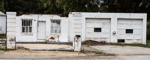
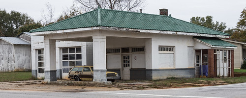
Rather than take the shorter, direct route to the milestones along current U.S. 29, I went through Greer, Duncan, and Lyman on the old route of U.S. 29, now Poinsett Street (S.C. 290), Spartanburg Road, and Old Spartanburg Highway to see what old country stores, service stations, and anything else I found interesting.
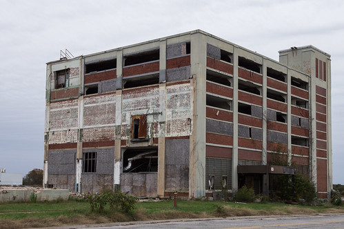
While in Lyman, I stopped by the site of the Lyman Mill to see what was left. Turns out the answer is "not much" except this husk of a building.
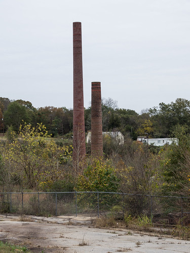
I took a detour off Old Spartanburg Highway into the mill village of Startex to visit the remains of the mill that closed in 1998. The two smoke stacks still remain...
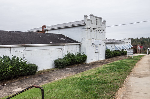
and also the mill office, but it's boarded up and for sale.
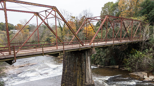
The old truss bridge across the Middle Tyger River is now closed and has been replaced by the modern concrete bridge I stood on to take this photo.
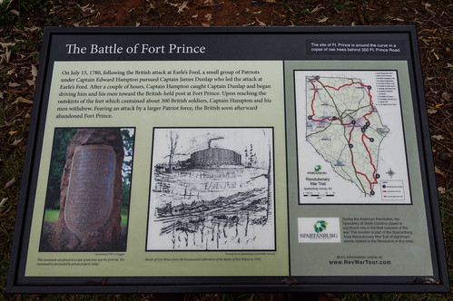
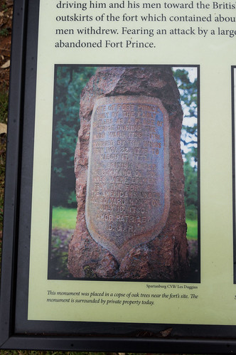
Then it was on to the monument to Fort Prince. Across from Fort Prince Memorial Gardens on Fort Prince Road north of Wellford is a info board about Fort Prince, the battle fought there, and the monument placed near the site in 1900.
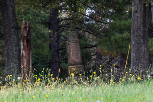
The monument is located off Fort Prince Road in a copse of trees on a small square of property belonging to the Daughters of the American Revolution.
The property surrounding the monument is private, so I took my photo from the side of the road.
A search of Google's newspaper archive found
this 1937 story in the Spartanbuirg Herald-Journal about the monument, it's history, and the fort's history. A photo of the monument is included in the story:
Except for the lack of trees, the monument appears to have changed little. The story included the text of the 1900 deed granting the property to the D.A.R. I found this part interesting:
...with the right away for footmen and vehicles to and from the site of "Fort Prince" to the nearest public road (Blackstock) by the most feasible route...
While road names and routes have changed since 1900, this deed still does grant the right for people to visit the monument. If I had known that, I might have paid it a visit.
Now on to the purpose of my trip. A post to the closed Facebook group
Abandoned, Old and interesting places in South Carolina reminded me of the existence of a milestone on S.C. 129 placed when it was U.S. 29. Discussion disclosed the existence of two more milestones new to me.
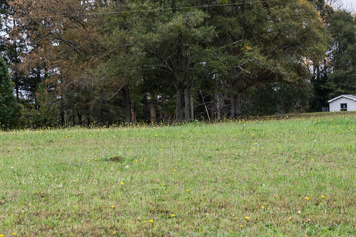
All of these milestones are on the north side of the road. Two milestones are on what is now S.C. 129, the other is on U.S. 29. All three (and the others now gone) were probably placed there in the early 1950s, when the road was originally built and designated U.S. 29. This snippet from
a 1951 Spartanburg County map by the S.C. Department of Transportation shows this route.
It's reasonable to assume more milestones lined this segment, but were probably removed when I-85 took over most of this segment, U.S. 29 returned to its old alignment, and the remainder named S.C. 129 as shown here from a snippet from
this 1964 Spartanburg County map:
I've left out details of other U.S. 29 route changes not important to this story. However, a much more complete history of U.S. 29 through South Carolina (including Spartanburg County) is available by visiting the
the U.S. 29 section [
2014 archive] of
MapMikey's South Carolina Highways Page.
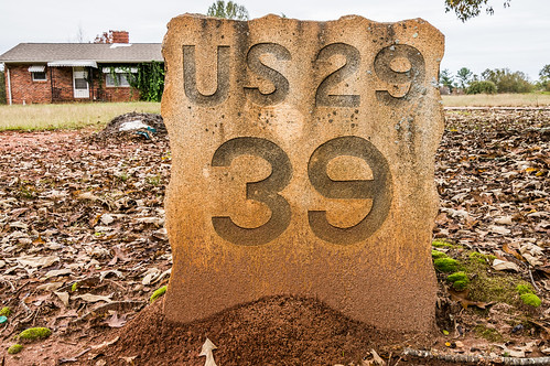
Coming in from the north east from Fort Prince Road, the milestones are on the right side of the road. Nice how that worked out, huh? The first one I visited is milestone 39.
This milestone is located on S.C. 129 between John Dodd Road and Martin Lane [
map link] in front of a private residence.
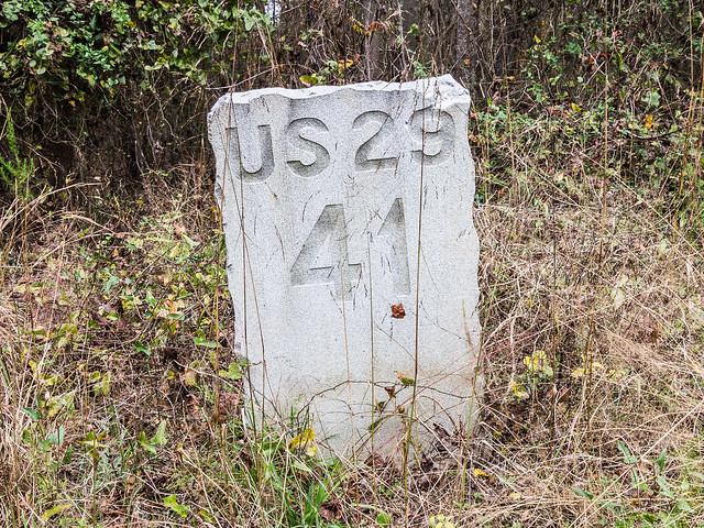
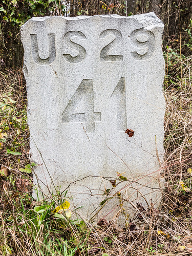
The second one is milestone 41.
This milestone is between Simmons Road and the bridge over the North Tyger River [
map].
This is the one posted to the closed Facebook group, and the one I knew about from
being posted to Panoramio.
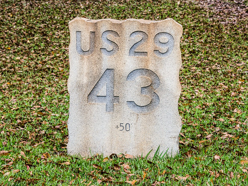
The last one is on U.S. 29 in Lyman and is milestone 43. I parked at a nearby Burger King and walked the short distance to take this photo.
Milestone 43 is located across the street from a Bojangles and an Arby's in front of a private residence [
map link].
This stone includes "+50" in the engraving. I was quite surprised to see that!
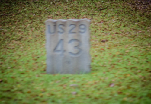
I was surprised because Tom Taylor had visited these milestones a few days before I could, and I didn't see the "+50" in his photo.
What does that "+50" mean? I have no idea. If you do, please leave a comment. Thanks!
I also wonder what happened to rest of milestones, and were they just placed in Spartanburg County or were more also placed in other counties along U.S. 29?
It was just as well this was the last stop because the rain that contented itself to remain sprinkles during my excursion became steady light rain as soon as I left Lyman. The rain had held off just long enough!
I left out many photos that didn't fit into the narrative, but they're all available in
an album on Flickr and
an album on Google Photos.


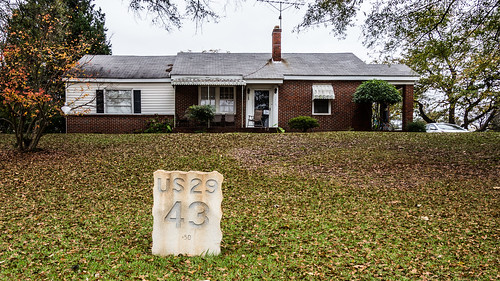


Hi Mark, if the second photo is Tom's then I can barely see the +50, so I'm guessing it wasn't engraved yesterday! As to the meaning, I believe sometimes mile markers can't be placed at exactly the right spot, due to an intersection or other impediment. In order to acknowledge this they would have put +/- the distance it is off by. 50 feet perhaps?
ReplyDeleteD'oh! You may be on to something! The distance between #39 and #41 measured right at 2 miles with Google Earth, but the measurement between #41 and #43 came out to 2.01 miles, or 2 miles and 52 feet.
DeleteI used the original alignment of the u.s. 29 - s.c. 129 intersection, not the current one that's a bit longer.
When I took my photo it was still in low light, and I was trying to stay out of traffic. I didn't get a clear a shot on that one as I would have liked. Truth be told, I didn't even notice the +50 when I was there.
ReplyDeleteGreat write up, as usual, Mark! I'm still working on my history of US 29 as the Bankhead Highway. Hoping to get that online soon.