Exploring Pinnacle Falls
 |
| Pinnacle Falls |
April 17, 2015
A few weeks ago I read a trip report about Pinnacle Falls, a waterfall on Abner Creek near the Rocky Bottom community in northern Pickens County. The photos looked so tempting I just had to see it. A few extra days off this week gave me a perfect a opportunity to visit this waterfall. But as usual when I take days off, I had to plan around bad weather. The forecast for Friday morning and afternoon looked good enough, the other days not so much. Friday it is.I also thought this adventure well worth sharing, so I put out an invitation and my long-time friend Eric decided to come along. I picked him up at his house and headed west and north toward Rocky Bottom.
We continued on past Rocky Bottom up F Van Clayton Memorial Highway then past Chimneytop Gap to the parking area. The parking area is located about halfway between a logging road and the Foothills Trail road crossing.
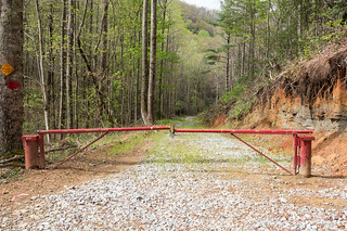
We begin the journey to Pinnacle Falls by walking past a locked swing gate.

A bit further down the trail we encountered a camp site...

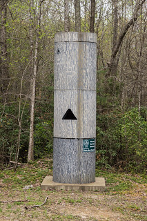
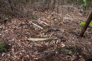
... and a bat roost.
The road then begins to descend toward Abner Creek.

A short distance away is a second creek crossing, this time for Dogwood Creek.

We had investigated a small cascade along Dogwood Creek. We both took photos, but I wasn't satisfied with mine so I didn't share them.
Just beyond the creek crossing on the left is the turn off for the trail leading to Pinnacle Falls. This path is narrow but easy to follow.
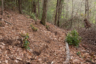
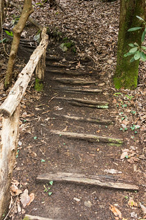
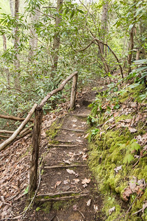
The path becomes a series of switchbacks and stairs.

Eric paused to take a photo of a ridge separating North and South Carolina.

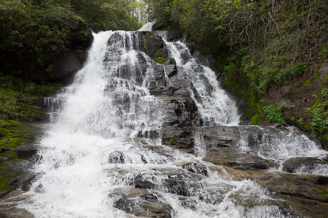
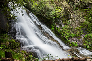
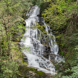
At the bottom, we were rewarded with a great view of the top of Pinnacle Falls from an observation deck.
Other steps take you to a rocky area where we took photos of the middle section.

I pointed out an observation deck on the other side the creek. We followed the orange path markers toward a spot along the creek where we could cross over and follow a trail on the other side. This was no easy task, but we made it.
We followed the narrow trail toward the observation deck.
The observation deck was nice and high, but the view of the waterfall was obscured by trees.
The view from the other side is much better.
Rather than cross the creek again, we elected to not wade back across. Instead we followed this trail down Abner Creek a while then made our way back to the same logging road. While this avoided a tougher climb back, the journey was longer and we still had to climb that same elevation. Next time I'll go back the same way we came in.
According to my GPS record of the trip, the total distance of our hike from the swing gate back to the swing gate was about 4.5 miles. If you stick to the shorter way in and out (recommended) your distance will be much less, but you will also be more exhausted.
My GPS tracks are plotted on the map below. The blue track is from my AGP AGL3080 tracker, the red one from my Nexus 7 (2013) tablet.
See full screen
The tracks and waymarks are downloadable from this map in GPX and other formats. A quick GIF tutorial is available from this link. Pinnacle Falls is also pinned on my incomplete Upstate South Carolina Waterfalls map, also downloadable in GPX and other formats.
Photos from the whole adventure are available in an album on Flickr and an album on Google Photos.
In the next post, A few stops along Pumpkintown Road, I'll show photos of the old and historical buildings we stopped at along the way.


Comments
Post a Comment