Cokesbury - Ninety Six History Tour

Cokesbury College
Cokesbury is situated a few miles north of Greenwood, South Carolina. Cokesbury was established in 1824 as a planned Methodist village after the people of the Tabernacle community decided to move to a higher elevation. The village was named Mount Ariel at first, but became Cokesbury in 1834 to honor Methodist bishops Thomas Coke and Francis Asbury.In 1854, the Bascombe Lodge No. 80 of Freemasons opened the Masonic Female College of South Carolina, an experiment in women's education. Financial difficulties forced the school to close in 1874. In 1876, the South Carolina Methodist Conference bought the building to house the Cokesbury Conference School. This school was male-only until 1882, then co-educational until the school closed in 1918. In 1918, the building became a public school until closing in 1954 with ownership reverting to the Methodist Conference. After 1954, the building became neglected and fell into disrepair. Without a major restoration effort in the late 1960s and early 1970s, the school building would have been torn down. In the In 1971, the building was donated to the Cokesbury Historical and Recreation Commission who are still in charge of the building's preservation.
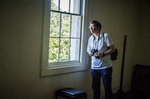
When we arrived a few minutes after 10am, the temperature was comfortable for mid to late June. A nice contrast to the stifling heat during my last visit. We've all taken photos from the roadside before, but this is Tom and Allen's first chance to visit the grounds and building. Understandably, they were more than ready to get started, so away we went.


These antique pews were donated by a historic Methodist church in Lancaster, South Carolina.


 |
| from 2012's visit |


The room on the left is the recitation room, containing yet another piano.


Tommy O'Dell, a member of the Cokesbury Historical and Recreational Commission, was on hand to tell the story of Cokesbury's history and other interesting stories of the surrounding area.


From examining deeds on this property, the local Methodist church bought the property in 1962 before transferring ownership to the state conference. In 1971, the state conference transferred ownership to the Cokesbury historical commission. Could the church have been built sometime during the late 1960s or early 1970s when interest in restoring Cokesbury College was at a peak? Could be.
We headed down Allen University Road to the Payne Institute monument.


Further down the road is what may be the ruins of a school I had spotted on the Greenwood County GIS map. This part of the road was in rough shape and overgrown. The school ruins can wait until fall or winter when the vegetation is gone.
Tabernacle Cemetery
A few miles down S.C. 254 from Cokesbury, near the Park Seed Company, is a historical marker for Tabernacle Cemetary.
Beside the marker is a dirt road leading to the cemetery.


 |
| from the Twlight Zone |
The two most prominent people buried here are Nathan George Evans, ...


We found a few handwritten gravestones off to the side to puzzle over:


Ninety Six Depot
Abandoned railroads fascinate me, yet I'm not interested in trains or the railroads themselves. I'm fascinated by the changing times and other reasons railroads have been abandoned, and how visible some remain by satellite after many decades.Abandoned railroads are also great candidates for conversion to hiking trails. The town of Ninety Six did just that by converting an abandoned railroad right-of-way traversing the town into the Historic Downtown Trail.
The former train depot, between Main Street and trail, is one of the oldest structures still standing in Ninety Six. The depot has found a new use a senior center and a cafe.


Ninety Six National Historic Site
About two miles south of Ninety Six is the Ninety Six National Historic Site. The original village of Ninety Six was an important trading center in the colonial era, and to protect the trading center from Indian attacks a stockade fort was built. When the British took control of the area in 1780, they constructed the star fort and other fortifications to defend themselves from attacks by the Patriots. In May 1781, the attack came in the form of a siege 28 days long, the longest of the American Revolution. Approaching British reinforcements forced the siege to be called off, but the fort was abandoned anyway, and the village burned.Old Ninety Six was rebuilt after the war, and a college was established there in 1785. In 1787, the name of town would be renamed after that college, Cambridge. After a realignment of judicial districts in 1800, Cambridge would lost its courthouse and its importance. The population dwindled away, and would become a ghost town. With the coming of the railroad through the area, a new village named Ninety Six began growing around the depot in 1852. In 1905, the town was incorporated.
We arrived in the parking lot early afternoon. The heat and humidity was uncomfortable for me in the sun, so I chose to wear my straw hat for this part of the adventure.
Tom has been to the park several times, but the experience was new to Allan and me. Tom also has family connections to the area: one of his grandmothers had a house in the Ninety Six area. Later, Allan and I would find out how deep these family connections went.
The first photo opportunity that presented itself from the parking lot was the Logan House.


We all dutifully wandered down the winding trail toward the battlefield, pausing to read the informative signs on the way.


While we were out on the battlefield, we kept hearing loud planes overhead. Eventually, we spotted them when they came out of the clouds. I didn't think to take a photo, but Tom did:
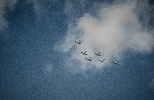 |
| by Tom Taylor |
We continued on to the boundaries of old Ninety Six.


From here, we walked up to a recreation of the stockade fort.


Wrapup
Here's map of the locations we visited:My photos from the trip are available on Flickr, and on Google+ photos in the albums Cokesbury History Tour - 2013, Tabernacle Cemetery - 2013, Ninety Six Depot - 2013, and Ninety Six National Historic Site - 2013.
You can read Tom's blog entry about the trip, and view his photos. Speaking of Tom...
Update 7/10/2013: Alan has uploaded his photos to Flickr from the Cokesbury tour, Tabernacle Cemetery, and Ninety Six.


That was a great trip, and I'm so glad you kept us posted on the dates for the tour. Didn't want to miss it this year. Thanks!
ReplyDelete