To Caesar's Head
Yesterday I traveled up to Caesar's Head to revisit two relatively unknown waterfalls, Misty Falls and Mashbox Falls, and visit the area where Caesar's Head Hotel once stood.
Misty Falls and Mashbox Falls are on tributaries of Oil Camp Creek and are located not far off of U.S. 276. I had already visited these falls back in the spring, but foliage was too thick then photograph well.
No trails are available to either Misty Falls or Mashbox Falls, and despite their nearness to U.S. 276 neither one are easy to get to. I chose to park at a pulloff at a bend in the curve as shown on the map below.
View To Caesars Head in a larger map
Just beyond the pulloff at the next curve is Oil Camp Creek Road, now mostly hiking trail. I decided against parking here because getting back out seemed too risky.
Misty Falls is the less difficult of the two to reach, so I made that one my first stop. Ignoring the sound of rushing water from Mashbox Falls, I followed Oil Camp Creek road down a series of switchbacks until I once again heard the sound of rushing water.
Misty Falls wasn't hard to find or even to approach, but all the growth around now it made it impossible to get a satisfactory photograph although I did take some. Admitting defeat, I made my way back up the road until I once heard the sound of Mashbox Falls.
I started down heading toward a gulley that seemed to offer the easiest grade down. Before I got to the gulley though, I came across what appeared to be abandoned trail that offered an easier path. While following the path toward the river, I came across a rusty gas can that confirmed my suspicions about the trail. I may have to come back someday and trace its path.

I also lost my "lens pen" here. If you find it, keep it. Or leave it be. Either way, I've already replaced it. I can't help but imagine someone in the distant future finding it stuck in the ground somewhere, picking it up, and wondering what it's supposed to do.
Anyway...
The trail took me to the river and then upstream toward the falls. This tributary of Oil Camp Creek had some better photo opportunities than the other one.
I also came across an interesting tree that didn't let some pesky rock get in its way.
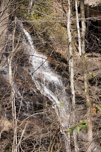
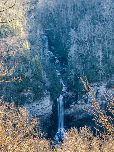
I knew I was close when I found the rusty mashbox, a metal box used back in the day to mix the "mash" used in the moonshine-making process. Nearby, I found a barrel no doubt used in some way to assist in the process.
Mashbox Falls is shrouded in trees, but I managed to find one angle where the falls weren't completely obscured. Later, I found out shooting a photo from the right side might have been better. Oh well!
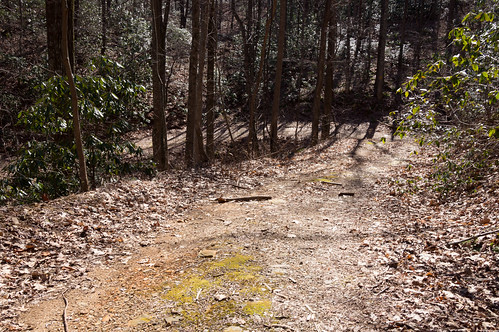
It took longer to reach the falls than I planned, so I elected to go back up the shorter but harder, much steeper way. After stopping every few feet to catch my breath, I eventually came across an old, abandoned logging road. While somewhat overgrown, the path was too flat to be anything else. I followed this road back out to U.S. 276, but found myself north of where I had parked. Like the old trail with the rusty gas can, I may come back someday and learn where this road goes.
After a breather and a drink of water, I moved on to find what's left of Caesar's Head Hotel. Benjamin Hagood bought the area around Caesar's Head in 1850 and soon built a cottage near the summit that became the hotel.
Ownership of the hotel would change over the years, becoming owned by members of the Marchant family in 1946 and the family retains ownership today. The hotel itself changed too, with the addition of a third story in the early 1900s.
All good things must come to an end, and for this hotel the end came in early September 1954 when it burned down not long after closing for the season.
 I found the general location from this plat:
Or on a modern map, the hotel was about where the tennis courts are now (the southern point below). The hotel related ruins like the spring and cottage ruins in a wooded area (around the northern point).
View To Caesars Head in a larger map
Putting the hotel in the general area of this photo:
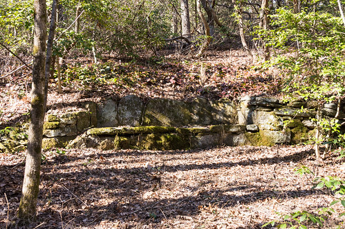
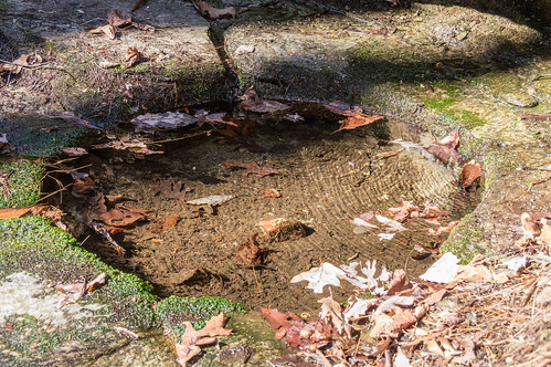
I didn't expect to find ruins of the hotel so I wasn't disappointed when I didn't. But I did find some ruins related to the hotel:
With this done, I had just enough time for one more adventure, and that was to Raven Cliff Falls. Riven Cliff Falls joined Caesar's Head State Park in 1981, just one year after the park itself opened. This photo was taken late in the day and the sun was in a poor position for a good photo, but the greatness of the falls still comes through.
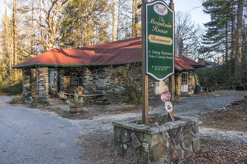
On the way back, I stopped long enough to take some photos of The Mountain House Restaurant, popularly known in the past as the "rock store".
The "rock store" building was built in 1926 and has served as an Esso station, a post office, and a soda & ice cream shop. Too bad they weren't open or the ice cream would have tempted me. Oh well.
Caesar's Head State Park has more waterfalls I have yet to visit, and the park itself has some interesting trails I haven't been to indecades a few years making it likely I'll be back sometime.
Further reading
Misty Falls and Mashbox Falls are on tributaries of Oil Camp Creek and are located not far off of U.S. 276. I had already visited these falls back in the spring, but foliage was too thick then photograph well.
No trails are available to either Misty Falls or Mashbox Falls, and despite their nearness to U.S. 276 neither one are easy to get to. I chose to park at a pulloff at a bend in the curve as shown on the map below.
View To Caesars Head in a larger map
Just beyond the pulloff at the next curve is Oil Camp Creek Road, now mostly hiking trail. I decided against parking here because getting back out seemed too risky.
Misty Falls is the less difficult of the two to reach, so I made that one my first stop. Ignoring the sound of rushing water from Mashbox Falls, I followed Oil Camp Creek road down a series of switchbacks until I once again heard the sound of rushing water.
 |
| Oil Camp Creek Road switchbacks |
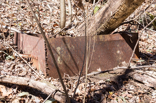
I started down heading toward a gulley that seemed to offer the easiest grade down. Before I got to the gulley though, I came across what appeared to be abandoned trail that offered an easier path. While following the path toward the river, I came across a rusty gas can that confirmed my suspicions about the trail. I may have to come back someday and trace its path.
I also lost my "lens pen" here. If you find it, keep it. Or leave it be. Either way, I've already replaced it. I can't help but imagine someone in the distant future finding it stuck in the ground somewhere, picking it up, and wondering what it's supposed to do.
Anyway...
The trail took me to the river and then upstream toward the falls. This tributary of Oil Camp Creek had some better photo opportunities than the other one.
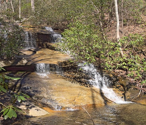 |
| Downstream of Mashbox Falls |
I also came across an interesting tree that didn't let some pesky rock get in its way.
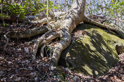 |
| Obstacles: I over come them! |
 |
| Mashbox |
Mashbox Falls is shrouded in trees, but I managed to find one angle where the falls weren't completely obscured. Later, I found out shooting a photo from the right side might have been better. Oh well!
It took longer to reach the falls than I planned, so I elected to go back up the shorter but harder, much steeper way. After stopping every few feet to catch my breath, I eventually came across an old, abandoned logging road. While somewhat overgrown, the path was too flat to be anything else. I followed this road back out to U.S. 276, but found myself north of where I had parked. Like the old trail with the rusty gas can, I may come back someday and learn where this road goes.
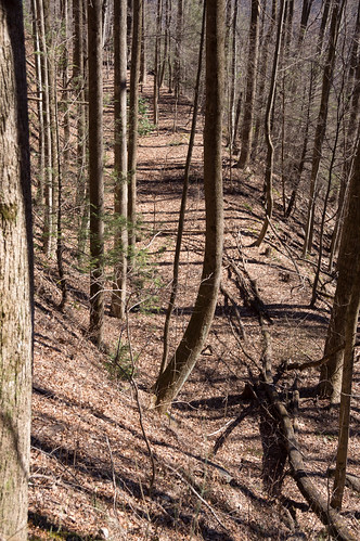 |
| Logging road |
After a breather and a drink of water, I moved on to find what's left of Caesar's Head Hotel. Benjamin Hagood bought the area around Caesar's Head in 1850 and soon built a cottage near the summit that became the hotel.
Ownership of the hotel would change over the years, becoming owned by members of the Marchant family in 1946 and the family retains ownership today. The hotel itself changed too, with the addition of a third story in the early 1900s.
 |
| From the June 3, 1870 The Daily Phoenix (Columbia, SC) |
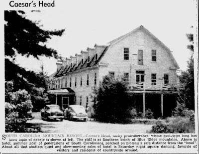 |
| Photo from the August 18, 1947 (Charleston, SC) News and Courier |

.jpg) |
| Plat book G, page 122-123 |
Or on a modern map, the hotel was about where the tennis courts are now (the southern point below). The hotel related ruins like the spring and cottage ruins in a wooded area (around the northern point).
View To Caesars Head in a larger map
Putting the hotel in the general area of this photo:
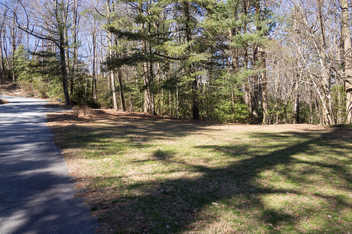 |
| Intersection of Echo Drive and a private road |
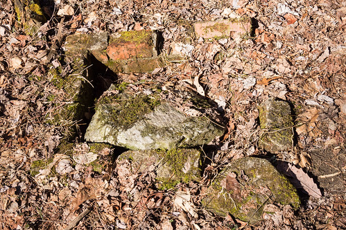 |
| Brick square |
 |
| Exposed water pipe |
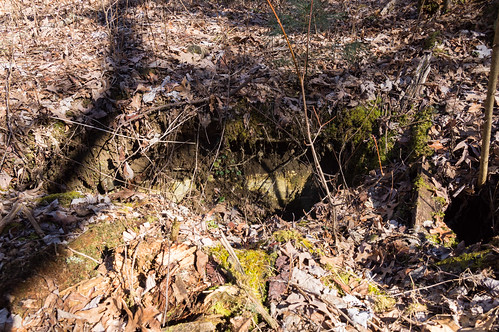 |
| Underground concrete block ruins |
|
| Raven Cliff Falls |
 |
| The Mountain House Restaurant |
The "rock store" building was built in 1926 and has served as an Esso station, a post office, and a soda & ice cream shop. Too bad they weren't open or the ice cream would have tempted me. Oh well.
Caesar's Head State Park has more waterfalls I have yet to visit, and the park itself has some interesting trails I haven't been to in
Further reading
- Mashbox and Misty Falls at North Carolina Waterfalls
- History: The Last Resort from the July 2009 G Magazine.
- Fire Razes Hotel At Caesar's Head from the September 9, 1954 The Times-News.
- 1890 photo of the Caesar's Head Hotel at Clemson Digital Library. Hotel is two stories in this photo.
- 1914 photo of the Caesar's Head Hotel at Clemson Digital Library. Hotel is three stories in this photo.
- Do You Know Your South Carolina? from the August 18, 1947 The News and Courier.
- 1850 deed where Benjamin Hagood buys Caesar's Head.
- Plat book G, pages 122-123 from the Greenville County Register of Deeds showing the location of the hotel. Some of deeds for properties in this plat (I didn't check them all) have a deed restricting disallowing a hotel, inn, or restaurant on the property.


Excellent history and research, as usual. I've been to Caesar's Head plenty of times, but haven't really explore that area to this extent. Now I may have to make a trip back.
ReplyDeleteI really enjoyed reading this. I had heard of the hotel but had never taken the time to learn about it myself. Thanks!
ReplyDeleteThanks for the wonderful story and photos. My ancestors, the Ashworths, lived in the Oil Camp area and had a plantation there in the 1800s and early 1900s.
ReplyDeleteLooks like a fun day. I will have to see if I can find the mashbox someday. Have you ever searched for the hotels at Chick Springs near Taylors, or Whitestone near spartanburg?
ReplyDeleteThanks! The Chick Springs Hotel was torn down and a house built over the old hotel site. I have been to Whitestone Springs where the hotel was:
Deletehttp://markemark4.blogspot.com/2013/11/whitestone-spring-part-1-visiting.html
I'd like to go back sometime and check that place over once again.